Kirjojen hintavertailu. Mukana 11 342 296 kirjaa ja 12 kauppaa.

Kirjahaku

Etsi kirjoja tekijän nimen, kirjan nimen tai ISBN:n perusteella.

22 kirjaa tekijältä Harvey Map Services Ltd.

Ochil Hills

Ochil Hills

Harvey Map Services Ltd.

HARVEY MAP SERVICES LTD
2021
kartta, viikattu
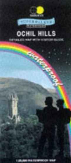
NEW REVISED EDITION AND FORMAT. More than a map an essential piece of equipment. This new generation of HARVEY Superwalker is designed to be the most practical tool for navigation outdoors. The format gives more mapping on the sheet without making the map heavy and bulky.
Ben Nevis

Ben Nevis

Harvey Map Services Ltd.

HARVEY MAP SERVICES LTD
2017
kartta, viikattu
Ben Nevis with the Mamores and Grey Corries ranges at 1:25,000 on a double-sided, waterproof and tear-resistant map from Harvey Map Services in their Superwalker series, with the peak area also shown in greater detail at 1:12,500.
Serengeti

Serengeti

Harvey Map Services Ltd.

Harvey Map Services Ltd
2019
kartta, viikattu
The only fully detailed map of this entire ecosystem, it embodies the years of research done by Frankfurt Zoological Society, & is the official management map for staff in the field. This is far more than just a map: On the reverse side is a wealth of authorative information, including migration patterns, wildlife, the peoples of the Serengeti, climate, landscape & habitat. It also includes enlarged inset maps of Grumeti River & Seronera.
Knoydart

Knoydart

Harvey Map Services Ltd.

Harvey Map Services Ltd
2018
kartta, viikattu
Knoydart & Kintail, seventh in this highly successful & innovative British Mountain Map series, is a long awaited title. It is the only detailed map to cover this famous wilderness area on one sheet. This all weather map for climbers, hillwalkers, mountaineers & mountain bikers includes 43 Munros & 21 Corbetts. It is printed on polyethylene which is durable, tearproof & 100% waterproof. Colour shading is used for easy identification of hills & valleys & the map weighs less than half the weight of a laminated map. There is also an extension covering Glen Affric.
Ben Nevis Summit

Ben Nevis Summit

Harvey Map Services Ltd.

Harvey Map Services Ltd
2009
kartta, viikattu
Now in new format: Tough. Light. Waterproof. Printed on polyethylene. Supplied folded in a plastic pocketThis map for hillwalkers provides an enlargement of the summit of Ben Nevis at 1:12,500 scale. Size A3 (297x420mm).Useful for detailed navigation in this complex area, particularly in poor conditions. Has a 100m grid for use with GPS or a romer. Includes the bearings for the escape route recommended by the Mountain Rescue.
Hadrian's Wall

Hadrian's Wall

Harvey Map Services Ltd.

HARVEY MAP SERVICES LTD
2019
kartta, viikattu
Toughdurable. XT40 - virtually indestructible. Light, compact. Entire route on one sheet. Clear easy to read. Sites of Roman remains. Accommodation and services. Great value for money.
West Highland Way

West Highland Way

Harvey Map Services Ltd.

HARVEY MAP SERVICES LTD
2018
kartta, viikattu
Toughdurable - XT40 virtually indestructible. LightCompact. Entire route on one sheet. Cleareasy to read. Full key in English, FrenchGerman. Accommodation and services.
Great Glen Way

Great Glen Way

Harvey Map Services Ltd.

HARVEY MAP SERVICES LTD
2019
kartta, viikattu
The HARVEY series of Long Distance Route maps have long been a success. Now we have applied the advanced technology used in the creation of last years best selling British Mountain Maps of Ben Nevis, Cairngorm, Lake District etc to provide the XT40 version of the route maps.
Forest of Bowland

Forest of Bowland

Harvey Map Services Ltd.

Harvey Map Services Ltd
2008
kartta, viikattu
Two-in one - Great value maps of the Forest of Bowland. One side for walking, one side for cycling. This detailed waterproof map of the Forest of Bowland is purpose-made for the outdoors. Made in co-operation with the Forest of Bowland AONB, the walking map is at the popular 1:25000 scale and shows full detail for safe navigation in the hills. The cycling map at 1:55000 shows a variety of suggested cycling routes, including some off-road, as well as the network of minor roads & tracks. Information useful for cyclists - such as cycle shops, cycle hire, steep hills etc.
Bob Graham Round

Bob Graham Round

Harvey Map Services Ltd.

HARVEY MAP SERVICES LTD
2009
kartta, viikattu
This historic 72 Mile route, completed by Bob Graham in 1932, is now a popular long distance endurance challenge. This map is your essential navigational guide, with recommended route and changeover points shown. Detailed clear and easy to read, printed on waterproof paper, lightweight to carry and can be used with GPS.
Cleveland Way

Cleveland Way

Harvey Map Services Ltd.

HARVEY MAP SERVICES LTD
2020
kartta, viikattu
Cleveland Way National Trail was the second to be established in Britain and is now over 40 years old. Many walkers consider it to be a classic route because of the variety of landscapes through which it travels.
Skye Trail

Skye Trail

Harvey Map Services Ltd.

Harvey Map Services Ltd
2019
kartta, viikattu
Entire route on one map The Skye Trail is a challenging unmarked route of 127km (79 miles) through the island of Skye. It is specifically aimed at experienced hillwalkers. The route follows much of the amazing Trotternish Ridge and passes beneath the peaks and pinnacles of the Cuillin, which are considered to be the finest mountains in Britain. There are also remarkable coastal cliffs, steep trails, high drops and haunting ruins of deserted villages destroyed in the highland clearances. You have various choices of alternative routes through either tough terrain or easier walking with spectacular mountain views and coastal scenery. It is not waymarked making this map an essential piece of your equipment. Tough, light, durable and 100% waterproof Route clearly marked
Rob Roy Way

Rob Roy Way

Harvey Map Services Ltd.

HARVEY MAP SERVICES LTD
2018
kartta, viikattu
Rob Roy Way is a walk across part of the Southern Highlands of Scotland taking in some of the most beautiful countryside in the UK. Starting from Drymen it goes north east to finish in Pitlochry.
Arran

Arran

Harvey Map Services Ltd.

Harvey Map Services Ltd
2020
kartta, viikattu
More than a map,an essential piece of equipment. This new generation HARVEY Superwalker is designed to be the most practical tool for navigation outdoors. The format gives more mapping on the sheet without making the map heavy and bulky. The fold has been developed to allow you to open directly to any part, and either side of the sheet easily no more struggling in the wind. The Superwalker XT25 is based on original HARVEY mapping with all the information a walker would expect on a map at 1:25,000 scale. The whole of the Arran Coastal Route is also shown on this map. The clarity of the mapping has been improved to enable more people to read it without their glasses. The map is uncluttered by information irrelevant to the walker.The precise contouring and delicate hill shading give an immediate picture of the ground. Experience the satisfaction of fine navigation with the Superwalker XT25, now printed on our 100% waterproof and almost indestructible paper, whatever the weather!
Cape Wrath Trail North

Cape Wrath Trail North

Harvey Map Services Ltd.

HARVEY MAP SERVICES LTD
2019
kartta, viikattu
Cape Wrath Trail is a challenging route from Fort William to Cape Wrath. It is around 200 miles long and passes through some of Scotland's wildest and most spectacular scenery.