Kirjojen hintavertailu. Mukana 11 244 527 kirjaa ja 12 kauppaa.

Kirjahaku

Etsi kirjoja tekijän nimen, kirjan nimen tai ISBN:n perusteella.

17 kirjaa tekijältä Martin Thelander

Robert Louis Stevenson, Treasure Island Map
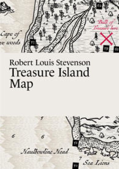
The original map of Treasure Island was lost when Stevenson sent it to his publisher. This map is based on Stevenson’s vivid descriptions and on the map in the 1883 edition of Treasure Island (Cassel), and also on Monro Scott Orr’s beautiful map in the 1934 edition. Contains an illustrated map, not the full text. A3-format, folded to A6-format. Printed on recycled paper.
Selma Lagerlöf, The Wonderful Adventures of Nils Map
Join Nils Holgersson on his wonderful journey through Sweden! An illustrated map with 100 places highlighted along the way. The novel was originally written as a Swedish geography textbook but became one of Lagerlöf's most popular books and has been translated into over 60 languages. Contains an illustrated map, not the full text. A3-format, folded to A6-format. Printed on recycled paper.
Mary Shelley, Frankenstein Map

Mary Shelley, Frankenstein Map

Martin Thelander

Paris Grafik
2023
muu
Follow Victor Frankenstein as he travels through the northern highlands of Scotland or when he confronts the monster in the barren landscapes of the high Alps. Mary Shelley’s novel ranges widely across the globe and this illustrated map lists more than a hundred places featured in the book. Contains an illustrated map, not the full text. A3-format, folded to A6-format. Printed on recycled paper.
Virginia Woolf, Mrs Dalloway Map

Virginia Woolf, Mrs Dalloway Map

Martin Thelander

Paris Grafik
2023
muu
"Mrs. Dalloway said she would buy the flowers herself." So begins Virginia Woolf’s beloved novel from 1925. But where does she buy her flowers? This illustrated map shows the locations from the book in order of appearance in the text. It also includes the routes taken by eight of the main characters. Contains an illustrated map, not the full text. A3-format, folded to A6-format. Printed on recycled paper.
Voltaire, Candide Map

Voltaire, Candide Map

Martin Thelander

Paris Grafik
2023
kartta, viikattu
This beautifully illustrated map displays the places and routes featured in Voltaire’s satirical novel from 1759. The story revolves around Candide, who is taught by his mentor, Dr. Pangloss, that they live in the “best of all possible worlds”. Candide’s journey is plagued with misfortunes that challenge his optimistic outlook. Includes concise descriptions of the book’s main characters. Contains an illustrated map, not the full text. A3-format, folded to A6-format. Printed on recycled paper.
Jane Austen, Pride and Prejudice Map

Jane Austen, Pride and Prejudice Map

Martin Thelander

Paris Grafik
2023
muu
Jane Austen vividly describes many fictional and real locations throughout England in her classic novel from 1813. This map includes over 60 of these places and shows how they relate to each other. It also features an illustrated map of the novel’s main characters. ?Contains an illustrated map, not the full text. A3-format, folded to A6-format. Printed on recycled paper.
Bram Stoker, Dracula Map

Bram Stoker, Dracula Map

Martin Thelander

Paris Grafik
2024
muu
Bram Stoker’s classic novel published in 1897 spans many locations across Europe. Both in Transylvania, where Count Dracula’s castle is situated, and in England, where a significant part of the story unfolds. This illustrated map showcases most of the locations and routes described in the novel. ?Contains an illustrated map, not the full text. A3-format, folded to A6-format. Printed on recycled paper.
Homer, The Odyssey Map

Homer, The Odyssey Map

Martin Thelander

Paris Grafik
2024
muu
One side of this beautifully illustrated map depicts the Aegean Sea and the surrounding areas where most of the places mentioned in Homer's epic poem can confidently be located. The other side of the map illustrates how Homer himself might have envisioned the world and Odysseus' adventurous journeys in the outer limits of it. The map also presents a number of location theories that scholars have proposed over the years. ?Contains an illustrated map, not the full text. A3-format, folded to A6-format. Printed on recycled paper.
Mark Twain, Adventures of Huckleberry Finn Map
Join Huckleberry Finn and Jim on their journey downstream along the powerful Mississippi River! This map features stunning illustrations and marks the majority of the locations referenced in Mark Twain's beloved novel from 1884. Additionally, it also indicates which states permitted or prohibited slavery during the time of the story's occurrence. ?Contains an illustrated map, not the full text. A3-format, folded to A6-format. Printed on recycled paper.
Charlotte Brontë, Jane Eyre Map

Charlotte Brontë, Jane Eyre Map

Martin Thelander

Paris Grafik
2024
muu
Even though Charlotte Bronte uses fictional names, it is possible to roughly locate the places she so vividly describes in her beloved novel from 1847. This illustrated map shows the places Jane Eyre visits and it also features an illustrated map of the novel’s main characters. ?Contains an illustrated map, not the full text. A3-format, folded to A6-format. Printed on recycled paper.
Jules Verne, Twenty Thousand Leagues Under the Sea Map
Join Professor Aronnax and his servant Conseil on their fantastic journey through the world's oceans aboard Captain Nemo's submarine. This map shows the forests of Crespo Island, Atlantis, a fictitious underwater tunnel beneath the Suez Canal, and many other of the places Jules Verne so vividly describes. ?Contains an illustrated map, not the full text. A3-format, folded to A6-format. Printed on recycled paper.
Daniel Defoe, Robinson Crusoe Map

Daniel Defoe, Robinson Crusoe Map

Martin Thelander

Paris Grafik
2025
muu
This detailed map shows all the locations described on the nearly deserted island where Robinson Crusoe resided for 28 years after a shipwreck. The map also depicts the other places described in the novel after the journey's beginning in Kingston upon Hull, England, in 1651. ?Contains an illustrated map, not the full text. A3-format, folded to A6-format. Printed on recycled paper.
Emily Brontë, Wuthering Heights Map

Emily Brontë, Wuthering Heights Map

Martin Thelander

Paris Grafik
2025
muu
Follow along with this illustrated map to the places mentioned in Emily Brontë’s remarkable 1847 novel. While Wuthering Heights, Thrushcross Grange and the nearby town of Gimmerton are fictional, their possible real-life inspirations are shown. This map also features a detailed and illustrated chart of the novel’s main characters. Contains an illustrated map, not the full text. A3-format, folded to A6-format. Printed on recycled paper
Joseph Conrad, Heart of Darkness Map

Joseph Conrad, Heart of Darkness Map

Martin Thelander

Paris Grafik
2025
muu
One side of this illustrated map depicts the Thames and its estuary, where the story begins. The other side follows Marlow’s journey up the Congo River—the very river where Conrad once worked and which inspired his novella. There’s also a map showing the colonisation of Africa from 1880 to 1914.
James Joyce, Ulysses Map

James Joyce, Ulysses Map

Martin Thelander

Paris Grafik
2025
muu
Yes! Step into the world of Ulysses and follow Stephen Dedalus, Leopold Bloom, and other characters as they wander through Dublin on June 16, 1904. Inspired in form and colour by the first edition of James Joyce’s groundbreaking modernist masterpiece from 1922, this map brings to life many of the locations and routes described in the novel.
Louisa May Alcott, Little Women Map

Louisa May Alcott, Little Women Map

Martin Thelander

Paris Grafik
2025
muu
Much of the beloved novel Little Women takes place in a setting that clearly reflects Concord, Massachusetts, as the town appeared around 1860, when Louisa May Alcott lived there. This richly illustrated literary map invites you to explore both real locations and the fictional settings that emerge in the story. On the reverse side of the map, you can also follow Amy and Laurie’s journeys through Europe.
Herman Melville, Moby-Dick Map

Herman Melville, Moby-Dick Map

Martin Thelander

Paris Grafik
2025
muu
This map depicts Captain Ahab’s voyage aboard the whaling ship Pequod in his obsessive pursuit of the white sperm whale, Moby Dick. It is inspired by the beautiful wind and current charts that began to be produced during the period. Although Moby-Dick is a book about the sea, it is just as much about life on land, and a large number of places are mentioned in the story—many of which are shown on the map. The whaling ship Pequod itself also appears, rendered with many details.