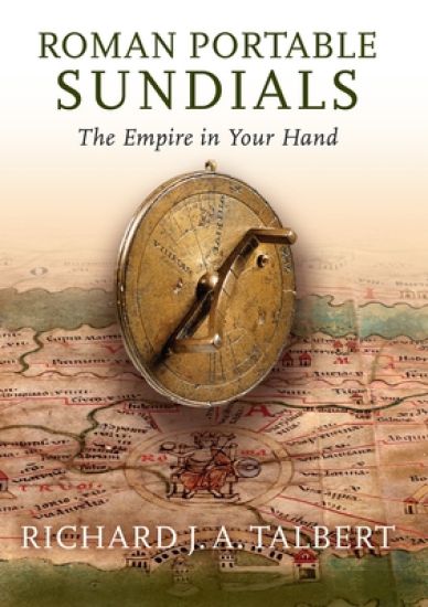
In an unscientific era when maps were rarities, how did ancient Romans envisage their far flung empire? This was done by various means for certain, including with the aid of an ingenious type of portable sundial that has barely attracted notice. As the Romans understood before the first century BCE, to track the passage of the sun across the sky hour-by-hour one needed to know one's latitude and the time of year, and that, furthermore, sundials did not have to be fixed objects. These portable instruments, crafted in bronze, were adjustable for the changes of latitude to be expected on long journeys--say, for instance, from Britain to Spain, or from Alexandria to Rome, or even on a Mediterranean tour. For convenient reference, these sundials incorporated lists of twenty to thirty names of cities or regions, each with its specific latitude. One of the insights of Roman Portable Sundials is that the choice of locations offers unique clues to the mental world-map and self-identity of individuals able to visualize Rome's vast empire latitudinally. The sixteen such sundials known to date share common features but designers also vied to create enhancements. Comparison with modern calculations shows that often the latitudes listed are incorrect, in which case the sundial may not perform at its best. But then the nature of Romans' time-consciousness (or lack of it) must be taken into consideration. Richard Talbert suspects that owners might prize these sundials not so much for practical use but rather as prestige objects attesting to scientific awareness as well as imperial mastery of time and space. In retrospect, they may be seen as Roman precursors to comparable Islamic and European instruments from the Middle Ages onwards, and even to today's luxury watches which display eye-catching proof of their purchasers' wealth, sophistication, and cosmopolitanism. Richly enhanced with detailed photographs, line drawings, maps, a gazetteer, and a table of latitudes and locations, Roman Portable Sundials brings these overlooked gadgets out of the shadows at last to reveal their hitherto untapped layers of meaning.