Kirjojen hintavertailu. Mukana 12 016 292 kirjaa ja 12 kauppaa.

Kirjahaku

Etsi kirjoja tekijän nimen, kirjan nimen tai ISBN:n perusteella.

16 kirjaa tekijältä Steve Davison

The North Wessex Downs

The North Wessex Downs

Steve Davison

Robert Hale Ltd
2013
nidottu
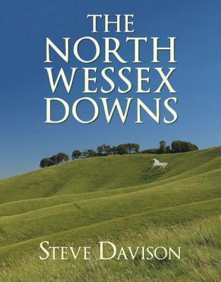
The Areas of Outstanding Natural Beauty have been described as the jewels of the English landscape, and the North Wessex Downs, the third largest AONB, is no exception. Its predominant feature is its underlying chalk geology, and it covers one of the most continuous tracts of chalk downland in England. As well as its treasures in the form of chalk and ancient woodland, the North Wessex Downs also has a fascinating human history, stretching back some 5,000 years. The archaeology of the area is both rich and varied, with a number of impressive monuments, including the Neolithic stone circle at Avebury-which forms part of a World Heritage Site-the truly beautiful Uffington White Horse, and the magical Wayland's Smithy, plus a myriad of Bronze Age barrows and Iron Age hill forts. Despite being located in southern England-a densely populated region-the North Wessex Downs is surprisingly unspoiled and sparsely populated, giving it a true sense of the idyllic England of old. Hidden amongst the folded contours of this chalk countryside are picture-postcard villages with thatched cottages, historic churches, and magnificent stately houses, while out on the open downs breathtaking views stretch over rounded chalk hills, with wide open skies above.
Walking in the Chilterns

Walking in the Chilterns

Steve Davison

CICERONE PRESS
2021
pokkari
This guidebook to Walking in the Chilterns offers 35 of the best walks in the Chilterns Area of Outstanding Natural Beauty. The Chiltern Hills is a peaceful walking destination of chalk hills and ancient woodlands within easy reach of London. The walks in this guidebook range from 4 to 12 miles and are suitable for most walkers. GPX files available to help with navigation.
Walking on Dartmoor

Walking on Dartmoor

Steve Davison

CICERONE PRESS
2023
nidottu
A guidebook to 39 day walks exploring Dartmoor, plus a 2-day Ten Tors challenge. Exploring the dramatic scenery of Devon’s national park there are walks suitable for all abilities, from low-level shorter walks to higher level more strenuous and demanding routes. The day walks, all easily accessible from Ivybridge, Tavistock and Okehampton, range from 7–13km (4–21 miles) and can be enjoyed in 2–6 hours. The Ten Tors route is a longer more challenging walk that takes 2 days and covers 58km (36 miles). 1:50,000 OS maps included for each walk Sized to easily fit in a jacket pocket GPX files available to download Refreshment and public transport options are given for each walk Information given on local geology and wildlife
Walking in the North Wessex Downs

Walking in the North Wessex Downs

Steve Davison

CICERONE PRESS
2021
nidottu
A guidebook to 30 circular walks in the North Wessex Downs National Landscape. Exploring the beautiful scenery of Berkshire, Hampshire, Wiltshire and Oxfordshire the walks are suitable for all abilities, from gentle strolls to more strenuous and demanding walks. The walks range in length from 6 to 21 km (4–13 miles) and can be enjoyed in 2–6 hours. Many of the walks follow parts of the ancient Ridgeway National Trail and the Kennet and Avon Canal. 1:50,000 OS maps reproduced at 1:40,000 for greater clarityGPX files available to downloadDetailed information on refreshment and transport options for each walkEasy access from Swindon, Reading and BasingstokeHighlights include the Uffington White horse and Avebury
Walking the Sarsen Way

Walking the Sarsen Way

Steve Davison

CICERONE PRESS
2024
nidottu
Guidebook to the Sarsen Way (79km) from Coate Water Park to Salisbury and the Cranborne Droves Way (28km) connecting Salisbury to Wessex Ridgeway at Win Green. These long-distance paths are part of the Great Chalk Way. Both can be walked in a week and are suitable for all abilities. The routes are presented in 8 stages, ranging from 10.5km to 17.3km. Reverse route descriptions are also included. Step-by-step route descriptions plus 1:50k OS mappingCentres include Swindon, Chiseldon, Avebury, Durrington, Amesbury, Great Durnford, Old Sarum, Salisbury, ShaftesburyComprehensive planning information and notes on sites along the routeGPX files available to downloadThe compact format is conveniently sized for slipping into a jacket pocket or the top of a rucksack
15 Short Walks on Exmoor

15 Short Walks on Exmoor

Steve Davison

CICERONE PRESS
2024
nidottu
Would you like to explore the best of Exmoor? This guidebook covers 15 of the area's best short walks (between 4.5 and 11km, all under three hours) including Dunkery Beacon, Valley of Rocks, Allerford, Selworthy, Tarr Steps, Great Hangman, Dunster and Malmsmead. Why choose this guidebook? Easy to moderate walks suitable for almost everyoneShort climbs but no challenging terrainNumbered points which tie maps to clear route descriptionDetails of public toilets and refreshments along the routeRoute Summary Table to help you choose your walk Cicerone’s Short Walks guidebooks contain everything you need to get outdoors and discover the best of an area. The routes are perfect if you’re new to walking or looking for something you can enjoy with the whole family. Let the adventures begin!
15 Short Walks on Dartmoor North - Okehampton and Chagford
Would you like to explore the best of Okehampton and Chagford? This guidebook covers 15 of Dartmoor's best short walks including Chagford, Belstone, Hound Tor and Bowerman's Nose, High Willhays and Yes Tor, and Meldon Reservoir. Why choose this guidebook? Walks under three hours, plus one challenge routeEasy to follow with clear route descriptionsFacilities, parking and highlights for every routeNo specialist gear needed, walk all year roundOrdnance Survey mapping Cicerone’s Short Walks guidebooks contain everything you need to get outdoors and discover the best of an area. The routes are perfect if you’re new to walking or looking for something you can enjoy with the whole family. Let the adventures begin!
15 Short Walks on Dartmoor South - Ivybridge and Princetown
Would you like to explore the best of Ivybridge and Princetown? This guidebook covers 15 of Dartmoor's best short walks including Cox Tor, Great Staple Tor, Merrivale, Drizzlecombe, Ditsworthy, Sheepstor and Wistman's Wood. Why choose this guidebook? Walks under three hours, plus one challenge routeEasy to follow with clear route descriptionsFacilities, parking and highlights for every routeNo specialist gear needed, walk all year roundOrdnance Survey mapping Cicerone’s Short Walks guidebooks contain everything you need to get outdoors and discover the best of an area. The routes are perfect if you’re new to walking or looking for something you can enjoy with the whole family. Let the adventures begin!
The Kennet and Avon Canal

The Kennet and Avon Canal

Steve Davison

CICERONE PRESS
2024
nidottu
Two-part guidebook to walking along the Kennet and Avon Canal. The first part describes the 152km (94 mile) route from Reading to Bristol, incorporating the UNESCO World Heritage Site of Bath and Bristol’s Floating Harbour. The second part describes 20 circular walks, taking in the best sections of the canal and interesting places nearby. All routes can be walked year-round and are suitable for walkers of every ability. The canal path route is described in 7 stages of 15 to 29km (9 to 18 miles), though it can easily be split into shorter or longer stages. The day walks are between 7 and 15km (4 and 9 miles) are described, taking between 2-4.5 hours. OS 1:50,000 mapping and step-by-step route descriptions for each walkEasy access from Reading, Newbury, Hungerford, Great Bedwyn, Pewsey, Devizes, Bradford-on-Avon, Bath, Keynsham and BristolHighlights include Crofton Pumping Station, the Caen Hill flight of locks at Devizes, the ornate aqueducts at Avoncliff and Dundas and the North Wessex Downs and Cotswolds AONBComprehensive planning information and information on local history, geology and wildlife GPX files available to download
Dead Innocent (Second Edition)

Dead Innocent (Second Edition)

Steve Davison

Alice Fred Books
2020
nidottu
A deadly secret. A groundbreaking discovery. A cold-blooded slaying. London. Young scientist Rita Sidhu is on the brink of something beautiful. A rising star in the field of genetics, she's involved with a massive breakthrough in heart-disease care. But tragedy threatens her bright future when she becomes a suspect in her boyfriend's gruesome murder. DCI Terence Varcy still mourns the loss of his wife and child. But the grieving policeman never expected working the case of a medical genius's murdered sweetheart would expose a string of vicious killings. And when the woman's boss disappears and the body count rises, the methodical investigator won't rest until he avenges their deaths. Desperately playing detective as loved ones drop around her, Rita is terrified when she's pulled into a killer's twisted web. And Varcy is running out of time to track down a brutal killer with one more scientist in their sights... Can Varcy save Rita before she suffers her partner's grisly fate? Dead Innocent is the shocking second book in the Varcy and Kendrick crime thriller series. If you like complex mysteries, relentless cops, and cutting-edge science, then you'll love Steve Davison's chilling whodunit. Buy Dead Innocent to keep the vital signs alive today
Guide to Dorset Pub Walks

Guide to Dorset Pub Walks

Steve Davison

COUNTRYSIDE BOOKS
2022
nidottu
Discover Dorset's lovely countryside with this guide to some of the best walks in the county. There are 20 circular routes here varying in length from 23/4 to 61/4 miles. At the heart of each walk is a great local pub. Explore the county's world-famous Jurassic coastline, including the chalk stack of Old Harry and the south coast's highest point at Golden Cap. Wander through rolling downland scenery with flower-rich meadows, visiting Iron Age hillforts with commanding defensive positions that offer great views. Take a walk along the former Saxon defences at Wareham or meander alongside peaceful rivers, follow paths through a patchwork of hedge-lined fields accompanied by birdsong, or explore picture-postcard villages and enjoy the tranquillity of their historic churches.
Ridgeway National Trail

Ridgeway National Trail

Steve Davison

Cicerone Press
2022
pokkari
Guidebook to the Ridgeway National Trail, an 87 mile (139km) route through the south of England from Avebury in Wiltshire to Ivinghoe Beacon in Buckinghamshire. Accompanied by a pull-out 1:25K mapping booklet, this guidebook details the trail in both directions and features information on historic sites and facilities along the way.
Walking in the New Forest

Walking in the New Forest

Steve Davison

CICERONE PRESS
2021
pokkari
A guidebook to 30 walks of between 3 and 10 miles set throughout the New Forest National Park in Hampshire and Wiltshire. Routes explore ancient woodland, heather-clad heath and dramatic coastline, all within easy reach of Southampton, Bournemouth and Salisbury. Walks for all abilities, easily combined to create longer challenges.
Ridgeway Map Booklet

Ridgeway Map Booklet

Steve Davison

Cicerone Press
2024
pokkari
Map of the 87 mile (139km) Ridgeway National Trail through the south of England from Avebury in Wiltshire to Ivinghoe Beacon in Buckinghamshire. This booklet is included with the Cicerone guidebook to the trail, and shows the full route on Ordnance Survey 1:25,000 maps. Presented in 12 stages in the guidebook, the trail typically takes 6-8 days.
The Ridgeway National Trail

The Ridgeway National Trail

Steve Davison

CICERONE PRESS
2026
nidottu
A guidebook to walking the Ridgeway National Trail between Avebury in Wiltshire and Ivinghoe Beacon in Buckinghamshire. Covering 139km (87 miles), this mostly low-level route is suitable for all abilities and takes 6 to 9 days to hike. The route is described in both directions and in 12 stages, ranging from 8 to 16 km (5-10 miles) in length. Detours and diversions are included to historic and archaeological sites close to the Trail. Contains step-by-step description of the route alongside 1:50,000 OS maps Includes a separate trail map containing OS 1:25,000 mapping and route line Handy route summary table and facilities planner help you plan your itinerary Packed with historical information, as well as detail maps showing nearby historic and archaeological sites Details of refreshments, accommodation and public transport given for each route stage
The Ridgeway Trail Map

The Ridgeway Trail Map

Steve Davison

CICERONE PRESS
2026
nidottu
A booklet of all the mapping needed to complete the Ridgeway National Trail between Avebury in Wiltshire and Ivinghoe Beacon in Buckinghamshire. Covering 139km (87 miles), this mostly low-level route is suitable for all abilities and takes 6 to 9 days to hike. The full route line is shown on 1:25,000 OS maps The trail map can be used to walk the trail in either direction Sized to easily fit in a jacket pocket Detours and diversions to nearby historical and archaeological sites are also provided An accompanying Cicerone guidebook – Walking the Ridgeway – is also available, which includes a copy of this map booklet The relevant extract from the OS Explorer map legend is included