Inclusive Design: What's in It for Me? presents a comprehensive review of current practice in inclusive design. With emphasis on new ideas for improvement and arguments for wider implementation in future, a unique combination of leading opinions on inclusive design from both industry and academia are offered. The theme throughout encourages a positive view of inclusive design as a good and profitable process and to produce a change to more effective approaches to "design for all". Inclusive Design is composed of two parts with a common chapter structure so that the business and design arguments in favour of inclusive design can be easily compared and assimilated: The Business Case presents the industrial and management benefits of inclusive design. It concentrates on demographic, legal and ethical reasons for all businesses being better off taking inclusivity into account in the design of their products or services. Case histories demonstrating the commercial success of inclusive design are drawn from the experiences of companies such as Tesco, Fiat and The Royal Mail. The Designers' Case focuses on the factors a designer needs to take into account when dealing with inclusivity. "Who is going to use my design?" "What do they need from my design?" "How do I take any medical needs into account?" "Just how "inclusive" is my design?" are all questions answered in this section which presents the necessary tools for effective inclusive design. This part of the book aims to convince a designer that inclusive design is a realistic goal. Inclusive Design will appeal to designers, researchers and students and to managers making decisions about the research and design strategies of their companies.
The Caribbean islands of Trinidad and Tobago provide a fascinating opportunity for anyone interested in natural history, particularly birds. Trinidad's position, a mere ten miles from the South American mainland, means that its flora and fauna are essentially continental by nature. This second edition has been completely revised and updated and features 106 species of birds.
The rural landscape of England and Wales in the mid-nineteenth century is minutely depicted in the large-scale plans and schedules drawn for the Tithe Commissioners. Among other features shown on the maps are field boundaries and rights of way, whilst the accompanying schedules record the names of owners and occupiers, field names, land use and area. The amount of detailed information they provide, together with their uniformity, place the surveys as the most complete record of the agrarian landscape at any period. This book describes the nature of tithe payments, the Tithe Commutation Act of 1836 and the survey of over 11,000 parishes. The uses made of the surveys for reconstructing early field systems, for tracing land use and understanding farming practices, are systematically considered, The abstraction, computer processing and mapping of vast quantities of data are discussed.
The tithe surveys of the early Victorian Age, after the great Domesday Book of the eleventh century, represent the most detailed and important national inventory to be taken before our own times. This 1986 book reconstructs elements of mid-nineteenth-century rural landscapes and farming systems by analysing the wealth of quantitative data which these tithe surveys contain, communicated cartographically by a set of 582 computer-generated maps, and statistically by a series of tables. The book also reveals the richness and variety of written evidence which the 14,829 parish tithe files (P.R.O. Class IR 18) contain, by means of analytical place and subject indexes for each English and Welsh county (some 200,000 entries in all) and by essays in which themes commonly encountered in the tithe file papers of each county are described. These sections of the book will be an essential tool for historians and historical geographers.
This book offered the first comprehensive study of the enclosure mapping of England and Wales. Enclosure maps are fundamental sources of evidence in many types of historical inquiries. Although modern historians tend to view these large-scale maps essentially as sources of data on past economies and societies, this book argues that enclosure maps had a much more active role at the time they were compiled. Seen from this perspective of their contemporary society, enclosure maps are not simply antiquarian curiosities, cultural artefacts, or useful sources for historians but instruments of land reorganisation and control which both reflected and consolidated the power of those who commissioned them. The book is accompanied by a fully searchable, descriptive and analytical web catalogue of all parliamentary and non-parliamentary enclosure maps extant in public archives and libraries and offers an essential research tool for economic, social and local historians and for geographers, lawyers and planners.
The tithe surveys of mid-nineteenth-century England and Wales marked a new departure in government-sponsored, cadastral surveying of the nation's land. The 11,800 large-scale, detailed maps which they comprise are recognised as one of the most important sets of manuscript historical sources used by historical geographers and economic, social and local historians as well as lawyers representing clients in property and rights of way disputes and county and local planning offices. Despite this much acknowledged value, historians are not well served with indexes, descriptive catalogues or indications of tithe map coverage. A first object of this book is to provide a standard work of reference which will be an essential research tool for users of tithe maps. The database has also been analysed to reveal the general cartographic characteristics of this internationally important government survey.
The tithe surveys of mid-nineteenth-century England and Wales marked a new departure in government-sponsored, cadastral surveying of the nation’s land. The 11,800 large-scale, detailed maps which they comprise are recognised as one of the most important sets of manuscript historical sources used by historical geographers and economic, social and local historians as well as lawyers representing clients in property and rights of way disputes and county and local planning offices. Despite this much acknowledged value, historians are not well-served with indexes, descriptive catalogues or indications of tithe map coverage. A first object of this book is to provide a standard work of reference which will be an essential research tool for users of tithe maps. The database has also been analysed to reveal the general cartographic characteristics of this internationally important government survey.
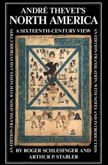
Andre Thevet was one of the most widely travelled Frenchmen of the sixteenth century, visiting almost all the main countries and regions of western Europe, the Near East, and Brazil. He served four consecutive French kings, beginning with Henry II, as Royal Cosmographer and "garde des singularitez." As cosmographer, he wrote three major books dealing with the discovery and subsequent exploration of the New World: Les Singularitez de la France antarctique (1556), La Cosmographie universelle (1575), and the Grand Insulaire (unpublished, 1586). Although the portions of these works devoted to South America have received considerable attention from scholars, Thevet's work on North America has remained inaccessible to students of the Age of Discovery. Professors Schlesinger and Stabler have now added Thevet to the list of enjoyable books by early European explorers of North America.
Since 1950, the Highway Capacity Manual has been a standard used in theplanning, design, analysis, and operation of virtually any highway traffic facilityin the United States. It has also been widely used abroad, and has spurred thedevelopment of similar manuals in other countries.The twin concepts of capacity and level of service have been developedin the manual, and methodologies have been presented that allow highwaytraffic facilities to be designed on a common basis, and allow for the analysis ofoperational quality under various traffic demand scenarios. The manual alsoaddresses related pedestrian, bicycle, and transit issues. This book details the fundamental development of the concepts ofcapacity and level of service, and of the specific methodologies developed todescribe them over a wide range of facility types. The book is comprised of twovolumes. Volume 1 (this book) focuses on the development of basic principles,and their application to uninterrupted flow facilities: freeways, multilanehighways, and two-lane highways. Weaving, merging, and diverging segmentson freeways and multilane highways are also discussed in detail. Volume 2focuses on interrupted flow facilities: signalized and unsignalized intersections, urban streets and arterials. It is intended to help users of the manual understand how concepts,approaches, and specific methodologies were developed, and to understand theunderlying principles that each embodies. It is also intended to act as a basicreference for current and future researchers who will continue to developnewand improved capacity analysis methodologies for many years to come.
Since 1950, the Highway Capacity Manual has been a standard used in theplanning, design, analysis, and operation of virtually any highway traffic facilityin the United States. It has also been widely used abroad, and has spurred thedevelopment of similar manuals in other countries.The twin concepts of capacity and level of service have been developedin the manual, and methodologies have been presented that allow highwaytraffic facilities to be designed on a common basis, and allow for the analysis ofoperational quality under various traffic demand scenarios. The manual alsoaddresses related pedestrian, bicycle, and transit issues. This book details the fundamental development of the concepts ofcapacity and level of service, and of the specific methodologies developed todescribe them over a wide range of facility types. The book is comprised of twovolumes. Volume 1 (this book) focuses on the development of basic principles,and their application to uninterrupted flow facilities: freeways, multilanehighways, and two-lane highways. Weaving, merging, and diverging segmentson freeways and multilane highways are also discussed in detail. Volume 2focuses on interrupted flow facilities: signalized and unsignalized intersections, urban streets and arterials. It is intended to help users of the manual understand how concepts,approaches, and specific methodologies were developed, and to understand theunderlying principles that each embodies. It is also intended to act as a basicreference for current and future researchers who will continue to developnewand improved capacity analysis methodologies for many years to come.
Although much has been written about the economy of the Soviet Union, little attention has been given to its insurance system. Providing a unique introduction to the topic, Insurance in the Soviet Union examines whether socialist ideology changes the legal foundations and implementation of insurance. The book describes the administrative structure, market, extent of protection, types of policies, and the place of insurance in the general structure of Soviet finance.
A companion volume to Rogers's Insurance in the Soviet Union (Praeger Publishers, 1986), this new work provides an in-depth examination of the operations of insurance industries in eastern European socialist countries. Rogers covers the administrative structure of insurance programs, the types of policies written, the insurance markets, and the extent of insurance protection. These topics provide the background to his discussion of two important issues: the transition from private to public insurance in socialist countries and the influence of the Soviet Union. In the latter case, there is explicit recognition by Soviet writers that practices in Eastern Europe have resulted in modifications of Soviet practices.
This book provides a basic outline of the history of the American steel industry, a sector of the economy that has been an important part of the industrial system. The book starts with the 1830's, when the American iron and steel industry resembled the traditional iron producing sector that had existed in the old world for centuries, and it ends in 2001. The product of this industry, steel, is an alloy of iron and carbon that has become the most used metal in the world. The very size of the steel industry and its position in the modern economy give it an unusual relevance to the economic, social, and political system.
This book provides a basic outline of the history of the American steel industry, a sector of the economy that has been an important part of the industrial system. The book starts with the 1830's, when the American iron and steel industry resembled the traditional iron producing sector that had existed in the old world for centuries, and it ends in 2001. The product of this industry, steel, is an alloy of iron and carbon that has become the most used metal in the world. The very size of the steel industry and its position in the modern economy give it an unusual relevance to the economic, social, and political system.