Marguerite Yourcenar is best known as the author of the 1951 novel Mémoires d’Hadrien, her recreation of the life of the Roman emperor Hadrian. The work can be examined from the perspective of the issues raised by writing Roman imperial biography at large and the many ways in which Mémoires has a claim to historical authenticity. In Marguerite Yourcenar’s Hadrian, Keith Bradley explains how Mémoires d’Hadrien came to be written, gives details of Yourcenar’s own biography, and describes some of the intricate historical problems that her novel’s portrait of Hadrian presents. He draws on Yourcenar’s correspondence, her interviews with journalists, and her literary corpus as a whole, emphasizing Yourcenar’s profound knowledge of the ancient evidence on which her life of Hadrian is based and exploiting a wide range of contemporary Yourcenarian criticism. The book pays special attention to the methods by which Yourcenar believed Hadrian’s life history to be recoverable, compares examples of modern life-writing, and contrasts the procedures of conventional Roman biographers. Revealing how and why Mémoires d’Hadrien is as it is, Marguerite Yourcenar’s Hadrian illustrates how imaginative literary recreation is often little different from historical speculation.
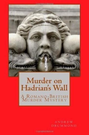
Have you ever wanted to know the Latin word for "underwear"? Or have you ever wondered what life was like for a soldier stationed on Hadrian's Wall? Maybe you just want to read a deviously and complicated historical "whodunnit", as Centurion Versillius faces down the Cult of Mithras, his superiors, the civil administration, the townspeople and even his own men in the search for a vicious killer. Travel back to AD 350, to find a Roman Britain which had existed for centuries, but was going through a period of dramatic change. The ties that held the empire together were fraying, as Britannia, the most northerly part of the empire, was finding out. Not altogether the best time to have a particularly nasty murderer stalking the streets of your Romano-British town... SOME COMMENTS MADE BY AMAZON READERS: "5.0 out of 5 stars Brilliant idea - A "Morse-like" detective who is a Roman Centurion" Best $1 I have ever spent...William E. Smith, Canada "Great debut novel" This novel had believable characters and excellent period detail throughout. And it kept me guessing " whodunit" right up until the final chapter...Empress Caramel, UK. "Very Good Book" I loved the historical detail and would definitely read another book by this writer...Bigdave, UK. "Authenticity is Credibility" Vivid description, accuracy, and a strong sense of place...Stephen S, USA. "Can't wait for more" Kept me guessing to the end, well written and the period detail was good...Angela L, UK. "It is very clever to write a believable story set in a historical context so I enjoyed the book very much and was dying to discover the murderer." Kendall, USA. "Excellent period detail" I did not guess "who dunnit"...I shall look out for more from this author...Sue, UK. "An entertaining tale" ...and a good murder story. I liked it very much. Andros. UK
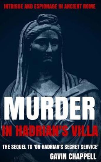
Imperial agent Gaius Flaminius Drusus is working undercover as a tribune in the Praetorian Guard. His remit is to investigate the death of Rufinus Crassus, the senator who died mysteriously after his assassination attempt on the emperor Hadrian. Commissary Centurion Probus thinks the senator was murdered by his fellow conspirators to keep him silent. Identifying the murderer takes them only a short time, but the investigation becomes more complicated when the murderer is poisoned, and Flaminius finds himself under suspicion. The empress gives him five days in which to identify the poisoner. Can Flaminius identify the poisoner? And at the same time root out the conspirators before they can make a fresh bid for power? Or will he be tried and executed for murder? The sequel to "ON HADRIAN'S SECRET SERVICE."
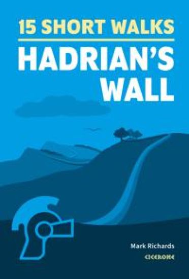
Would you like to explore Hadrian's Wall? This guidebook covers 15 of the best short walks in the area (between 4 and 11km), including Birdoswald, Sycamore Gap, Housesteads, Vindolanda and Sewingshields Crags. Why choose this guidebook? Walks under three hours, plus one challenge routeEasy to follow with clear route descriptionsFacilities, parking and highlights for every routeNo specialist gear needed, walk all year roundOrdnance Survey mapping Cicerone’s Short Walks guidebooks contain everything you need to get outdoors and discover the best of an area. The routes are perfect if you’re new to walking or looking for something you can enjoy with the whole family. Let the adventures begin!
The Hadrian’s Wall Community Archaeology Project (WallCAP) conducted a series of fieldwork projects along the Hadrian’s Wall corridor between 2019 and 2021\. The work focused on sites that were poorly understood or under particular threat and aimed to improve understanding of them so they could be better managed in future. At several sites excavation was followed by conservation and consolidation work. This volume brings together the final reports of these excavations, at seven Roman sites in the Wall corridor. As the sites were spread along the length of the Wall the character and afterlife of the Wall in very different landscape locations could be compared. An assessment of the Vallum at Heddon on the Wall identified how earthwork archaeology survived in a sloped, heavily ploughed landscape. Three excavations investigated the condition of the stone Wall curtain at Port Carlisle, Walltown Crags, and Steel Rigg and Cats Stairs. At each site the Wall builders had responded to the demands of the local terrain and made use of local resources. It is also clear how at each site the Wall had a different post-Roman history. Excavations at the bridging point of the Cam Beck revealed for the first time how the Wall was carried over a ‘minor’ watercourse, and discovered traces of the Turf Wall. Small buildings were also identified just south of the Wall as it approached the bridge. At Corbridge Roman town, excavations on the northern periphery of the settlement demonstrated that from early in its history the most northerly town in Europe was of considerable extent. The area investigated showed that, even at the edge of town, shops lined the roads alongside well-appointed houses with bustling yards. Later on in the Roman period the town contracted behind walls and cremation burials were inserted by the road. Each site is reported on independently, presenting the primary data for each investigation. The volume concludes with a synthetic analysis of what the results of these excavations together reveal about Hadrian’s Wall, considering, amongst other things, construction details and the decay and destruction of the monument in the centuries following Roman occupation.
The Hadrian’s Wall Community Archaeology Project (WallCAP) was funded by the National Lottery Heritage Fund to promote the value of heritage – specifically of the Hadrian’s Wall World Heritage Site – to local communities, and to provide opportunities for volunteers to engage with the archaeology and conservation of the Wall to better ensure the future of the monument. This short book provides a summary of the project, communicating the range of activities undertaken during the project and key results. It explores the structure and aims of the project, and creates an insightful overview of the many different people and communities that participated. Archaeological fieldwork resulted in a number of new discoveries and insights into Hadrian’s Wall. The revolutionary new work to explore the stones of Hadrian’s Wall, its source geology and how stones were reused from the monument is also discussed. Each chapter is supported by full colour illustrations, and contributions from project volunteers also bring the project into a vibrant focus.
A detailed examination of selected stone buildings from each of the forts associated with Hadrian's Wall, with discussions of their form and construction, architectural details, construction sequence and dimensions. Comparisons are also made with structures from other sites within the Province. Lengthy appendices contain data sheets for primary and secondary forts and catalogues of decorated stonework. Includes numerous plans, reconstruction drawings and photographs.
DEGREESAby P.R. Hill DEGREESDMany scholars have examined the building of Hadrian's Wall from the viewpoints of the order of construction and the responsibility of each legion for particular structures and lengths of curtain wall. Others have examined the design of the Wall and its structural elements. This book is concerned largely with the practical aspects of the physical construction of the Wall. Its purpose is to examine all of the processes necessary to build the Wall, rather than simply the work of putting one stone on another. The line had to be surveyed and the infrastructure and support services had to be set up; the principal relevant operations included quarrying, stone dressing, and lime burning, with the subsidiary operations of sand and water supply, scaffolding, and transport. Each is treated separately before consideration of the techniques of actually building the Wall. The digging of the Vallum and the ditch is discussed, and the addition of the forts and other changes to the programme are included. Organisational aspects arising from the study, such as the hours of work, the potential labour force, and a theoretical rate of working are grouped together in a later chapter. The study is confined to the curtain wall and turrets, and the defences of the milecastles and forts, on Hadrian's Stone Wall, and so far as possible all examples of Roman techniques are taken from the Wall and its immediate locality.
Please note: This product is a map. It was more than just a wall: it was a whole military zone designed to control movement across the northern frontier of the Roman province of Britannia. Great earthwork barriers survive, along with the remains of forts and temporary camps; watch-towers and fortified gates; civilian settlements, temples, cemeteries, bath-houses, roads and bridges. Stretching across the spine of England from the North-East coast to the Irish Sea, the line of the frontier extends for over 100 miles through every type of landscape: from the streets of urban Tyneside, through arable fields; along the crags of the wild Whin Sill; to the sands of the Solway, and down the coast of Cumbria. Drawing upon the extensive expertise and unrivalled archives of English Heritage, and those of its partners, this map depicts the fruits of modern archaeological research: in field survey, geophysics, excavation, and the analysis of aerial photographs. Using Ordnance Survey 1:25,000 data - the ideal scale for walkers - this revised new map shows with great clarity all the elements of Hadrian’s Wall, and distinguishes between those features that are visible and those that have been levelled through time. A brief text explains the remains on the ground, and how to use the map to find them – including the museums and the best places to visit. This World Heritage Site is now more accessible than ever before, so see the landscape through new eyes.
Hadrian's Wall was one of the Romans' most ambitious structures. When completed, it ran for 73 miles between the west and east coasts of Northern England. It crossed the crags and hills of some of Britain's wildest and most beautiful terrain. The Hadrian's Wall path is one of England's official 'National Trails'. It leads you on an unforgettable journey of discovery along the route of the Wall. Discover the incredible surviving sections of the Wall and its forts, milecastles and turrets. This definitive two-way guide to the Hadrian's Wall Path contains real OS mapping at 1:25,000 and both eastbound and westbound routes are described in full. There are 14 different itineraries with schedules of 3, 4, 5, 6, 7, 8 and 9 days for walkers and runners and the guide includes both eastbound and westbound itineraries. Difficult calculations of time, distance and altitude gain are done for you. Also includes: * Extraordinary detail on the history and construction of Hadrian's Wall * Section on the unmissable forts of Hadrian's Wall * Detailed information on equipment and travelling light * Everything the trekker needs to know: route, costs, difficulty, weather, travel, and more * Full accommodation listings: the best inns, B&Bs and hotels * Information for both self-guided and guided trekkers * Numbered waypoints linking the Real Maps to our clear descriptions
The Roman Empire is celebrating the eighth anniversary of Hadrian's succession. In Egypt, sacrifices are offered in the temples, chariot races are held in the Alexandrian Hippodrome, and in the arena, ten days of gladiatorial combats are fought in the blazing sun. Beyond the city, however, lies a turbulent province. Avidius Pollio, legate of the 22nd Legion, fears an uprising. Despite tight security, rebels make inroads from the desert, and robbers and river pirates are at their bloody work in the Delta. The imminent inundation of the Nile does little to allay the legate's fears, and there are also signs that the province has an enemy within. Back in Alexandria, stepping out for the first time onto the arena sands is a familiar figure. With Egypt on the verge of rebellion, why has Gaius Flaminius Drusus, imperial agent, begun a new career-as a gladiator? Part Five in ON HADRIAN'S SECRET SERVICE
The Reiving Rogue, book two in the Hadrian's Wall time travel trilogy, follows Ashlynn's sister, Jacklyn James, as she searches for answers to her sister's disappearance and finds herself transported back in time to the Anglo-Scottish border when reiving bands of men ran the countryside. Will Jacklyn find her sister or will she too be lost to the tides of time?
After the death of her husband William, Lynda James goes in search of her lost daughters. Ashlynn, an historian and archaeologist, disappeared while on a dig at Hadrian's Wall. Jacklyn, a free spirited journalist, went to the wall to search for her missing sister. Instead of finding Ashlynn, Jacklyn also disappears. Now, Lynda has come to the wall in search of her missing daughters.With the help of a mysterious taxi driver named John Graham, Lynda searches the length and breadth of Hadrian's Wall and the countryside beyond. Will Lynda find her missing girls, some kind of a sign as to where they went, or will she forever bear the pain of not knowing what happened to them?
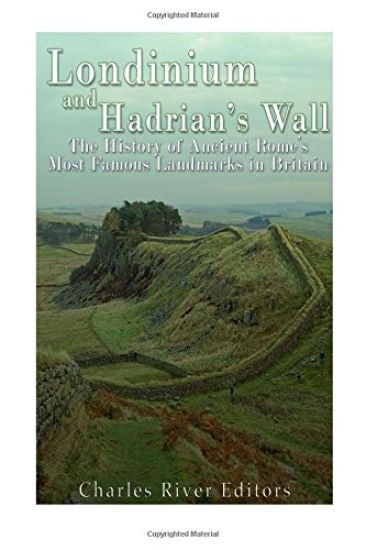
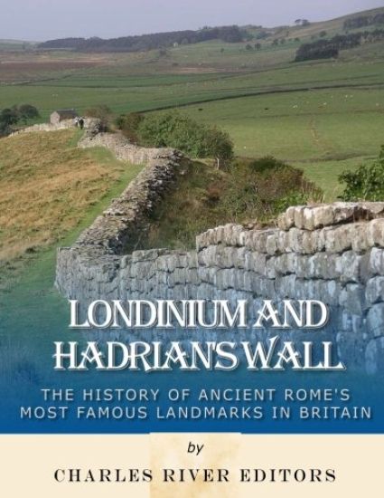
*Includes pictures *Includes ancient accounts of the landmarks *Includes online resources and a bibliography for further reading The famous conqueror from the European continent came ashore with thousands of men, ready to set up a new kingdom in England. The Britons had resisted the amphibious invasion from the moment his forces landed, but he was able to push forward. In a large winter battle, the Britons' large army attacked the invaders but was eventually routed, and the conqueror was able to set up a new kingdom. Over 1,100 years before William the Conqueror became the King of England after the Battle of Hastings, Julius Caesar came, saw, and conquered part of "Britannia," setting up a Roman province with a puppet king in 54 B.C. In the new province, the Romans eventually constructed a military outpost overlooking a bridge across the River Thames. The new outpost was named Londinium, and it covered just over two dozen acres. Londinium was initially little more than a small military outpost near the northern boundary of the Roman province of Britannia, but its access to the River Thames and the North Sea made it a valuable location for a port. During the middle of the first century A.D., the Romans conducted another invasion of the British Isles, after which Londinium began to grow rapidly. As the Romans stationed legions there to defend against the Britons, Londinium became a thriving international port, allowing trade with Rome and other cities across the empire. By the 2nd century A.D., Londinium was a large Roman city, with tens of thousands of inhabitants using villas, palaces, a forum, temples, and baths. The Roman governor ruled from the city in a basilica that served as the seat of government. What was once a 30 acre outpost now spanned 300 acres and was home to nearly 15,000 people, including Roman soldiers, officials and foreign merchants. The Romans also built heavy defenses for the city, constructing several forts and the massive London Wall, parts of which are still scattered across the city today. Ancient Roman remains continue to dot London's landscape today, reminding everyone that almost a millennium before it became the home of royalty, London was already a center of power. The Romans were master builders, and much of what they built has stood the test of time. Throughout their vast empire they have left grand structures, from the Forum and Pantheon in Rome to the theatres and hippodromes of North Africa and the triumphal gates in Anatolia and France. Wherever they went, the Romans built imposing structures to show their power and ability, and one of their most impressive constructions was built on the northernmost fringe of the empire. Shortly after the emperor Hadrian came to power in the early 2nd century CE, he decided to seal off Scotland from Roman Britain with an ambitious wall stretching from sea to sea. To accomplish this, the wall had to be built from the mouth of the River Tyne - where Newcastle stands today - 80 Roman miles (76 miles or 122 kilometers) west to Bowness-on-Solway. The sheer scale of the job still impresses people today, and Hadrian's Wall has the advantage of being systematically studied and partially restored. A study of the wall and its history provide an insight not only into the political context of Rome at the time but the empire's incredible engineering capabilities. Londinium and Hadrian's Wall: The History of Ancient Rome's Most Famous Landmarks in Britain analyzes the history of the influential Roman presence in England, and the ruins that remain thousands of years later. Along with pictures of important people, places, and events, you will learn about Londinium and Hadrian's Wall like never before.