
Kirjahaku
Etsi kirjoja tekijän nimen, kirjan nimen tai ISBN:n perusteella.
1000 tulosta hakusanalla Johan Huizinga
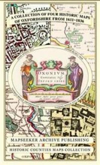
Oxfordshire 1611 - 1836 - Fold Up Map that features a collection of Four Historic Maps, John Speed's County Map 1611, Johan Blaeu's County Map of 1648, Thomas Moules County Map of 1836 and a Plan of Oxford 1836 by Thomas Moule. The maps also feature a number of Oxfords famous historic buildings.
Mapseeker Publishing Ltd.
Historical Images Ltd
2013
kartta, viikattu
This folded map (890mm x 1000mm when unfolded) is an ideal souvenir for tourists to Oxfordshire and also a valuable reference resource for local and family history research. It includes 4 Historic Maps of Oxfordshire.
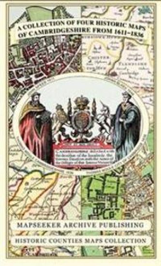
Cambridgeshire 1611 - 1836 - Fold Up Map that includes Four Historic Maps of Cambridgeshire, John Speed's County Map of 1611, Johan Blaeu's County Map of 1648, Thomas Moule's County Map of 1836 and Thomas Moule's Plan of Cambridge City 1836
Mapseeker Publishing Ltd.
Historical Images Ltd
2013
kartta, viikattu
This folded map (890mm x 1000mm when unfolded) is an ideal souvenir for tourists to Cambridgeshire and also a valuable reference resource for local and family history research. It includes 4 Historic maps of Cambridgeshire
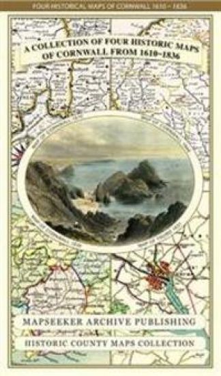
Cornwall 1611 – 1836 – Fold Up Map that features a collection of Four Historic Maps, John Speed’s County Map 1611, Johan Blaeu’s County Map of 1648, Thomas Moules County Map of 1836 and Robert Dawson’s Reform Act Plan of Truro 1831. The maps are surrounded by Cornwall’s Historic Buildings.
Mapseeker Publishing Ltd.
Mapseeker Archive Publishing
2014
kartta, viikattu
This folded map (890mm x 1000mm when unfolded) is an ideal souvenir for tourists to Cornwall and also a valuable reference resource for local and family history research. It includes 4 Historic maps of Cornwall, John Speed's County Map of Cornwall 1611, Johan Blaeu's County Map of Cornwall 1648,Thomas Moule's County Map of Cornwall 1836 and the Plan of Truro by Dawson 1831. All the maps have been meticulously re-produced from antique originals and printed on 90 gsm "Progeo" paper which was specially developed as a map paper. It has high opacity to help reduce show through and a cross grain giving it greater durability to as the map is being folded.
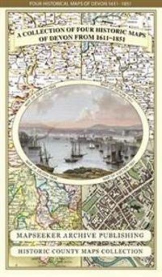
Devon 1611 – 1836 – Fold Up Map that features a collection of Four Historic Maps, John Speed’s County Map 1611, Johan Blaeu’s County Map of 1648, Thomas Moules County Map of 1836 and a Plan of Exeter 1851 by John Tallis.
Mapseeker Publishing Ltd.
Mapseeker Archive Publishing
2014
kartta, viikattu
This folded map (890mm x 1000mm when unfolded) is an ideal souvenir for tourists to Devon and also a valuable reference resource for local and family history research. It includes 4 Historic maps of Devon, John Speed's County Map of Devon 1611, Johan Blaeu's County Map of Devon 1648,Thomas Moule's County Map of Devon 1836 and the detailed Plan of Exeter 1851 by John Tallis. All the maps have been meticulously re-produced from antique originals and printed on 90 gsm "Progeo" paper which was specially developed as a map paper. It has high opacity to help reduce show through and a cross grain giving it greater durability to as the map is being folded.
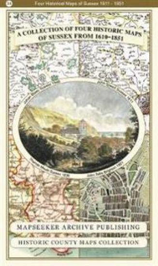
County of Sussex 1611 - 1836 - Fold Up Map that features a collection of Four Historic Maps, John Speed's County Map 1611, Johan Blaeu's County Map of 1648, Thomas Moules County Map of 1836 and a Plan of the City of Brighton from 1851 by John Tallis. The maps feature a number of vignette views from the period including Brighton's Chain Pier.
Mapseeker Publishing Ltd Mapseeker Publishing Ltd
Historical Images Ltd
2019
pokkari
This folded map (890mm x 1000mm when unfolded) is an ideal souvenir for tourists to Sussex and also a valuable reference resource for local and family history research. It includes 4 Historic maps of Sussex.
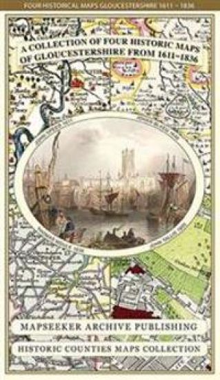
Gloucestershire 1611 – 1836 – Fold Up Map that features a collection of Four Historic Maps, John Speed’s County Map 1611, Johan Blaeu’s County Map of 1648, Thomas Moules County Map of 1836 and a Plan of Gloucester 1805 by Cole and Roper. The maps also feature three historic views of Gloucester from the 1840’s.
Mapseeker Publishing Ltd.
Mapseeker Archive Publishing
2014
kartta, viikattu
This folded map (890mm x 1000mm when unfolded) is an ideal souvenir for tourists to Gloucestershire and also a valuable reference resource for local and family history research. It includes 4 Historic maps of Gloucestershire, John Speed's County Map of Gloucestershire 1611, Johan Blaeu's County Map of Gloucestershire 1648,Thomas Moule's County Map of Gloucestershire 1836 and The City of Gloucester 1805 by Cole and Roper. All the maps have been meticulously re-produced from antique originals and printed on 90 gsm "Progeo" paper which was specially developed as a map paper. It has high opacity to help reduce show through and a cross grain giving it greater durability to as the map is being folded.
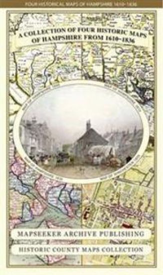
Hampshire 1610 – 1836 – Fold Up Map that features a collection of Four Historic Maps, John Speed’s County Map 1611, Johan Blaeu’s County Map of 1648, Thomas Moules County Map of 1836 and a Plan of Winchester 1805 by Cole and Roper. The maps also feature three historic views from the 1840’s, Gosport, Men of War at Spithead and The Saluting Platform at Portsmouth.
Mapseeker Publishing Ltd.
Mapseeker Archive Publishing
2014
kartta, viikattu
This folded map (890mm x 1000mm when unfolded) is an ideal souvenir for tourists to Hampshire and also a valuable reference resource for local and family history research. It includes 4 Historic maps of Hampshire, John Speed's County Map of Hampshire 1611, Johan Blaeu's County Map of Kent 1648, Thomas Moule's County Map of Hampshire 1836 and the detailed Plan of Winchester 1805 by Cole and Roper. All the maps have been meticulously re-produced from antique originals and printed on 90 gsm "Progeo" paper which was specially developed as a map paper. It has high opacity to help reduce show through and a cross grain giving it greater durability to as the map is being folded.
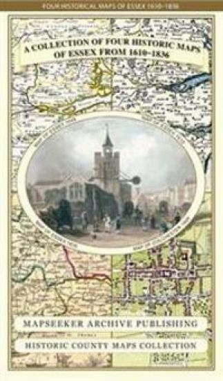
Essex 1610 – 1836 – Fold Up Map that features a collection of Four Historic Maps, John Speed’s County Map 1610, Johan Blaeu’s County Map of 1648, Thomas Moules County Map of 1836 and a Plan of Colchester 1805 by Cole and Roper.
Mapseeker Publishing Ltd.
Mapseeker Archive Publishing
2014
kartta, viikattu
This folded map (890mm x 1000mm when unfolded) is an ideal souvenir for tourists to Essex and also a valuable reference resource for local and family history research. It includes 4 Historic maps of Essex, John Speed's County Map of Essex1611, Johan Blaeu's County Map of Devon 1648,Thomas Moule's County Map of Essex 1836 and the detailed Plan of Colchester 1805 by Cole and Roper. All the maps have been meticulously re-produced from antique originals and printed on 90 gsm "Progeo" paper which was specially developed as a map paper. It has high opacity to help reduce show through and a cross grain giving it greater durability to as the map is being folded.
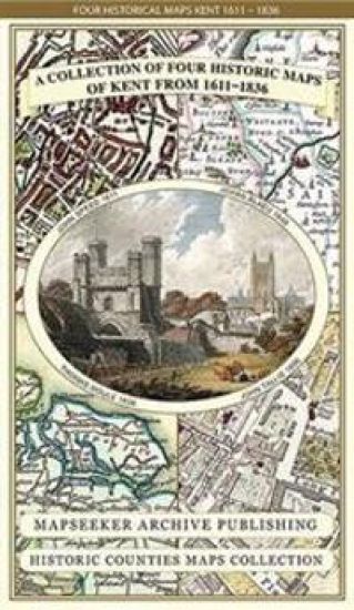
Kent County 1611 – 1836 – Fold Up Map that features a collection of Four Historic Maps, John Speed’s County Map 1611, Johan Blaeu’s County Map of 1648, Thomas Moules County Map of 1836 and a Plan of Canterbury 1806 by Cole and Roper.
Mapseeker Publishing Ltd.
Mapseeker Archive Publishing
2014
kartta, viikattu
This folded map (890mm x 1000mm when unfolded) is an ideal souvenir for tourists to the County of Kent and also a valuable reference resource for local and family history research. It includes 4 Historic Maps of Kent. John Speed's County Map of Kent1611, Johan Blaeu's County Map of Kent 1648, Thomas Moule's County Map of Kent 1836 and the detailed Plan of Canterbury by Cole and Roper 1806 All the maps have been meticulously re-produced from antique originals and printed on 90 gsm "Progeo" paper which was specially developed as a map paper. It has high opacity to help reduce show through and a cross grain giving it greater durability to as the map is being folded.
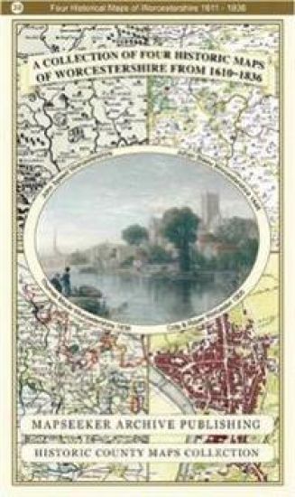
Worcestershire 1610 – 1836 – Fold Up Map that features a collection of Four Historic Maps, John Speed’s County Map 1610, Johan Blaeu’s County Map of 1648, Thomas Moules County Map of 1836 and Cole and Roper’s Plan of the City of Worcester 1805. The map’s also features early Victorian views from around Worcestershire.
Mapseeker Archive Publishing
2018
nidottu
This folded map (890mm x 1000mm when unfolded) is an ideal souvenir for tourists to Worcestershire and also a valuable reference resource for local and family history research. It includes 4 Historic maps of Worcestershire, John Speed's County Map of Worcestershire 1611, Johan Blaeu's County Map of Worcestershire 1648,Thomas Moule's County Map of Worcestershire 1836 and the detailed Plan of the City of Worcester by Cole and Roper 1805. All the maps have been meticulously re-produced from antique originals and printed on 90 gsm "Progeo" paper which was specially developed as a map paper. It has high opacity to help reduce show through and a cross grain giving it greater durability to as the map is being folded.
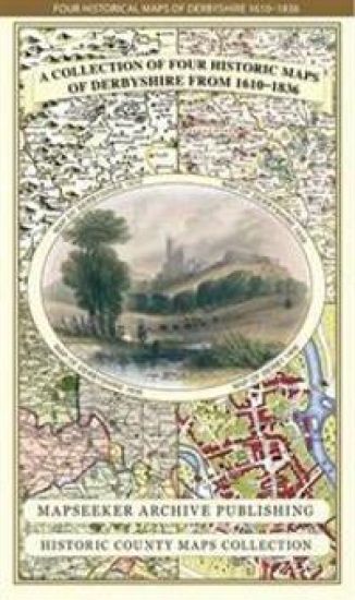
Derbyshire 1610 – 1836 – Fold Up Map that features a collection of Four Historic Maps, John Speed’s County Map 1611, Johan Blaeu’s County Map of 1648, Thomas Moules County Map of 1836 and Cole and Roper’s Plan of the City of Derby 1806. The map’s also features early views of Barlborough Hall, Doveridge House, Chatsworth House and Tissington Hall.
Mapseeker Publishing Ltd.
Mapseeker Archive Publishing
2014
kartta, viikattu
This folded map (890mm x 1000mm when unfolded) is an ideal souvenir for tourists to Derbyshire and also a valuable reference resource for local and family history research. It includes 4 Historic maps of Derbyshire, John Speed's County Map of Derbyshire 1611, Johan Blaeu's County Map of Derbyshire 1648,Thomas Moule's County Map of Derbyshire 1836 and the detailed Town Plan of Derby 1806 by Cole and Roper. All the maps have been meticulously re-produced from antique originals and printed on 90 gsm "Progeo" paper which was specially developed as a map paper. It has high opacity to help reduce show through and a cross grain giving it greater durability to as the map is being folded.
Somersetshire 1611 – 1836 – Fold Up Map that features a collection of Four Historic Maps, John Speed’s County Map 1611, Johan Blaeu’s County Map of 1648, Thomas Moules County Map of 1836 and a Plan of the City of Bath from 1851 by John Tallis. The maps feature a number of vignette views from the period.
Mapseeker Publishing Ltd.
Mapseeker Archive Publishing
2014
kartta
This folded map (890mm x 1000mm when unfolded) is an ideal souvenir for tourists to Somersetshire and also a valuable reference resource for local and family history research. It includes 4 Historic maps of Somerset, John Speed's County Map of Somerset 1611, Johan Blaeu's County Map of Somerset 1648,Thomas Moule's County Map of Somerset 1836 and a detailed Plan of The City of Bath 1851 by John Tallis. All the maps have been meticulously re-produced from antique originals and printed on 90 gsm "Progeo" paper which was specially developed as a map paper. It has high opacity to help reduce show through and a cross grain giving it greater durability to as the map is being folded.
Shropshire 1611 - 1836 - Fold Up Map that features a collection of Four Historic Maps, John Speed's County Map 1611, Johan Blaeu's County Map of 1648, Thomas Moules County Map of 1836 and a Map of the Severn Valley Railway in 1887.The maps also feature a number of early views across Shropshire including the famous Ironbridge over the Severn and the Severn at Bridgnorth.
Mapseeker Publishing Ltd Mapseeker Publishing Ltd
Historical Images Ltd
2019
pokkari
This folded map (890mm x 1000mm when unfolded) is an ideal souvenir for tourists to Shropshire and also a valuable reference resource for local and family history research. It includes 4 Historic maps of Shropshire.
Middlesex 1611 â?? 1836 â?? Fold Up Map that features a collection of Four Historic Maps, John Speedâ??s County Map 1611, Johan Blaeuâ??s County Map of 1648, Thomas Moules County Map of 1836 and a Map of the Environs of London 1836.
Mapseeker Publishing Ltd.
Historical Images Ltd
2019
pokkari
This folded map (890mm x 1000mm when unfolded) is an ideal souvenir for tourists to Middlesex and also a valuable reference resource for local and family history research. It includes 4 Historic maps of Middlesex.
A Lancashire 1611 – 1836 – Fold Up Map that features a collection of Four Historic Maps, John Speed’s County Map 1611, Johan Blaeu’s County Map of 1648, Thomas Moules County Map of 1836 and a Plan of Lancaster and Preston from 1824. The maps also feature early Victorian views around Liverpool as well as Manchester and Blackpool.
Mapseeker Archive Publishing
2018
nidottu
This folded map (890mm x 1000mm when unfolded) is an ideal souvenir for tourists to Lancashire and also a valuable reference resource for local and family history research. It includes 4 Historic maps of Lancashire, John Speed's County Map of Lancashire 1611, Johan Blaeu's County Map of Lancashire 1648, Thomas Moule's County Map of Lancashire 1836 and detailed Town Plans of both Lancaster and Preston 1824. All the maps have been meticulously re-produced from antique originals and printed on 90 gsm "Progeo" paper which was specially developed as a map paper. It has high opacity to help reduce show through and a cross grain giving it greater durability to as the map is being folded.
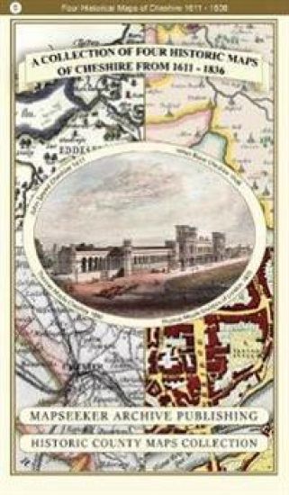
A Cheshire 1611 – 1840 – Fold Up Map that features a collection of Four Historic Maps, John Speed’s County Map 1611, Johan Blaeu’s County Map of 1648, Thomas Moules County Map of 1840 and Cole and Roper’s Plan of the City of Chester 1805.
Mapseeker Archive Publishing
2018
nidottu
This folded map (890mm x 1000mm when unfolded) is an ideal souvenir for tourists to Cheshire and also a valuable reference resource for local and family history research. It includes 4 Historic maps of Cheshire, John Speed's County map of Cheshire 1611, Johan Blaeu's County Map of Cheshire 1648,Thomas Moule's County Map of Cheshire 1836 and the detailed Plan of The City of Chester by Cole and Roper 1805. All the maps have been meticulously re-produced from antique originals and printed on 90 gsm "Progeo" paper which was specially developed as a map paper. It has high opacity to help reduce show through and a cross grain giving it greater durability to as the map is being folded.

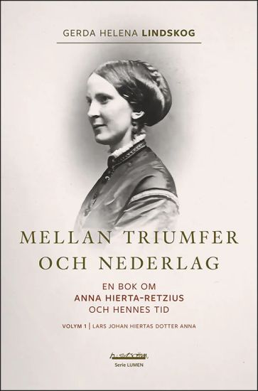
Mellan triumfer och nederlag : en bok om Anna Hierta-Retzius och hennes tid. Volym 1, Lars Johan Hiertas dotter Anna
Gerda Helena Lindskog
h:ström - Text Kultur AB
2023
nidottu
Anna Hierta-Retzius var dotter till tidningskungen Lars Johan Hierta, gift med skallmätaren Gustaf Retzius och i sin ungdom nära vän med Ellen Key. Anna Hierta-Retzius arbete för kvinnors och barns rätt har lyfts fram av enstaka moderna kvinnohistoriker men när kvinnokampen beskrivs på bred front faller hon ofta bort. Länge var hon ihågkommen endast som "sedlighetshyenan", överklasskvinnan som med blå plym i håret tågade in till festligheterna till diktaren Ibsens ära, och som sedan sägs ha legat bakom de 284 kvinnornas protest mot Ellen Keys tal om en Ny moral för Den nya kvinnan. Hur kom det sig att hon, som i ungdomen varit beundrad och älskad av många i Stockholms liberala kulturkretsar, i mogen ålder gjordes till åtlöje i skandalpressen? Vem minns idag att Anna Hierta i sin strid för samma kvinnofrid som vi slåss för idag, oförskräckt och radikalt argumenterade för samskolor som en väg mot ett naturligare umgänge mellan könen? I sina unga år hade hon tillsammans med sin syster Ebba en central roll bland eleverna i den berömda Lärokursen för fruntimmer. Tillsammans med Lars Hierta och Ellen Ankarsvärd grundade systrarna Hierta också Föreningen för Gift Qvinnas Eganderätt. Och 1878, precis innan hon gifte sig, förverkligade hon en dröm om en skola som snart togs ifrån henne. Detta är den första volymen av två om en av vår tids mest beryktade offentliga kvinnor och om hennes tid, 1841-1924. Gerda Helena Lindskog är född i Västergötland och har under flera decennier bott växelvis i norra Sverige och Visby. Som författare och forskare har hon haft inriktning på bilden av samerna och Norrland i barnlitteraturen, men också på den kontroversiella historien om arbetsstugor för barn i Norrbotten och Västerbotten. År 2016 blev hon hedersdoktor vid Luleå tekniska universitet. "Jag har ägnat några dagar åt att läsa Gerda Helena Lindskogs 2-volyms-biografi över Anna Hierta Retzius. Anna gick från att som ung vara vapendragare för sin far Lars Hiertas liberalism och uppskattad organisatör av många olika kvinnoemancipatoriska och andra projekt, till att åldras som en isolerad, starkt högervriden och sedesamhetspropagerande hustru till skallmätaren Gustaf Retzius. ... Materialet är väldigt rikt och jag vill gärna rekommendera böckerna till den som vill sätta sig in i komplexiteten i förra sekelskiftets kvinnokamp." - Gudrun Dahl, Professor emerita, SU.

Gephyrea: Indsamlede paa den Norske Nordhavs-expedition ved D. C. Danielssen og Johan Koren
Antigonos Verlag
2025
sidottu