Kirjojen hintavertailu. Mukana 12 045 102 kirjaa ja 12 kauppaa.

Kirjahaku

Etsi kirjoja tekijän nimen, kirjan nimen tai ISBN:n perusteella.

1000 tulosta hakusanalla Devon Nichole

Dorset and East Devon

Dorset and East Devon

Malcolm Hart

The Crowood Press Ltd
2009
nidottu
The Dorset and East Devon region is characterized by a variety of beautiful landscapes and a wealth of exciting geology, including such features as Lulworth Cove, Durdle Door, Chesil Beach, the fossil-laden cliffs of Lyme Regis and the red cliffs of East Devon. The area is equally well-known for numerous fascinating examples of how our ancestors interacted with the landscape, from Neolithic burial mounds and earthworks, through more recent effects of mining, quarrying and mineral extraction, to the local materials used to build houses.
Rail Freight in Devon and Cornwall

Rail Freight in Devon and Cornwall

David Mitchell

Silver Link Books
2019
sidottu
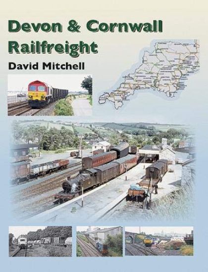
The way it was - an Historical perspective; traffic connected to an agriculture based economy, including a look at broccoli traffic etc. Supporting photos mainly steam from the 1950s (more b&w but some colour). - Milk traffic. A brief history with a more detailed (mainly pictorial) look at individual dairies from 1960s through to the end in 1981. Locations including Torrington, Lapford, Hemyock, Seaton Jn, Chard Jn, Totnes and Lostwithiel. A little steam, more diesel hydraulic and ending with diesel electric classes (mix of b&w and colour, weighted towards the former.) - China Clay. Probably the largest section of the book, perhaps 20%+. A bit of history with a few steam photos, but also a more detailed pictorial look at those loading points active from the 1970s to the present such as Burngullow and the Parkandillack branch, Par Harbour, Goonbarrow Jn, Fowey docks, Wenford, Moorswater and Plymouth. Views inclg related buildings, wagons etc (mainly colour). - Ball clay; Meeth and Heathfield branches - mainly 1970s to the end in early 2000's. - Grain and Fertiliser traffic; a short section, mainly on the Truro, Plymouth & Lapford service in the 1990s. - Coal.A general look, but majoring on Exmouth Jn Coal concentration depot (1967-92).Also 1990s flows for Plymstock cement works and Falmouth Docks. - Oil. Traffic flows to Exeter, Heathfield, Plymouth and Hayle Wharves etc (1970s to the end in 2012). - MOD. A shortish section, dealing with traffic to local bases, including nuclear from Devonport Dockyard. (1970s on). - Scrap Metal - from Plymouth, Exeter and St Blazey. (1970s on). - Cement. A brief look back to the 1960s-70s; Exeter Central, Plymouth and Chacewater in the 1980s; also the more recent Moorswater flow. - Timber. Traffic from Lapford (1980s), Exeter (1990s), Teignbridge & Exeter (present). - Aggregate. ( Mainly Mendip Rail to Exeter from 1990s on). - 'Speedlink', 'Enterprise' etc. Wagonload from 1970s to the end (2000s). Including a look at various locations, including Barnstaple, Whimple (cider), Pinhoe (bricks), Exeter, Plymouth, Cornwall (calcified seaweed) etc. - A short look at a couple of special 'one off' traffics. (1990s) - A section on 'civils' traffic, p.w. work trains. (Length might depend on space available after the above!), and - Railway ballast trains, mainly from Meldon Quarry (a little steam, photos from 1960s to the end). - Weed killers, RHTT and test trains.(Photos under the different sections could include some wagon views. All photos from 1990s on probably in colour; prior to that would be a mix.)
Villages of Devon

Villages of Devon

Martin Dunning

FRITH BOOK COMPANY LTD.
2001
pokkari
Featuring around 150 detailed photographs from the Frith archive, this collection provides a comprehensive look at the villages of Devon. It includes extended captions to pictures, a full introduction and a voucher for a free mounted print.
Dartmoor South Devon Cycling Country Lanes & Traffic-Free Family Routes
Explore Dartmoor and South Devon by bike with this laminated, waterproof Dartmoor map. With 18 circular, clearly-marked routes this easy-to-use map will help you discover the best of Dartmoor along the quietest country lanes. Some of Britain’s finest landscapes can be discovered in Dartmoor National Park. Discover desolate moorland tracks, lush valleys, thick woodland and picturesque villages. Combine this with the rocky coastline, quiet creeks and rolling hills of south Devon and you’re in for some beautiful days in the saddle as you explore this wonderful landscape. Our Dartmoor and South Devon Cycling Country Lanes map includes: * Traffic-free family cycling trails - including the Granite Way, Plym Valley Trail and Totnes to Dartington Riverside Trail with recommendations on where to park. * National Cycle Network routes - the linked series of traffic-free paths and traffic-calmed roads being developed across the UK. * Our personal favourites – we’ve explored every corner of this Dartmoor and South Devon to bring you the best circular routes to make the most of your weekend whether you fancy a lazy meander or a full-on tour. So, if you seek the peace of quiet country lanes, the beauty of lush river valleys and the heaven-sent views across Dartmoor, afforded by flat ridges which soon swoop you down to picturesque villages with tea rooms awash with clotted cream, and hospitable inns. Look no more. It is all here.
Exmoor  North Devon The Quantocks Gravel & Mountain Bike Routes
Explore Exmoor and North Devon on your mountain bike with this laminated, waterproof Exmoor map. With 10 clearly-marked routes this easy-to-use map will help you discover the best of Exmoor and North Devon off road. From sand-dunes, surf beaches and rocky cliffs of the coast, through wooded hills and green-pastured valleys to the heather and tawny-grasses of the high moors; for such a small area Exmoor contains an extraordinary variety of scenery. Add the pubs and cafes of friendly country towns, and the fabled Devon cream teas of village tea-shops, all linked by narrow, high-banked lanes which see little traffic that much of their surface is covered by moss and grass, and a network of forest tracks and ancient green lanes and bridleways, and you have one of the secret jewels of the UK's off-road riding scene. But what you won't get - with one or two very obvious exceptions - are bone-juddering gnarly descents, so if you're looking for the "Oh my God" factor, this isn't the place. Instead, you have a collection of superbly varied and rideable routes - from the almost flat circuit of Braunton and the Burrows to the challenging climbs and long, open descents of some of the inland routes. Outside of Exmoor's National Park, the Quantock Hills deserve a special mention. With views out over the waters of the Bristol Channel, this area of interconnected ridges above steeply wooded combes is covered with trails that could have been designated for off-road biking. But when the sun is shining on the great ridge of the Quantocks from Crowcombe Park Gate towards Beacon Hill, or high up on Dunkery Beacon in the midst of Exmoor - one thing is for sure - this is as close to off-road riding heaven as it gets.
A History of Devon

A History of Devon

Robin Stanes

Phillimore Co Ltd
2000
nidottu
Since the first edition of this book, this has remained the most popular book about the county for more than a decade. Devon has a greater sense of identity than most other counties and this very attractive volume reveals the reasons why. “ ... impressed by how it flows between subject and concepts. It is certainly the best book I have read which gives an easy to understand history of this County.” Dartmoor National Park Authority
The Companion Guide to Devon

The Companion Guide to Devon

Toulson Shirley

Companion Guides
1991
sidottu
In Devon the thread of history is everywhere evident - on its wild, grand moors and in its charming villages, in the ubiquitous craftsmanship in wood, clay and wool on which its prosperity has so often rested - and Shirley Toulson traces it faithfully in this most comprehensive and engaging of guidebooks. We follow her through the pastoral delights of the South Hams, across Exmoor and Dartmoor, to the harbour-towns, where each quayside is drenched in Devon's maritime history, compellingly recounted for us in this most companionable of guides to this most hospitable of counties.
Cornwall & West Devon Cycle Map 1
First in a new series of cycle maps covering the whole country. The first map covers from Lands End in Cornwall to Plymouth. The maps are all produced at a scale of 1:100 000 showing important features including the National cycle Network. Sections on road, off road and traffic free are all shown in differing colours along with their route number. Other roads and their classification are shown enabling you to link rides or explore sections and discover new routes at home or further afield. Facilities such as toilets, pubs, accommodation, bike shops, repair stations and railway stations are all shown. The mapping also has relief shading giving you a clear picture of the terrain (and steepness of any hills) you will encounter. Scale: 100 000 (10mm = 1 Km, 16mm = 1 Mile) Folded size: 163mm x 105mm Unfolded: 650mm x 800mm Tear and water-resistant paper Double sided
North and South Devon Cycle Map 2
First in a new series of cycle maps covering the whole country. The maps are all produced at a scale of 1:100 000 showing important features including the National cycle Network. Sections on road, off road and traffic free are all shown in differing colours along with their route number. Other roads and their classification are shown enabling you to link rides or explore sections and discover new routes at home or further afield. Facilities such as toilets, pubs, accommodation, bike shops, repair stations and railway stations are all shown. The mapping also has relief shading giving you a clear picture of the terrain (and steepness of any hills) you will encounter. Scale: 100 000 (10mm = 1 Km, 16mm = 1 Mile) Folded size: 163mm x 105mm Unfolded: 650mm x 800mm Tear and water-resistant paper Double sided
Poets of Devon and Cornwall, from Barclay to Coleridge
Alexander Barclay, Richard Carew, Humfrey Gifford, Anne Dowriche, Sir Walter Ralegh, Sir Arthur Gorges, Joseph Hall, John Ford, Robert Herrick, Sidney Godolphin, William Strode, William Browne, Mary, Lady Chudleigh, John Gay, Samuel Taylor Coleridge. All of these are poets born in the two westernmost counties of England, or - like Hall and Herrick - poets who were active there. In time we stretch from the very beginning of the 16th century until the early 19th century. We begin with Barclay, a priest at Ottery St. Mary, and we close with Coleridge, the son of a priest at Ottery St. Mary, his birthplace. We have names that echo down through the ages (Ralegh), great writers central to the development of English poetry (Herrick, Coleridge), we have divines (Hall, Herrick), we have cavaliers (Godolphin), we have balladeers (Gay), we have under-recognised talents (Gorges, Strode, Browne, Chudleigh), we have virtuoso translators (Barclay, Carew) and we have two women poets (Dowriche, Chudleigh), one of whom influenced Marlowe and another whose work was admired by Dryden.This anthology presents an unusual collection of some fine poets from the south-west corner of England and inaugurates a new Classics series from Shearsman Books.
Sky High South Devon Coast

Sky High South Devon Coast

Jason Hawkes

PIXZ BOOKS
2009
sidottu
The coast is famous for its safe harbours aroundwhich, from ancient times, little communitiesestablished themselves. It is towards this shorethat most of Devons rivers run, creating deeptidal valleys. These days some of the most desirableand expensive homes in Britain are to befound here. And where fishing boats once tied upalongside granite harbour walls, yachts now lay upat pontoons or rock gently at vast marinas.The South Devon coastline provides the meansfor thousands to enjoy leisure pursuits. The SouthWest Coast Path follows the cliff edge for most ofits route through South Devon, while sandybeaches are thronged
Day Walks in Devon

Day Walks in Devon

Jen Benson; Sim Benson

Vertebrate Graphics Ltd
2017
pokkari
Day Walks in Devon features 20 circular routes, between 8.8 and 17.6 miles (14.1km and 28.3km), suitable for hillwalkers of all abilities. Local authors Jen and Sim Benson share their favourite walks in North Devon and Exmoor, Torridge and West Devon, Mid and East Devon, Dartmoor, and South Devon and the South Hams.
Exmoor & North Devon Coast Path Trailblazer Walking Guide
Practical, complete guide to walking Exmoor & North Devon Coast Path, the first section of the South West Coast Path, from Minehead to Bude (124.5 miles). This spectacular route passes through the Exmoor National Park following the highest coastline in England (over 800ft), through numerous idyllic villages such as Lynton and Clovelly, around Barnstaple Bay and Hartland Point to the seaside resort of Bude just over the border with Cornwall. ?The Trailblazer Exmoor and North Devon Coast Path Guide includes: 55 large-scale walking maps in two-colour style, 13 town plans, 8 stage maps and 2 overview mapsPlaces to stay with reviews - bunkhouses, campsites, B&Bs, hostels, pubs, hotelsPlaces to eat with reviews - cafes, teashops, pubs, restaurants, takeawaysGPS Waypoints - downloadable from Trailblazer websiteNew edition includes extra colour mapping for each stage of the walkAlso includes 60 colour photosItineraries for all walkers - whether walking the route in its entirety over a week to 10 days or sampling the highlights on day walks and short breaksWhat to see - attractions, history, cultureComprehensive public transport information - for all access points on the coastFlora and fauna - four page full colour flower guide, plus an illustrated section on local wildlifeFull information on the Exmoor National ParkGreen hiking - understanding the local environment and minimising our impact on it