Kirjojen hintavertailu. Mukana 11 342 296 kirjaa ja 12 kauppaa.

Kirjahaku

Etsi kirjoja tekijän nimen, kirjan nimen tai ISBN:n perusteella.

1000 tulosta hakusanalla Aa Creative Press

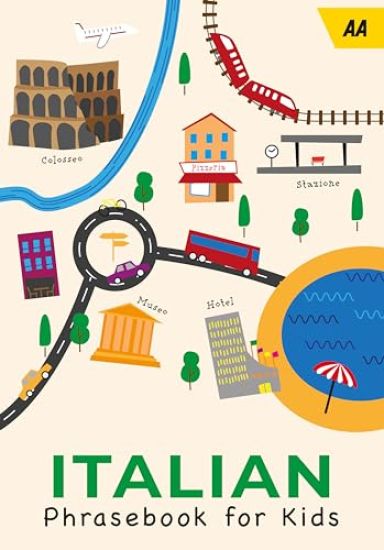
AA Italian Phrasebook for Kids
A great way to have fun and learn at the same time. Designed for children, with the emphasis on fun, these phrasebooks are perfect for children on the move; for holidays, school trips and exchanges. The series covers the most popular European destinations for family holidays. France, Italy and Spain are presented in cartoon format so that the text is easily accessible for children.
AA Spanish Phrasebook for Kids
A great way to have fun and learn at the same time. Designed for children, with the emphasis on fun, these phrase books are perfect for children on the move; for holidays, school trips and exchanges. The series covers the most popular European destinations for family holidays. France, Italy and Spain are presented in cartoon format so that the text is easily accessible for children.
AA 50 Walks in Brecon Beacons & South Wales
The books feature all the practical detail you need, accompanied by fascinating background reading on the history and wildlife of the area, and clear mapping for ease of use. Every route has been colour coded according to difficulty. All walks are annotated with local points of interest and places to stop for refreshments. Every walk is given a summary of distance, time, gradient, level of difficulty, type of surface and access, landscape, dog friendliness, parking and public toilets. Great for a full day out with recommended sights and attractions plus places to eat and drink. Features included revamped cover designs, walk details with a summary of distance, time, terrain and parking, full colour maps for each walk with links to clear route directions, full introduction to each walk providing information on local interests and advise for dog owners.
AA 50 Walks in Devon
The books feature all the practical detail you need, accompanied by fascinating background reading on the history and wildlife of the area, and clear mapping for ease of use. Every route has been colour coded according to difficulty. All walks are annotated with local points of interest and places to stop for refreshments. Every walk is given a summary of distance, time, gradient, level of difficulty, type of surface and access, landscape, dog friendliness, parking and public toilets. Great for a full day out with recommended sights and attractions plus places to eat and drink. Features included revamped cover designs, walk details with a summary of distance, time, terrain and parking, full colour maps for each walk with links to clear route directions, full introduction to each walk providing information on local interests and advise for dog owners.
AA 50 Walks in Gloucestershire
The books feature all the practical detail you need, accompanied by fascinating background reading on the history and wildlife of the area, and clear mapping for ease of use. Every route has been colour coded according to difficulty. All walks are annotated with local points of interest and places to stop for refreshments. Every walk is given a summary of distance, time, gradient, level of difficulty, type of surface and access, landscape, dog friendliness, parking and public toilets. Great for a full day out with recommended sights and attractions plus places to eat and drink. Features included revamped cover designs, walk details with a summary of distance, time, terrain and parking, full colour maps for each walk with links to clear route directions, full introduction to each walk providing information on local interests and advise for dog owners.
AA 50 Walks in Herefordshire & Worcestershire
The books feature all the practical detail you need, accompanied by fascinating background reading on the history and wildlife of the area, and clear mapping for ease of use. Every route has been colour coded according to difficulty. All walks are annotated with local points of interest and places to stop for refreshments. Every walk is given a summary of distance, time, gradient, level of difficulty, type of surface and access, landscape, dog friendliness, parking and public toilets. Great for a full day out with recommended sights and attractions plus places to eat and drink. Features included revamped cover designs, walk details with a summary of distance, time, terrain and parking, full colour maps for each walk with links to clear route directions, full introduction to each walk providing information on local interests and advise for dog owners.
AA 50 Walks in Oxfordshire
The books feature all the practical detail you need, accompanied by fascinating background reading on the history and wildlife of the area, and clear mapping for ease of use. Every route has been colour coded according to difficulty. All walks are annotated with local points of interest and places to stop for refreshments. Every walk is given a summary of distance, time, gradient, level of difficulty, type of surface and access, landscape, dog friendliness, parking and public toilets. Great for a full day out with recommended sights and attractions plus places to eat and drink. Features included revamped cover designs, walk details with a summary of distance, time, terrain and parking, full colour maps for each walk with links to clear route directions, full introduction to each walk providing information on local interests and advise for dog owners.
AA 50 Walks in Shropshire
The books feature all the practical detail you need, accompanied by fascinating background reading on the history and wildlife of the area, and clear mapping for ease of use. Every route has been colour coded according to difficulty. All walks are annotated with local points of interest and places to stop for refreshments. Every walk is given a summary of distance, time, gradient, level of difficulty, type of surface and access, landscape, dog friendliness, parking and public toilets. Great for a full day out with recommended sights and attractions plus places to eat and drink. Features included revamped cover designs, walk details with a summary of distance, time, terrain and parking, full colour maps for each walk with links to clear route directions, full introduction to each walk providing information on local interests and advise for dog owners.
AA 50 Walks in Staffordshire
The books feature all the practical detail you need, accompanied by fascinating background reading on the history and wildlife of the area, and clear mapping for ease of use. Every route has been colour coded according to difficulty. All walks are annotated with local points of interest and places to stop for refreshments. Every walk is given a summary of distance, time, gradient, level of difficulty, type of surface and access, landscape, dog friendliness, parking and public toilets. Great for a full day out with recommended sights and attractions plus places to eat and drink. Features included revamped cover designs, walk details with a summary of distance, time, terrain and parking, full colour maps for each walk with links to clear route directions, full introduction to each walk providing information on local interests and advise for dog owners.
AA 50 Walks in Warwickshire
The books feature all the practical detail you need, accompanied by fascinating background reading on the history and wildlife of the area, and clear mapping for ease of use. Every route has been colour coded according to difficulty. All walks are annotated with local points of interest and places to stop for refreshments. Every walk is given a summary of distance, time, gradient, level of difficulty, type of surface and access, landscape, dog friendliness, parking and public toilets. Great for a full day out with recommended sights and attractions plus places to eat and drink. Features included revamped cover designs, walk details with a summary of distance, time, terrain and parking, full colour maps for each walk with links to clear route directions, full introduction to each walk providing information on local interests and advise for dog owners.
AA 50 Walks in North Yorkshire
The books feature all the practical detail you need, accompanied by fascinating background reading on the history and wildlife of the area, and clear mapping for ease of use. Every route has been colour coded according to difficulty. All walks are annotated with local points of interest and places to stop for refreshments. Every walk is given a summary of distance, time, gradient, level of difficulty, type of surface and access, landscape, dog friendliness, parking and public toilets. Great for a full day out with recommended sights and attractions plus places to eat and drink. Features included revamped cover designs, walk details with a summary of distance, time, terrain and parking, full colour maps for each walk with links to clear route directions, full introduction to each walk providing information on local interests and advise for dog owners.
AA 50 Walks In West Yorkshire
The books feature all the practical detail you need, accompanied by fascinating background reading on the history and wildlife of the area, and clear mapping for ease of use. Every route has been colour coded according to difficulty. All walks are annotated with local points of interest and places to stop for refreshments. Every walk is given a summary of distance, time, gradient, level of difficulty, type of surface and access, landscape, dog friendliness, parking and public toilets. Great for a full day out with recommended sights and attractions plus places to eat and drink. Features included revamped cover designs, walk details with a summary of distance, time, terrain and parking, full colour maps for each walk with links to clear route directions, full introduction to each walk providing information on local interests and advise for dog owners.
AA Road Map Brittany

AA Road Map Brittany

AA Publishing
2024
kartta, viikattu
Fully updated, the maps combine clear design with detailed, useful content and a super, user-friendly layout. The mapping includes road detail to ensure you never lose your way or miss finding a place of interest. Each map features a clearly classified road network with country-specific road numbering and shows road and rail projects under construction as well as planned projects. Toll points, service areas, tourist routes, national parks, beaches, ski resorts, visitor attractions and towns of interest are also highlighted.
AA Road Map Normandy
Fully updated, the maps combine clear design with detailed, useful content and a super, user-friendly layout. The mapping includes road detail to ensure you never lose your way or miss finding a place of interest. Each map features a clearly classified road network with country-specific road numbering and shows road and rail projects under construction as well as planned projects. Toll points, service areas, tourist routes, national parks, beaches, ski resorts, visitor attractions and towns of interest are also highlighted.
AA Road Map Paris & The North

AA Road Map Paris & The North

AA Publishing
2024
kartta, viikattu
Fully updated, the maps combine clear design with detailed, useful content and a super, user-friendly layout. The mapping includes road detail to ensure you never lose your way or miss finding a place of interest. Each map features a clearly classified road network with country-specific road numbering and shows road and rail projects under construction as well as planned projects. Toll points, service areas, tourist routes, national parks, beaches, ski resorts, visitor attractions and towns of interest are also highlighted.
AA Road Map Provence & French Riviera
Fully updated, the maps combine clear design with detailed, useful content and a super, user-friendly layout. The mapping includes road detail to ensure you never lose your way or miss finding a place of interest. Each map features a clearly classified road network with country-specific road numbering and shows road and rail projects under construction as well as planned projects. Toll points, service areas, tourist routes, national parks, beaches, ski resorts, visitor attractions and towns of interest are also highlighted.
AA Big Easy Read Atlas Britain 2025
This A3 format atlas provides giant scale mapping and type throughout making it very easy to use. It is available in two binding styles; paperback and spiral bound. Each page has been titled with its geographical location so you can turn to the page you need more easily. Wide minor roads (more than and less than 4m wide), National Trust, English and World Heritage sites, crematorium locations and other hard-to-find places are indicated on the mapping. There are 72 city, town and port plans including a central district map of London and a full-colour admin map showing all the latest unitary authority areas. Plus, scenic routes and tourist sites with satnav friendly post codes.
AA Big Road Atlas Britain 2025
This best-selling A3 format atlas is available in two binding styles; softback and spiral bound. Each page has been titled with its geographical location so you can turn to the page you need more easily. Wide minor roads (more than and less than 4m wide), National Trust, English and World Heritage sites, crematorium locations and other hard-to-find places are indicated on the mapping. There are 68 city, town and port plans including central London and a list of tourist sites with satnav friendly post codes. Plus scenic routes, caravan and camping sites and over 240 service areas.
AA Easy Read Atlas Britain 2025
This A4 format atlas provides giant scale mapping and type throughout making it very easy to use. Each page has been titled with its geographical location so you can turn to the page you need more easily. Wide minor roads (more than and less than 4m wide), National Trust, English and World Heritage sites, crematorium locations and other hard-to-find places are indicated on the mapping. There is also a full-colour admin map showing all the latest unitary authority areas and a 6 page route-planning map.