Kirjojen hintavertailu. Mukana 11 699 587 kirjaa ja 12 kauppaa.

Kirjahaku

Etsi kirjoja tekijän nimen, kirjan nimen tai ISBN:n perusteella.

1000 tulosta hakusanalla Philip Stuart

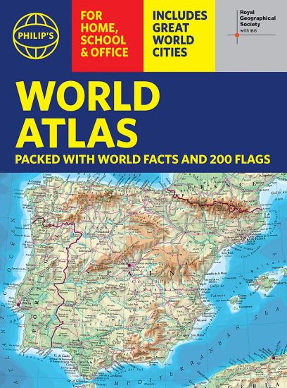
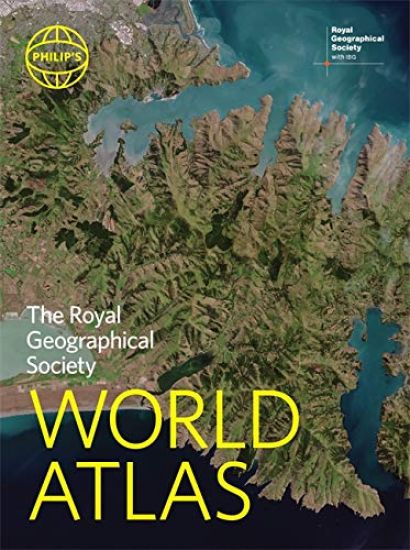
Philip's RGS World Atlas
"An excellent world atlas. Very illuminating, good colours, clear texts...good glossary and, last but not least, up-to-date". Amazon customer review· The market-leading world atlas for work, study or leisure· Great value for money and top seller on Bookscan in this price range. · 96 pages of authoritative world maps, physical and political· 70 city maps in the fascinating World Cities section, with full-page satellite images for 10 great cities· Over 35,000 place name indexAll this and a special 32-page introductory section - 'The World in Focus' - covers key geographical themes such as the Earth's position in the Solar System, the structure of the Earth, climate and weather, the environment, population, resources, economics and international organizations. Vital information on topics covered in geography, humanities and economics courses.The information-packed World Atlas from Philip's, published in association with the Royal Geographical Society has been fully updated for this new 2021 edition.
Philip's Driver's Atlas Britain
PHILIP'S: BRITAIN'S CLEAREST MAPS FOR NEW DRIVERS AND EXPERIENCED MOTORISTS ALIKE- Clear 4 miles to 1 inch maps - fully updated for easy driving - Superb detail for journey planning and leisure activities - London street plan plus 47 town and city centre plans - Route planner, distance table and London approaches map - Excellent value for money at only £9.99 Philip's Driver's Atlas Britain is an excellent value, concise paperback atlas containing all the map features normally included only in the more expensive road atlases. The front section has a route planner, key to map symbols, London approaches, plus a key map and distance table.For easy navigating the atlas covers all of Britain at 4 miles to 1 inch (parts of Scotland at 5 miles to 1 inch, Orkney and Shetland at 6 miles to 1 inch). The maps clearly mark service areas, roundabouts and multi-level junctions, and in rural areas distinguish between roads over and under 4 metres wide - a boon for drivers of wide vehicles. The town plan section includes a street plan of London plus 47 town and city centre maps, marking car parks and places of interest. Completing the atlas is a huge index of 28,000 place names, so you can always find your desired destination.
Philip's Navigator Street Atlas Lincolnshire
The only county Street Atlas with all the named streets of Lincolnshire and perfect back-up for emergency services, delivery drivers, visitors and locals. With more than 24,000 named streets, roads, lanes and alleys, this is the essential map book for residents and visitors - especially if you're in a hurry. Includes all the streets in BOSTON, GRANTHAM, GRIMSBY, LINCOLN, PETERBOROUGH, SCUNTHORPE, Alford, Barton-upon-Humber, Bourne, Brigg, Chapel St Leonards, Cleethorpes, Coningsby, Gainsborough, Holbeach, Horncastle, Immingham, Long Sutton, Louth, Mablethorpe, Market Deeping, Market Rasen, Skegness, Sleaford, Spalding, Spilsby, Stamford.- Street mapping clearly shows car parks, stations, schools, hospitals and many places of interest, even those off the beaten path- A practical route-planning section showing all A and B roads- Super-clear mapping- Easy-to-use index- Scales: 1¾ inches to 1 mile (1:36,000) and 3½ inches to 1 mile (1:18,000). Major towns: 7 inches to 1 mile (1:9,000).Other information on the maps includes postcode boundaries, car parks, railway and bus stations, post offices, schools, colleges, hospitals, police and fire stations, places of worship, leisure centres, footpaths and bridleways, camping and caravan sites, golf courses, and many other places of interest.
Philip's RGS Junior School Atlas
The 11th edition of the market-leading atlas for primary school pupils, Philip's RGS Junior School Atlas has been fully revised and updated with all the latest facts and curriculum requirements.- The essential atlas for primary schools with clear and easy-to-follow maps and diagrams - updated for 2021/2022- Published in association with the Royal Geographical Society- Recommended for Key Stage 2 of the National Curriculum - and all 7-11 year olds - An excellent introduction to mapping concepts such as scale, direction, symbols, longitude and latitude- 22-page Britain and Ireland section with clear thematic charts, diagrams and large-scale regional maps- 22-page section on The World, with political maps - and thematic treatment of key themes, from volcanoes and earthquakes to transport and tourism- Continents section with physical and political maps- Easy-to-follow map references and 1,000-place indexThe market-leading atlas for pupils at primary schools, Philip's RGS Junior School Atlas is a stimulating and authoritative first introduction to the world of maps, and is recommended for Key Stage 2 of the National Curriculum.The introductory section describes the meaning of scale, how to measure distances using the maps, and explains the symbols on the maps.The following section is devoted to the United Kingdom and Ireland. Thematic maps cover topics such as mountains and rivers, climate and weather, population and cities, farming and fishing, industry and energy, transport, tourism and conservation. Regional maps of England and Wales, Scotland and Ireland complete this section.The rest of the atlas is made up of world thematic maps and world continental maps. Included are topics such as the world's climate, vegetation, agriculture, energy sources, and environmental concerns, such as global warming. A simple letter-figure index completes the atlas - a useful introduction to help the young reader find his/her way around the maps. Available in both Hardback and Paperback editions.
Philip's RGS Junior School Atlas
The 11th edition of the market-leading atlas for primary school pupils, Philip's RGS Junior School Atlas has been fully revised and updated with all the latest facts and curriculum requirements. - The essential atlas for primary schools with clear and easy-to-follow maps and diagrams - updated for 2021/22- Published in association with the Royal Geographical Society- Recommended for Key Stage 2 of the National Curriculum - and all 7-11 year olds - An excellent introduction to mapping concepts such as scale, direction, symbols, longitude and latitude- 22-page Britain and Ireland section with clear thematic charts, diagrams and large-scale regional maps- 22-page section on The World, with political maps - and thematic treatment of key themes, from volcanoes and earthquakes to transport and tourism- Continents section with physical and political maps- Easy-to-follow map references and 1,000-place indexThe market-leading atlas for pupils at primary schools, Philip's RGS Junior School Atlas is a stimulating and authoritative first introduction to the world of maps, and is recommended for Key Stage 2 of the National Curriculum.The introductory section describes the meaning of scale, how to measure distances using the maps, and explains the symbols on the maps.The following section is devoted to the United Kingdom and Ireland. Thematic maps cover topics such as mountains and rivers, climate and weather, population and cities, farming and fishing, industry and energy, transport, tourism and conservation. Regional maps of England and Wales, Scotland and Ireland complete this section.The rest of the atlas is made up of world thematic maps and world continental maps. Included are topics such as the world's climate, vegetation, agriculture, energy sources, and environmental concerns, such as global warming. A simple letter-figure index completes the atlas - a useful introduction to help the young reader find his/her way around the maps. Available in both hardback and paperback editions.
Philip's RGS Children's School Atlas

Philip's RGS Children's School Atlas

David Wright; Jill Wright;

Philip's
2021
sidottu
"This is such a great book for primary school age children and a little beyond for finding out about the world, its countries and people" Amazon customer review- Philip's atlas, designed specially to use at home and at school with guidance for parents and teachers- Clear maps and fascinating facts bring geography to life for readers aged 7-12- Published by Philip's the UK's leading school atlas publisher, in association with the Royal Geographical Society- Quizzes, activity ideas and puzzles to make learning fun- Past winner of the Geographical Association's award for making a significant contribution to geographyThe atlas is organized spread by spread in the classic sequence: first Europe, then its land neighbour Asia, followed by Africa, Australia and Oceania, North America and South America.Illustrated with captivating full-colour photographs and packed with fact boxes, curiosities, flags, stamps and quiz questions, Philip's RGS Children's Atlas is both fun to use and easy to understand.Now in its 16th edition, Philip's RGS Children's Atlas is a past winner of the Geographical Association's award for making a significant contribution to geography. The atlas was judged "an excellent 'all round' children's atlas with simple yet well-designed maps, well-illustrated with colour photographs. It links places to issues, events and real people, giving a clear sense of place."
Philip's RGS Modern School Atlas
- Britain's best-selling school atlas - now in its 100th edition- Recommended for Key Stage 4, GCSE and A-level in England and Wales (Scottish National Qualifications/Highers) and international schools.- Fully updated to reflect the latest changes in the curriculum- Published in association with the Royal Geographical Society- Combines superb digital maps of Britain and the world with up-to-date thematic maps across a wide range of topics- Essential learning including political, physical, climate and thematic mapping- Country-by-country statistics on population, land use, trade, tourism, energy, wealth and much more - World Themes Section - from volcanoes and earthquakes to population trends, languages and religions, all the key aspects and statistics of geography are explored and explained- Plus a special section on how satellite imagery is used to interpret global, environmental and urban patterns of change Britain's best-selling secondary school atlas, now in its 100th Edition. The contents are divided into sections for ease of use, with each page colour-coded for rapid reference. It contains clear explanations of scale, latitude and longitude, map projections and Geographical Information Systems (GIS).The physical maps of the United Kingdom and Ireland are accompanied by thematic maps on numerous key social and economic themes. The middle section is made up of World topographical maps, incorporating continental thematic maps on topics such as climate, population and economics, followed by 30 pages of World thematic maps.Completing the atlas is a section of World social and economic statistics, accompanied by the index to the topographical maps in the atlas, showing letter-figure grid references as well as latitude and longitude co-ordinates.Available in both hardback and paperback formats, Philip's Modern School Atlas 100th Edition is an unbeatable combination of highly detailed physical mapping backed up by numerous tables and enlightening thematic maps.
Philip's RGS Essential School Atlas
'The best educational book for secondary school kids' - Daily Mirror- The ideal school atlas for Key Stage 3 pupils and Scotland's National Qualifications., 11-14 years old- All updated for 2021-2022 specifically to meet curriculum needs- Specially focused 16-page UK and Ireland section- Comprehensive 62-page world section includes thematic maps on the environment, climate change, people, quality of life, and energy- Published in association with the Royal Geographical SocietyPhilip's RGS Essential School Atlas has been specially created for lower-secondary geography students (11-14 year olds). The maps have been carefully designed to be uncluttered and easy to read, containing specially selected place names and detail. A clear set of symbols and scale information accompanies every map, with a useful introductory section covering basic atlas skills, including aerial photographs and satellite images to further explain particular features on the maps. Latitude and longitude co-ordinates are included in the index, alongside figure-letter references. Fully up-to-date, the atlas includes detailed regional maps, charts and satellite images of Europe, Italy, the Middle East, China, Japan, Kenya, USA, Brazil, and the Arctic and Antarctica. It also focuses on areas of special interest for students of geography, such as Japan's volcanoes and earthquakes, conservation in Kenya, and water supply in the USA.Philip's RGS Essential School Atlas is ideal for special project work and is available in both hardback and paperback editions.
Philip's Stargazing 2022 Month-by-Month Guide to the Night Sky in Britain & Ireland
"If you buy just one guide...you won't do better than this" - BBC Sky at Night Magazine"I will continue to enjoy 'Philip's Stargazing' as the months go by" - Helen Sharman, Astronaut "Very useful indeed" - Chris Lintott, Sky at Night presenterDiscover the latest in stargazing with the new and definitive guide to the night sky.Whether you're a seasoned astronomer or just starting out, Philip's Stargazing 2022 is the only book you'll need. Compiled by experts and specially designed for use in Britain and Ireland, Stargazing 2022 acts as a handily illustrated and comprehensive companion.- 12 Brand-New Maps for year-round astronomical discovery- Month-to-Month information. Daily Moon Phase Calendar, highlighting special lunar events throughout the year- Planet Watch for ideal viewing days in 2022- Avoid light pollution with our detailed Dark Sky Map- Expert advice and insight throughout from internationally renowned Professor Nigel Henbest- A 'Behind the Scenes' look at astrophotography from expert Robin Scagell- Complete calendar of major astronomical events, including the Top 20 Sky Sights of 2022- Jargon Buster, explaining common or confusing terms - The planets' movements explained from solar and lunar eclipses to meteor showers and comets