Kirjahaku
Etsi kirjoja tekijän nimen, kirjan nimen tai ISBN:n perusteella.
1000 tulosta hakusanalla Howard Levin
282 pages with 65 total maps Locating original landowners in maps has never been an easy task-until now. This volume in the Family Maps series contains newly created maps of original landowners (patent maps) in what is now Howard County, Arkansas, gleaned from the indexes of the U.S. Bureau of Land Management. But it offers much more than that. For each township in the county, there are two additional maps accompanying the patent map: a road map and a map showing waterways, railroads, and both modern and many historical city-centers and cemeteries. Included are indexes to help you locate what you are looking for, whether you know a person's name, a last name, a place-name, or a cemetery. The combination of maps and indexes are designed to aid researchers of American history or genealogy to explore frontier neighborhoods, examine family migrations, locate hard-to-find cemeteries and towns, as well as locate land based on legal descriptions found in old documents or deeds. The patent-maps are essentially plat maps but instead of depicting owners for a particular year, these maps show original landowners, no matter when the transfer from the federal government was completed. Dates of patents typically begin near the time of statehood and run into the early 1900s. What's Mapped in this book (that you'll not likely find elsewhere) . . . 5202 Parcels of Land (with original landowner names and patent-dates labeled in the relevant map) 52 Cemeteries plus . . . Roads, and existing Rivers, Creeks, Streams, Railroads, and Small-towns (including some historical), etc. What YEARS are these maps for? Here are the counts for parcels of land mapped, by the decade in which the corresponding land patents were issued: DecadeParcel-count 1820s25 1830s427 1840s235 1850s1035 1860s584 1870s98 1880s455 1890s495 1900s1277 1910s504 1920s67 What Cities and Towns are in Howard County, Arkansas (and in this book)? Allbrook, Amity (historical), Antimony (historical), Athens, Atwood, Baker Springs, Battle Hill (historical), Bethany, Bethel (historical), Bissell (historical), Blue Bayou, Bluff Springs (historical), Briar, Brushy (historical), Buck Range, Burg, Cedar Glade (historical), Cedar Hill (historical), Center Point, Chapel Hill, Corinth, Davis Ford, Dial (historical), Dierks, Duckett, Duckett Ford, Euclid, Faulkner Springs, Forgy (historical), Galena, Green Plains, Hattie (historical), Henry, Martha (historical), Midway, Midway (historical), Mineola, Mineral Springs, Mount Carmel, Mount Olive (historical), Mouton (historical), Muddy Fork, Nashville, New Moon (historical), New Thompson (historical), Oak Hill (historical), Okay, Old Euclid (historical), Old Thompson (historical), Old Union (historical), Oreb (historical), Pates (historical), Perkins, Pryor Ridge (historical), Pump Springs (historical), Reed, Rosedale (historical), Rough Edge (historical), Saline (historical), Saratoga, Schaal, Schooley, Shiloh, Slip-Up and Hitch (historical), Smyrna (historical), Sunshine (historical), Temperanceville, Tollette, Umpire, Unity, Valley Ridge (historical), Wakefield (historical)
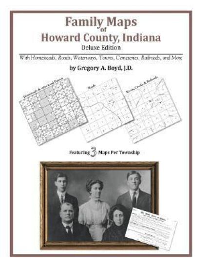
150 pages with 35 total maps Locating original landowners in maps has never been an easy task-until now. This volume in the Family Maps series contains newly created maps of original landowners (patent maps) in what is now Howard County, Indiana, gleaned from the indexes of the U.S. Bureau of Land Management. But it offers much more than that. For each township in the county, there are two additional maps accompanying the patent map: a road map and a map showing waterways, railroads, and both modern and many historical city-centers and cemeteries. Included are indexes to help you locate what you are looking for, whether you know a person's name, a last name, a place-name, or a cemetery. The combination of maps and indexes are designed to aid researchers of American history or genealogy to explore frontier neighborhoods, examine family migrations, locate hard-to-find cemeteries and towns, as well as locate land based on legal descriptions found in old documents or deeds. The patent-maps are essentially plat maps but instead of depicting owners for a particular year, these maps show original landowners, no matter when the transfer from the federal government was completed. Dates of patents typically begin near the time of statehood and run into the early 1900s. What's Mapped in this book (that you'll not likely find elsewhere) . . . 1393 Parcels of Land (with original landowner names and patent-dates labeled in the relevant map) 29 Cemeteries plus . . . Roads, and existing Rivers, Creeks, Streams, Railroads, and Small-towns (including some historical), etc. What YEARS are these maps for? Here are the counts for parcels of land mapped, by the decade in which the corresponding land patents were issued: DecadeParcel-count 1830s7 1840s813 1850s572 1860s1 What Cities and Towns are in Howard County, Indiana (and in this book)? Alto, Cassville, Center, Darrough Chapel, Greentown, Guy, Hemlock, Indian Heights, Jerome, Judson, Kappa Corner, Kokomo, New London, Oakford, Phlox, Plevna, Poplar Grove, Ridgeway, Russiaville, Shambaugh Siding, Shanghai, Sycamore, Vermont, West Liberty, West Middleton
General Tasker Howard Bliss and the "Sessions of the World," 1919
David F. Trask
American Philosophical Society Press
1966
pokkari
The Life, Public Services and Select Speeches of Rutherford B. Hayes. by J. Q. Howard.
James Quay Howard
University of Michigan Library
2006
pokkari

Poetical Works Of Henry Howard, Earl Of Surrey; Minor Contemporaneous Poets; And Thomas Sackville, Lord Buckhurst (1854)
KESSINGER PUBLISHING CO
2008
pokkari

The Lives Of Philip Howard, Earl Of Arundel, And Of Anne Dacres, His Wife (1857)
Henry Granville Fitzalan-Howard
KESSINGER PUBLISHING, LLC
2008
nidottu
The Lives Of Philip Howard, Earl Of Arundel, And Of Anne Dacres, His Wife (1857)
Henry Granville Fitzalan-Howard
KESSINGER PUBLISHING, LLC
2008
sidottu
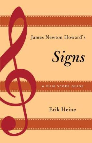
Released in 2002, M. Night Shyamalan’s Signs was the director’s follow-up to The Sixth Sense and Unbreakable, and his third collaboration with composer James Newton Howard. Well received by audiences and critics alike, the film was often cited by reviewers for its music. With its dependence on a single motive, the score is unique in Howard’s career, and one of his most effective and haunting works. In James Newton Howard’s Signs: A Film Score Guide, Erik Heine provides the first close reading of the composer’s work. Heine discusses Howard’s musical style and influences, as well as his ability to compose for a variety of genres, acknowledging him as one of the most versatile composers working today. The book shows how early sketches of cues for Signs were developed into the final score, allowing the reader insight into Howard’s compositional process. The book also demonstrates how Howard’s style is difficult to pigeonhole, since his focus is on serving the needs of the film. Drawing on completed orchestrated scores, as well as other material from the James Newton Howard Archive at the University of Southern California, the level of musical detail provided in this volume is unsurpassed. As a book that addresses Howard’s compositional style—and the only volume that significantly examines the music in any Shyamalan film—James Newton Howard’s Signs: A Film Score Guide will be of interest to music scholars, film scholars, and fans of the composer’s work.
The Love Life of Howard Handsome and Other Short Stories
Albert Zimbler
Createspace Independent Publishing Platform
2011
nidottu
Murder at the Old Howard: The Second Porridge Sisters Mystery
Donald McNeilly; Frank Cullen
Createspace Independent Publishing Platform
2011
nidottu