
Kirjahaku
Etsi kirjoja tekijän nimen, kirjan nimen tai ISBN:n perusteella.
1000 tulosta hakusanalla Philip Kitcher
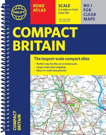
Philip's Compact Britain Road Atlas
Octopus Publishing Group
2025
kierre
Newly updated in a handy spiral-bound lie-flat format, Philip's Compact Britain Road Atlas features the super-clear digital cartography, which was voted Britain's clearest and most detailed mapping in an independent consumer survey.All of Great Britain in a super-clear set of maps specially created to fit in a glovebox, bag, backpack or motorcycle tank bag, with resilient lie-flat binding to ensure you have the detail you need and never get lost. A route planning section will help you navigate around the island easily and every part of Britain is clearly mapped. - Chunky 'glovebox' format - perfect for the car or backpack- Lie-flat spiral binding and A5 size - ideal for a motorcycle tank bag- Completely updated and revised with the latest information - Compact and great value for money- The clearest, most detailed road maps in a compact format - Complete coverage of Great Britain at 3.3 miles to 1 inch - Includes a 6-page route-planning section - Spiral binding for robust, long-lasting use
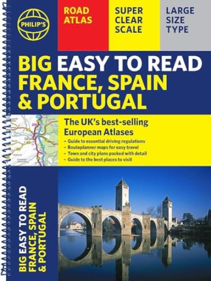
Philip's Big Easy to Read France, Spain & Portugal Road Atlas
Octopus Publishing Group
2025
kierre
The Philip's Big Easy to Read France, Spain and Portugal Road Atlas, in a large spiral bound lie-flat edition, is the must-have travelling atlas for anyone who needs the big picture for touring these countries and the adjacent countries including Belgium and Luxembourg.Scenic routes are highlighted on the road maps, with theme parks and World Heritage Sites also clearly shown. The maps highlight towns with low-emission zones and show motorway rest/parking areas, not forgetting handy listings of top sites to visit and useful ski resort information.From the market leaders in European Road Mapping, in addition to the main maps at 1:750,000, the road network is shown at three supplementary scales from 1:250,000 to 1:3M, with ultra-clear detailed maps for urban areas, so that you can navigate in this part of Europe with ease and the toll, toll-free and pre-pay motorways all clearly marked. Philip's Big Easy to Read France and Spain Road Atlas includes: * Easy to read and updated driving regulations, including speed limits;* Route-planning maps which enable journeys of over 800 miles to be planned without turning a page;* Super clear, detailed road maps, with scenic routes highlighted and toll, toll-free and pre-pay motorways all clearly marked;* Large-scale urban-area maps;* City-centre plans marking historic buildings and tourist attractions, as well as car parks, head post offices and other facilities;* Listings for ski resorts and top visitor attractions.
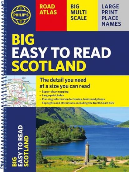
Philip's Big Easy to Read Scotland Road Atlas (Spiral A3)
Octopus Publishing Group
2025
kierre
Philip's Big Easy Read Scotland Road Atlas is an exceptionally clear guide to the best of Scotland from the market-leading map makers. Reliable and up to date, the fully indexed mapping is accompanied by town plans, tourist and planning information, and spectacular scenic routes including the celebrated North Coast 500. The detailed yet easy-read maps show national parks, cultural and historical attractions, long-distance footpaths and much, much more.· Exceptional clarity with large-print place names and large-scale maps· Large-print index· Super-sized A3 pages for easy reading on the go· Shows most of Scotland at a scale of 1 inch to 2.37 miles (1:150 000); most islands and north Scotland at 1 inch to 3.16 miles (1:200 000) and 1 inch to 3.95 miles (1:250 000)· Packed with ideas and details about places to visit· Easy to read mapping with the NC500, long-distance footpaths, national parks, museums, castles and more· Town centre maps, fully indexed for easy navigation· Clear travel-planning information - trains, planes and ferries· Hard-wearing and practical A3 format with spiral binding
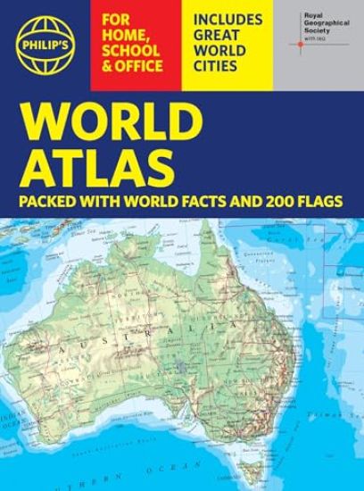
Philip's RGS World Atlas (A4)
Octopus Publishing Group
2025
nidottu
Thousands of global facts at your fingertips with the best value quick-reference World Atlas on the market, now fully updated. Both physical and political geography is clearly illustrated alongside the great cities of our planet.The highest peak? The deepest ocean trench? The wettest, driest, longest, largest - we list the world's fascinating extremes. Crammed with practical information like a Distance Chart for World Cities, World Time Zones, 200 State Flags and the top 100 most populous countries, we include around 15,000 places indexed for easy checking. Whether for the pub quiz, travel planning or school reference, this great value handy world atlas is crammed with everything you need to know.Alongside the topography and physical attributes of the earth we also show political boundaries and the great global cities, including transport hubs and places of interest from mosques to temples, palaces to zoos and shopping centres to tourist information centres.For this new edition, the maps have been fully updated to show the newly inaugurated capital of Indonesia, the new name for Kazakhstan's capital, renamed provinces in India, city name changes in Ukraine and much more. The physical and political statistics are the most recent available. Features include: * 200 Flags of the world's major states and territories* 21 City centre maps: transport (road, rail, trams, light railways, bus and railway stations) and places of interest including religious buildings (churches, abbeys, cathedrals, synagogues, shrines, temples, mosques), museums, galleries, theatres, palaces, castles, parks, gardens, zoos, shopping centres, hospitals, Tourist Centres.* World city distance table* World time zones map* Country comparisons table - the population and areas of the world's top 100 most populous countries* Physical comparisons- largest oceans, longest rivers, biggest islands, highest peaks, deepest trenches.* Continental Comparator - for each one we show area, coldest place, hottest place, wettest place, driest place * World topographic maps - with coloured contour layers and hill-shading clearly outlining the Earth's surface.* World political maps - the latest boundary and geopolitical changes.* Index of approx. 15,000 place-names - with geographical features like mountains, lakes and deserts, as well as towns.
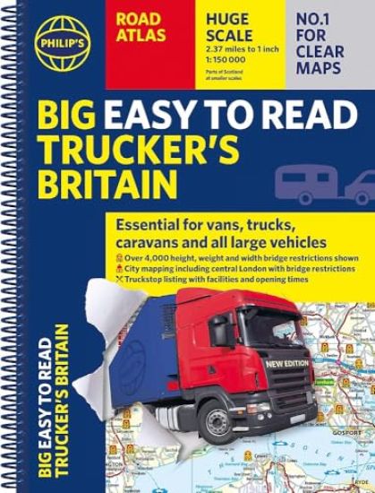
Philip's Big Easy to Read Trucker's Road Atlas Britain
Octopus Publishing Group
2025
kierre
PHILIP'S - THE ATLAS BRAND FOR TRUCKERS, CARAVANNERS AND OTHER SERIOUS ROAD USERS'The best of its kind with quick and easy to use information' Fleet Week- Essential, large, easy-to-read mapping for Truckers (and for Caravanners, too) - Over 4,000 bridges with restrictions - either height, weight or width - located on the maps- Super-clear scale maps of the UK - 'the detail you need at a size you can read'- Special Feature: 'Bridge Strikes' (including 'Most Hit Bridges' - all bridges struck five or more times in a year)- Truck stop/large vehicle listings and location maps, including the facilities and opening times- All approach mapping/urban area maps with bridge restrictions- Large-print index - with 30,000 names- Big format and spiral binding - easy-to-use and easy-to-read on the road'Even though I have a satnav I find a map essential for planning in stops on long routes.' a trucker customerThe new Philip's Big Easy to Read Trucker's Road Atlas Britain shows over 4,000 bridges with restrictions - either height, weight or width - and is indispensable for anyone driving a large vehicle, caravan or lorry. Super-clear, large-print maps and packed with the most useful information for drivers of large vehicles.
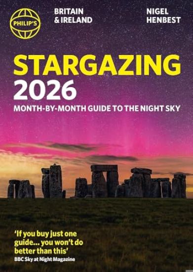
Philip's 2026 Stargazing Month-by-Month Guide to the Night Sky Britain & Ireland
Nigel Henbest
Octopus Publishing Group
2025
nidottu
Philip's Stargazing is the perfect practical guide for both budding and experienced astronomers."If you buy just one guide...you won't do better than this." - BBC Sky at Night Magazine"I will continue to enjoy 'Philip's Stargazing' as the months go by." - Helen Sharman, Astronaut"Very useful indeed." - Chris Lintott, Sky at Night presenterPhilip's Stargazing is essential for all those who enjoy exploring the night sky, with up-to-date monthly star charts, moon calendars and viewing tips, as well as the best dark-sky sites to visit and astronomy festivals through the year. In 2026 there is a 90% solar eclipse with the next total eclipse not due until 2090. Compiled by experts and specially designed for easy use, Stargazing 2026 is a comprehensive companion for both seasoned and novice astronomers.* Fully updated colour star chart for each month of the year* Viewing recommendations and practical advice including a 90% Solar Eclipse in August 26 * Top constellation, target object, topic and picture for each month* Daily Moon Phase Calendar, highlighting special lunar events throughout the year * Planet Watch for ideal viewing days in 2026* The best places to experience Dark Skies * The latest on Star Festival, Star Parties and astronomy-themed days out* Expert advice from internationally renowned astronomer professor Nigel Henbest * Special article by equipment expert Robin Scagell on the best first telescopes* Tips for using your smartphone to navigate the skies* Complete calendar of major astronomical events * Top 20 Sky Sights of 2026* Jargon Buster, explaining common or confusing terms * Clear Explanations of the planets' movements, solar and lunar eclipses, meteors and comets
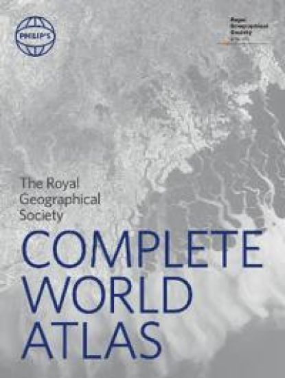
Philip's RGS Complete World Atlas
Octopus Publishing Group
2025
sidottu
A superbly detailed Philip's world atlas, published in association with the Royal Geographical Society. From global stats on climate and population to stunning satellite imagery, the world is revealed in all its splendour.The large section of physical and political maps have been selected to provide balanced coverage of the continents, while giving prominence to densely populated and economically or strategically important areas. Projections and scales have been chosen to maximize legibility and minimize distortion over the largest regions. Acclaimed by geographers everywhere, Philip's physical maps combine relief shading with layer-coloured contours to give a stunning visual impression of the Earth's surface, while charting physical features, settlements and communications with meticulous accuracy. Included also is a superb 26-page 'Images of Earth' section, showing 25 of the world's most important cities and regions in Europe, Asia, Africa, Australasia and the Americas in breath-taking satellite imagery. In addition, the atlas features a series of fascinating maps depicting our ocean seafloors in stunning detail. Completing the atlas, and with full latitude and longitude co-ordinates along with letter-figure grid references, the extensive index of over 64,000 names includes geographical features such as mountains, rivers, lakes and deserts, as well as provinces, towns and cities.
Philip's RGS Atlas of the World
Institute Of British Geographers
Octopus Publishing Group
2025
sidottu
Packed with the latest statistics and filled with glorious images and cartography, the Philip's RGS Atlas of the World gives a striking view of the Earth's surface and its many complexities and treasures. "This atlas brilliantly captures what a precious and impressive place we live in." Michael Palin "Beautifully put together, lavishly laid out. In a word - sumptuous!" Tim Marshall* Following the updated World Statistics, there is a new special feature on: Cities of Dreams? It delves into the history of cities and urbanisation and the development of wealth and innovation alongside slums and desperation. The decline and rise of cities around the world are examined as are possible sustainable futures eg the 15-minute city. * Images of Earth encapsulate the planet using satellites, with images processed exclusively for this atlas, ranging from Nuuk, Greenland to Hanoi, Vietnam. * The extensive Gazetteer of Nations has been comprehensively updated to include the latest economic and political information. * In World Geography we provide detailed studies of topics from Climate Change and weather records to reviews of Global Wealth and Standards of Living; alongside the latest migration flow and population data. * World city plans: 70 of the world's greatest cities in 119 maps are shown in detail with locations of great public buildings and the largest museums and galleries. * In World Maps, we reflect the new networks of high-speed railways and roads in China and Mexico, a new link between Jakarta and Bandung in Indonesia, a new city of Ekurhuleni recognised as a separate city outside Johannesburg, South Africa, new provinces in Ethiopia, and more first nation names in New Zealand and other countries.
Philip's 2027 Easy to Read Road Atlas of Britain (A4 Paperback)
Octopus Publishing Group
2026
nidottu
"The detail you need at a size you can read". The latest 2027 Philip's Easy to Read Road Atlas of Britain from the best-selling Road Atlas range has over 350 pages packed with exceptionally clear mapping and everything you need for exploring Britain. Now available as a practical paperback, it will enhance any trip.· Clear maps packed with extra details for a better journey· Huge 1:150,000 scale (approx 2.4 miles to 1 inch)· Large print place names· Large print index· Super-clear 10-page route planner to create the best journeys· Thousands of attractions clearly mapped, including castles, theme parks, gardens, zoos and more.· Over 100,000 copies of the Philip's Easy Read Road Atlases of Britain sold since launch in 2020.At last, a road atlas that everyone can read easily, in or out of the car, no matter what the conditions. With up-to-date mapping technology, your travels have never been easier to plan. This edition contains a wealth of useful information, including tourist attractions, to ensure the best possible journey. Whether it's dark, or if you just can't find your glasses, the 2027 Philip's Easy to Read Road Atlas of Britain is the ultimate road companion.
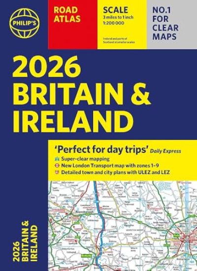
Philip’s 2027 Road Atlas Britain & Ireland
Octopus Publishing Group
2026
nidottu
'Good balance between detail and clarity with excellent town maps' What Car?'Perfect for day trips' The Daily ExpressPHILIP'S - Market leader and No. 1 in the UK for clear maps 2027 Philip's Road Atlas of Britain and Ireland is a top-of-the-range, A4-sized, paperback atlas featuring fully updated maps from the Philip's digital database. Voted Britain's clearest and most detailed in an independent consumer survey, the mapping is super-clear.* 88 fully indexed and detailed town-centre maps with Low Emission Zones and Ultra Low Emission Zones* Top tips for better and safer driving including how to parallel park* 160 pages of fully updated super-clear road maps* 10 pages of detailed route-planning maps, to help plan your route in advance* Mapping at a scale of 3 miles to 1 inch = 1:200,000 for clarity and ease of use* Major city approach maps with named arterial roads* Clear road mapping showing all of Ireland* Includes London Transport map zones 1-9The maps clearly mark service areas, roundabouts and multi-level junctions, and in rural areas distinguish between roads over and under 4 metres wide. It also includes a 2-page road map of Ireland, 10 pages of route-planning maps, a distance table, London Transport map, 10 large-scale city approach maps with named arterial roads, the latest ULEZ details, and 88 extra-detailed and fully indexed town and city plans. Wherever you are driving in Britain and Ireland, this is the ultimate road trip companion.
Philip's 2027 Big Road Atlas of Britain and Ireland
Octopus Publishing Group
2026
nidottu
'Good balance between detail and clarity with excellent town maps' What Car?PHILIP'S is No. 1 in the UK for clear maps. The latest 2027 Philip's Big Road Atlas of Britain and Ireland, in a supersize large format, is expertly illustrated with landscapes and natural attractions and has fully updated mapping from the Philip's digital database alongside all the detail and information needed for successful travel.* Low Emission and Ultra Low Emission Zones clearly marked on town plans* Top driving tips for safety and skill including parallel parking * The best scenic routes, natural features and landscape highlighted for enhanced travelling* Practical 'more to view per page' A3 size* Main scale of maps: 3 miles to 1 inch = 1:200,000 for ease of use* Route-planning section for the easiest navigation* 64 fully indexed town and city plans* City approach maps with named roads for the best access with the latest ULEZ clearly outlined* Clear road map showing all of Ireland* Includes London Transport map with zones 1-92027 Philip's Big Road Atlas of Britain and Ireland contains 96 pages of road maps covering Britain at 3 miles to 1 inch (Scottish Highlands and Western Isles at 4 miles to 1 inch, Orkney and Shetland at 5.25 miles to 1 inch). The maps clearly mark service areas, roundabouts and multi-level junctions for easy navigation, and in rural areas distinguish between roads over and under 4 metres wide, to help wide vehicles. There are extra-detailed town plans for easy navigation. The atlas also includes a 2-page road map of Ireland, route-planning maps, a distance table, London Transport map, and 12 large-scale city approach maps with named arterial roads and the expanded ULEZ clearly outlined for London. Wherever you are driving in Britain or Ireland, this is the ultimate road companion.
Philip's 2027 Easy to Read Multiscale Road Atlas of Europe
Octopus Publishing Group
2026
nidottu
PHILIP'S: THE BEST-SELLING EUROPEAN ATLAS RANGE IN THE UKWith the detail you need at a size you can read, the latest 2027 Philip's Easy to Read Multiscale Road Atlas of Europe is the ultimate driving companion. Including the rules and regulations across Europe for easy driving, and the high speed and main line networks if you need to take to the train.* Super-clear, easy to read main scale at 1:750,000 (12 miles to 1 inch)* Multiscale mapping with scales from 1:1.5M to 1:3M, showing more detail where you need it* Clear mapping of every country in Europe and the driving rules and regulations* Special mapping of canals and rivers for cruising and boating* Distance Chart and a 23-page route planning section included, for easy route planning across long distances* Spectacular scenic routes clearly highlighted* Including Europe's High-Speed Rail and Main Line Network to help plan long distance journeys with ease'The clearest and most detailed maps of Europe' David Williams MBE, former CEO Gem Motoring Assist'The best of its kind with quick, easy-to-use information' Fleet Week
Philip's 2027 Big Road Atlas of Europe
Octopus Publishing Group
2026
nidottu
PHILIP'S: THE BEST-SELLING EUROPEAN ATLAS RANGE IN THE UK with 'The clearest and most detailed maps of Europe' David Williams MBE, former CEO Gem Motoring Assist'The best of its kind with quick, easy-to-use information' Fleet WeekSuper-clear, easy-to-read main scale at 1:750,000 (12 miles to 1 inch)Extra pages with scales from 1:1.5M to 1:3M, showing more detail where you need itClear mapping of every country in Europe with all the driving regulations for each oneEasy-to-use large A3 format with large maps and large print place namesRivers and canals specially mapped for cruises and water-based travel 16-page route planning section, for easy route planning across long distances50 town and city plans for easy navigationOver 30 urban area maps to help driving in denser areasSpectacular scenic routes clearly highlightedTimes zones mapped across EuropeIncluding mapping of Europe's High-Speed and Main Line Rail Network to help plan long distance journeys Using the most up-to-date mapping technology, this is the ultimate road companion for moving around Europe.
Philip IV and the World of Spain’s Rey Planeta
BOYDELL BREWER LTD
2023
sidottu
Did Spain fall into decline or flourish in the seventeenth century? This edited collection looks at perceptions and representations of Philip IV, Spain's 'Planet King', and his government against the backdrop of the seventeenth-century General Crisis in Europe, wars, revolutions and a sovereign debt crisis. Scholars often associate Philip's reign (1621-1665) with decline, decadence, crisis, stagnation and adversity (as did many contemporaries); yet the glittering cultural and artistic achievements (enhanced by his patronage) of the period led it to be dubbed 'the' Golden Age. The book analyses these contradictions, examining Philip's own understanding of kingship and how he and his courtiers used art and ceremony to project an image of strength, tradition, culture and prestige, while, at the same time, the empire grappled with revolts in Europe and falling trade with its New World colonies.
In the world of modern art, the idea of appropriation, or the conscious manipulation of the recognised world of another artist, has long been accepted as a legitimate strategy in criticism of the tradition of art authorship, challenging the context of viewing contemporary work and the manipulation of omnipresent media images. The world of art itself is fair game to be pillaged or mined in the production of new art, but there is almost no recognised equivalent aesthetic in architecture. Philip Johnson consistently dealt with the concept of appropriation and used it as a design strategy from the very beginning of his illustrious career. A singular taste-maker, Philip Johnson influenced art, architecture and design during the second half of the 20th century. Philip Johnson and His Mischief: Appropriation in Art and Architecture looks at the concept of appropriation and how Johnson's style was influenced first by his mentor, Mies van der Rohe, and then by post-modern ideas and artists. This title serves to review Johnson's body of work and show that, far from being a weakness, his use of appropriation was a major part of his innovative success.
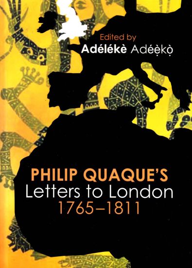
Philip Quaque’s letters to London, 1763-1811
Unisa Press
2017
nidottu
``There are many reasons to welcome Adeleke Ade?ko’s new edition of the letters of the Reverend Phillip Quaque: the letters bring new insights into the contradictions that defined the encounter between Europeans and West Africans in the modern period, and of Quaque's complicated life as he tried to negotiate his role as a subject caught between the aspiration to be modern and the brutality of the slave trade. Ade?ek?o’s careful editing of the letters makes them accessible to modern readers and ensures that the troubled and troubling voice of the African will become central to our understanding of the “Black Atlantic”.’ – Simon Gikandi, Robert Schirmer Professor of English, Princeton University.
Primary and Secondary Bibliography of Philip K. Dick up to February 1995, including foreign editions, phantom titles and a chronological listing.

The Power of Self Awareness: A Conversation with Philip Burley
Philip Burley
Mastery Press
2013
nidottu
In this conversation between medium Philip Burley and a young teacher, you will find questions about work, loss, and life common to all of us and answers flowing from spirit with universal meaning. If you are searching for greater satisfaction and contentment in your life's walk, the content of this booklet will be a light to guide your way. "Sometimes we think we have to save other people, but the God that lives in me lives in you, and God is just as involved in your life as in my life. Because I have that awareness in relation to my children, I don't worry about them. They may not walk the path I walk or do things as I would, but they have to live their lives, and I deeply respect that. I'm able to feel secure in watching them find their own way because I'm highly aware that the spiritual cause of life is guiding them. I know they will learn from life as I did--that life itself will teach them. Often I think that our experience is the greatest manifestation of God, because life is God. And since life teaches us, we can also say that God teaches us through life. So we learn. I see it all the time in myself and in others, and it's the same for you." Philip Burley

Confronting Depression to Stop Suicide: A Conversation with Philip Burley
Philip Burley
Mastery Press
2013
nidottu
Andrew is a young man recovering from a suicide attempt during which he journeyed on a "train" to the other side and realized that life does not stop when the physical body dies. In his meeting with medium and spiritual counselor Philip Burley, Andrew confronts his dependence on the opinion of others and begins to see the inner strength and potential that he has always possessed. Philip shares his own experience of self-discovery and his firm conviction that Andrew will move forward with increasing awareness of the indestructible light that resides within each one of us. "What is interesting to me is that I can see a brilliant light within each person that I see--the soul light. It doesn't matter what they've done with their life or what ups and downs they've experienced. Someone could be an alcoholic or a murderer, but the light within is still there at their core because it can't be touched, affected, or destroyed. The soul part of us is never touched because it's the God part of us." Philip Burley