Kirjojen hintavertailu. Mukana 11 505 967 kirjaa ja 12 kauppaa.

Kirjahaku

Etsi kirjoja tekijän nimen, kirjan nimen tai ISBN:n perusteella.

1000 tulosta hakusanalla Stephan Beneking

Streetsmart Shanghai Map by Vandam

Streetsmart Shanghai Map by Vandam

Stephan Van Dam

Vandam
2017
kartta, viikattu
With the release of StreetSmart Shanghai, New Yorks award-winning mapmaker Stephan Van Dam has achieved both a personal best and a great leap forward in information design of China's most Western-influenced metropolis.This pocket-sized, gloss-laminated, accordion-fold map 4 x 9 closed (9 x 32 open) is a graphic work of art that works. It shows immensely legible cartographic information and diagrammatic 3-D illustrations and is such an advance over what has previously been available that it will be indispensable not only to visitors, but to business and recreational travelers in Shanghai for years to come.
Streetsmart NYC Midtown Map by Vandam

Streetsmart NYC Midtown Map by Vandam

Stephan Van Dam

Vandam
2025
kartta, viikattu
StreetSmart NYC Map Midtown Edition maps all top attractions including museums, major architecture, hotels, theaters, shopping destinations, Broadway theaters and the subway system for all of Manhattan at an immensely legible scale of 1:32,000, complete with 3-D building illustrations. Clear information design allows users to read the map from three feet away and has earned VanDam maps a place in the MoMA Collection. The map is laminated, pocket size and easily fits into your pocket or purse. Dimensions: 4" x 9" closed, 9" x 24" open.Contents:Manhattan Street map scale 1:32,000Midtown Manhattan map Detail scale 1:17,000Manhattan Subway MapStreetSmart NYC Map Midtown Edition is so clear and easy to understand you can navigate the city with ease.For instance: You are looking to get from your Tribeca hotel to the High Line to meet friends at the Spanish Mercado in Hudson Yards, looking for the fastest subway connection from the Lower East Side to the Hudson Theater in Midtown, negotiating the shifting grids of the West Village, looking for the right uptown exit on the FDR Drive, making sense of the Dutch Colonial Grid Downtown to find the 9/11 National Memorial before dusk for that perfect shot, or hiking from the Met through Central Park to head to the Apollo Theater Harlem for a show. The map shows you the shortest route as well as the closest bathrooms.Locals call Manhattan "the City" and refer to the boroughs of Brooklyn, The Bronx, Queens and Staten Island collectively referred to as the City of New York.StreetSmart NYC Map Midtown Edition includes a stunning dimensional detail of Midtown Manhattan with Times Square at 1:17,000 scale at its center to make you feel you are there. Also includes transit information and an address finder covering all of New York City. In fact all subway stops are shown by their respective line in context right on the street map in detail as well as on an overview map so you understand the system.Stephan Van Dam, the map designer has lived in Manhattan for over 40 years and knows the city inside out. The map is updated four times a year and the most current map available. So get StreetSmart NYC Map Midtown Edition and become an instant New Yorker.
Streetsmart NYC Downtown Map by Vandam

Streetsmart NYC Downtown Map by Vandam

Stephan Van Dam

Vandam
2025
kartta, viikattu
StreetSmart NYC Map Downtown Edition maps all top attractions including museums, major architecture, hotels, theaters, shopping destinations, ferry connections and the subway system for all of Manhattan at an immensely legible scale of 1:32,000, complete with 3-D building illustrations. Clear information design allows users to read the map from three feet away and has earned VanDam maps a place in the MoMA Collection. The map is laminated, pocket size and easily fits into your pocket or purse. Dimensions: 4 x 9 closed; 9 x 24 open.Contents: Manhattan Street map scale 1:32,000 Downtown Manhattan map Detail scale 1:17,000 Manhattan Subway MapStreetSmart NYC Map Downtown Edition is so clear and easy to understand you can navigate the city with ease. For instance: You are looking to get from your Tribeca hotel to the High Line to meet friends at the Spanish Mercado in Hudson Yards, looking for the fastest subway connection from the Lower East Side to the Hudson Theater in Midtown, negotiating the shifting grids of the West Village where W 11 and W 4 Sts intersect, looking for the right uptown exit on the FDR Drive, making sense of the Dutch Colonial Grid Downtown to find the 9/11 National Memorial before dusk for that perfect shot, or hiking from the Met through Central Park to head to the Apollo Theater in Harlem for a show. The map shows you the shortest route as well as the closest bathrooms. Locals call Manhattan the City and refer to the boroughs of Brooklyn, The Bronx, Queens and Staten Island collectively referred to as the City of New York.StreetSmart NYC Map Downtown Edition includes a stunning dimensional detail of Lower Manhattan with the 9/11 Memorial at 1:17,000 scale at its center to make you feel you are there. The map also includes transit information and an address finder covering all of New York City. All subway stops are shown by their respective line in context right on the street map as well as on an overview map so you understand the detail and the overall system.StreetSmart NYC Map Downtown Edition includes a stunning dimensional detail of Downtown Manhattan with the 9/11 National Memorial site at 1:17,000 scale at its center to help you navigate the world s only vertical city based on a 17th C Dutch grid and make you feel you in charge. The map includes transit information and an address finder covering all of New York City. Stephan Van Dam, the map designer has lived in Manhattan for over 40 years and knows the city inside out. The map is updates four times a year and the most current map available. So get StreetSmart NYC Map Downtown Edition and become an instant New Yorker.
Streetsmart NYC Top 10 Map by Vandam

Streetsmart NYC Top 10 Map by Vandam

Stephan Van Dam

Vandam
2024
kartta, viikattu
StreetSmart (R) 2025 NYC Top 10 Edition maps all top attractions including museums, major architecture, hotels, theaters, shopping destinations, Broadway theaters and the subway and ferry systems for all of Manhattan at an immensely legible scale of 1:32,000, complete with 3-D building illustrations. Clear information design allows users to read the map from three feet away and has earned VanDam maps a place in the MoMA Collection. The map is laminated, pocket size and easily fits into your pocket or purse. Dimensions: 4" x 9" closed, 9" x 36" open.Contents: Manhattan Street map scale 1:32,000 Uptown Manhattan Map 1:33,000 Manhattan Subway Map 3D Poster of Manhattan SkyscrapersStreetSmart (R) 2025 NYC Top 10 Edition is so clear and easy to understand you can navigate the city with ease. The map combines the trusted NYC Midtown Edition map with a 3D skyline poster to create a graphic souvenir you can hang on your wall.For instance: You are looking to get from your Tribeca hotel to the High Line to meet friends at the Spanish Mercado in Hudson Yards, looking for the fastest subway connection from the Lower East Side to the new Lena Horne theater in Midtown, negotiating the shifting grids of the West Village, looking for the right uptown exit on the FDR Drive, making sense of the Dutch Colonial Grid Downtown to find the 9/11 National Memorial before dusk for that perfect shot, or hiking from the Met through Central Park to head to the Apollo Theater in Harlem for a show. The map shows you the shortest route as well as the closest bathrooms. Locals call Manhattan "the City" and refer to the boroughs of Brooklyn, The Bronx, Queens and Staten Island collectively referred to as the City of New York.The 3D Skyline poster view shows you Manhattan from the Brooklyn and Queens perspectives across the East River with all buildings clearly labeled. The top 10 must does are illustrated with a cheeky description revealing the New Yorker's perspective on the vertical city.StreetSmart NYC TOP 10 Edition makes you feel you are there. Included are complete transit information with all ferry connections, and an address finder covering all of New York City. In fact all subway stops are shown by their respective line in context right on the street map in detail as well as on an overview map so you understand the system.Stephan Van Dam, the map designer has lived in Manhattan for over 40 years and knows the city inside out. The map is updated four times a year and the most current map available. So get StreetSmart (R) NYC Map Top 10 Edition and become an instant New Yorker.
Streetsmart NYC Five Boro Map by Vandam

Streetsmart NYC Five Boro Map by Vandam

Stephan Van Dam

Vandam
2024
kartta, viikattu
The newly revised 2024 edition ofStreetSmart (R) NYC Five Boro Map maps all top attractions including museums, major architecture, hotels, theaters, shopping destinations plus subway and ferry routes for all of Manhattan at an immensely legible scale of 1:32,000, complete with 3-D building illustrations. Clear information design allows users to read the map from three feet away and has earned VanDam maps a place in the MoMA Collection. The map is laminated, pocket size and easily fits into your pocket or purse. Dimensions: 4" x 9" closed, 9" x 24" open.Contents: Manhattan Street map scale 1:32,000 Five Boro NY/NJ Overview Map: 1:155,000 NYC Subway MapStreetSmart NYC Five Boro Map is so clear and easy to understand you can navigate the city with ease.For instance: You are looking to find the Ferry from 34 Street in Manhattan to Fulton Landing under the Brooklyn Bridge, to get to Yankee Stadium, or walk from your Tribeca hotel to the High Line to meet friends at the Spanish Mercado in Hudson Yards, you are searching for the fastest subway connection from the Lower East Side to Downtown Brooklyn, negotiating the shifting grids of the West Village where W 11 St intersects W4 St, looking for the right northbound exit on the FDR Drive to the South Street Seaport, trying to make sense of the Dutch Colonial Downtown streets to find the 9/11 National Memorial before dusk for that perfect shot, or hiking from the Met through Central Park to head to the Apollo Theater Harlem for a show.Locals call Manhattan "the City" and refer to the boroughs of Brooklyn, The Bronx, Queens and Staten Island collectively referred to as the City of New York. VanDam publishes separate titles to Brooklyn, The Bronx and Queens in the StreetSmart Format.StreetSmart NYC Five Boro Map includes a stunning overview map to show the Five Boros in context of the NJ/NY Metro Area with all major cultural institutions and how they connect by ferry and expressway with exit numbers.Stephan Van Dam, the map designer has lived in NYC for over 40 years and knows the city inside out. The map is updated four times a year and the most current map available. So get StreetSmart NYC Map 5 Boro Edition and become an instant New Yorker.
Shopsmart London Map by Vandam

Shopsmart London Map by Vandam

Stephan Van Dam

Vandam
2016
kartta, viikattu
VanDam's award winning London StreetSmart Top City Shops Edition maps all top attractions including museums, major architecture, hotels, theatres, the subway system for all of London, and most importantly, all of the best shopping destinations - all at an immensely legible super-scale of 1:32,000, complete with 3-D building illustrations. Clear information design allows users to read the map from three feet away and has earned VanDam maps a place in the MoMA Collection.The London StreetSmart Top City Shops Edition includes a stunning dimensional detail of all of London with over 500 of the best shops in the city ranging from clothing to home design and travel gear to vintage stores. This is the definitive list for the shopaholic in you! The ultimate in luxury, fun, and quirky shopping. Also includes transit information and a street finder covering all of London.Simplicity reigns supreme in information design to make complex cities clear and understandable. Our typography creates character and reveals the true bones of the city. VanDam uses a letter grid to identify locations on maps - no confusing and cluttering K-28 or V-34s - its just the city from A-Z. Our covers map the icons of each city and turn them into collectible graphic art. Each sleek and laminated city map package opens to 32" x 9" and then easily folds down to 4" x 9" to snuggly fit into a shirt pocket or purse. Gain instant London ShopSmarts and a sexy souvenir to boot!
Engaging North Korea: The Role of Economic Statecraft

Engaging North Korea: The Role of Economic Statecraft

Stephan Haggard; Marcus Noland

East-West Center
2011
nidottu
This monograph reviews the efficacy of economic statecraft vis- -vis North Korea, with a particular focus on the use of sanctions and inducements on the part of the United States in seeking to achieve nonproliferation and wider foreign policy objectives. Two structural constraints operate: North Korea's particularly repressive state, with a narrowing governing coalition; and the country's changing economic relations. As an empirical matter, there is little evidence that sanctions had effect, or did so only in conjunction with inducements. However, inducements did not yield significant results either, in part because of severe credibility and sequencing problems in the negotiations.
Velocity

Velocity

Stephan Martiniere

DESIGN STUDIO PRESS
2011
sidottu
Never before-seen artwork from the award-winning science-fiction and fantasy artist Stephan Martiniere Following his previous books, Quantum Dreams and Quantumscapes, Velocity is a stunning new visionary collection of sci-fi book cover paintings, commercial and film art, video game designs, and never before-seen artwork from the fantastic imagination of acclaimed artist Stephan Martiniere.
Streetsmart NYC Transit Map by Vandam

Streetsmart NYC Transit Map by Vandam

Stephan Van Dam

Vandam
2024
kartta, viikattu
StreetSmart NYC Transit Map maps the entire NYC Transit system including subways, buses, ferries, Amtrak, and the NJ Transit, LIRR, and Metro North commuter lines. The map also shows key bus connections in Brooklyn, Queens, The Bronx & Staten Island. Manhattan has its own separate bus map.The map features a Service Guide to all trains showing where and when they run local or express by borough as well as a How to Get There destination guide which tells you exactly which trains to take to the TOP 100 sights and attractions across NYC. Clear information design allows users to read the map from three feet away and has earned VanDam maps a place in the MoMA Collection. The map is laminated, pocket size and easily fits into your pocket or purse. Dimensions: 4" x 9" closed, 9" x 24" open.Contents: NYC Transit Map Manhattan Bus Map Subway Service Guide Top 100 Attractions GuideStreetSmart NYC Transit Map is so clear and easy to understand you can navigate the city with ease. Public transportation, for all its issues, is the fastest way to get around town and make your trip a success. It is also the best show in town.For instance: You are looking to find the Ferry from 34 Street in Manhattan to Fulton Landing under the Brooklyn Bridge, or get from the Metropolitan Museum to Yankee Stadium, you are searching for the fastest subway connection from the Upper East Side to Downtown Brooklyn, or meeting friends at South Ferry to connect to the Statue of Liberty or want to see the action down Fifth Avenue from the leisurely comfort of the M1 Bus after having window shopped at Bergdorf Goodman.Locals call Manhattan "the City" and refer to the boroughs of Brooklyn, The Bronx, Queens and Staten Island collectively as the City of New York. VanDam publishes separate titles to Brooklyn, The Bronx and Queens in the StreetSmart Format.StreetSmart NYC Transit Map includes a stunning overview map to show the Five Boros in context of the NJ/NY Metro Area with all major cultural institutions, sights and attractions featured and how they connect by subway, bus, ferry, train and expressway.Stephan Van Dam, the map designer has lived in NYC for over 40 years and knows the city inside out. The map is updated twice a year and the most current map available. So get StreetSmart NYC Transit Map and become an instant New Yorker.
History Mapped Washington Map by Vandam

History Mapped Washington Map by Vandam

Stephan Van Dam

Vandam
2015
kartta, viikattu
VanDam's Washington Presidential Map is both a laminated street map to downtown NYC, Boston and Philadelphia and a handy history chart of the life of President George Washington. The history map puts his personal geography into the context of his age. The street maps cover all attractions including museums, monuments with self guide tours retracing the steps of our First President.Contents: Lower Manhattan Map scale 1:8,000 Downtown Boston Map scale: 1:16,000 Downtown Philadelphia Map scale: 1:8,000 WDC Capital Region Map scale: 1:238,000 Washington Life MapThe Washington Presidential Map life map details his trajectory from British soldier, surveyor, land and slave owner, signer of the Declaration of Independence, commander in chief during the Revolution War, leader of the Constitutional convention, and First President of the new nation. A must-have for every history buff and visitor to the Washington Monument who wants to understand why we honor this man.This special North East Edition includes detailed guided walking maps of the places where Washington made history: Downtown Boston, Philadelphia, Lower Manhattan and Mount Vernon along with a Greater Washington DC Metro Map. All at an immensely legible scale with 3D buildings.VanDam's Presidential Maps make history accessible, portable and understandable to wide audiences of all ages -- from history buffs to casual Mall visitors. A 3D graphic of the Washington Monument gives insights into the construction of what is arguably the nation's most important monument. This sleek laminated map package refolds easily to 4" x 9" (from 32" x 9" open) and snuggly fits into your pocket. The smartest and most memorable souvenir around.
Streetsmart Miami Map by Vandam

Streetsmart Miami Map by Vandam

Stephan Van Dam

Vandam
2017
kartta, viikattu
StreetSmart (R) Miami maps all of Miami, Miami Beach, Coral Gables, Coconut Grove, Miami Beach and all of Dade County's attractions, neighborhoods, museums, hotels, beaches and more all at an immensely legible scale complete with 3-D building illustrations. Eminently clear information design allows users to read the map from three feet away and has earned VanDam maps a place in the MoMA Collection. The map is laminated and easily fits into your shirt pocket or purse. Dimensions: 4 x 9 closed, 9 x 24 open.Coverage includes: Miami Downtown Street Map: 1:14,000 Dade County Area Freeway Map: 1:190,000 Coral Gables & Coconut Grove Details: 1:7,500 Miami Beach Detail: 1:6,500 Wynwood Arts & Design Detail: 1:6,500StreetSmart (R) Miami includes details of Downtown Miami, Miami Beach, Coral Gables and Coconut Grove plus a Dade County Freeway map so you know immediately how all of Miami s part connect. Whether you want go gallery hopping in the Wynwood Arts District, stroll Ocean Avenue in Miami Beach, have lunch in Little Haiti, pick up a friend from the Cruise Terminal or visit the new branch of Books and Books in Coconut Grove our map will be your treasured companion. SStreetSmart (R) Miami Simplicity reigns supreme in cartographic design to make complex cities clear and understandable. Our typography creates character and reveals the true bones of this booming Caribbean metropolis. The map uses a letter grid to identify locations on maps - no confusing and cluttering K-28 or V-34s - its just the city from A-Z. Our covers map the icons of each city and turn them into collectible graphic art. Gain instant Miami StreetSmarts and a memorable souvenir to boot!
Streetsmart Delhi & Golden Triangle Map by Vandam
"VanDam's StreetSmart Delhi & Golden Triangle maps all top attractions including archeological sites, museums, temple cities, forts, hotels, national parks and more at an immensely legible scale complete with 3-D building illustrations. Clear information design allows users to read the map from three feet away and has earned VanDam maps a place in the MoMA Collection. The map is film-laminated, accordion folded and pocket size.Coverage: Golden Triangle & Rajasthan Map 1:350,000; Greater Delhi Map: 1:15,000 Delhi Street Map: 1:44,000; Old Delhi Detail Map: 1:22,000 Connaught Place Detail Map: 1:22,000; Jaipur & Pink City Map: 1:35,000 City Palace Museum Map: 1:3,500; Taj Mahal 3D map illustration: 1:500Dimensions: 4 x 9 folded, 9 x 32 unfolded, easily fits into shirt pocket or purse.StreetSmart Delhi & Golden Triangle is so clear and legible you will instantly understand how all the parts of the Golden Triangle and Rajasthan connect. The map presents a comprehensive overview with critical details of the places you are likely to visit on your Northern India journey.A little Mughal family history: Take delight in the sublime geometry of Emperor Humayun's Tomb in southern Delhi as you proceed to Mathura, the city of Krishna. On the outskirts of town pay homage to the architectural wonder of his son Akbar's Tomb where hordes of monkeys play in the fields. Onward to Agra for your visit to The Taj Mahal, the most famous mausoleum of love built by Shah Jahan, Akbar's grandson, to his wife Mumtaz who died in childbirth. A special 3-D cutaway schematic illustrates the Taj's divine proportions and alludes to its presumed origin as a Shiva temple. While touching the soft, ivory colored marble look across the river to the Black Taj where Shah Jahan's son Aurangzeb imprisoned his love-sick dad for the remainder of his life.StreetSmart Delhi & Golden Triangle Wonders abound in this part of the world. While driving keep an eye out for women wearing colorful saris and intricate jewelry while tarring roads in their bare feet. From Agra the next stop is the abandoned city of Fatehpur Sikri an erstwhile capital of the Mughal Empire. Sariska National Park/b> where tigers and wild boar roam the grasslands is a must see before arriving in Jaipur the jeweled capital of Rajasthan.This map provides the critical detail and context so you can travel with confidence.StreetSmart Delhi & Golden Triangle covers all the bases from God's perspective to the most minute details. The map clearly identifies historic hotels (havelis), resorts, shiva temples, mosques, shrines, mausolea and parks to help you understand the regional cultures which make this region so diverse and uniquely beautiful. While staying at one of the historic havelis in Jaipur you will come to realize that many aspects of British culture are really Rajasthani in origin. Tea which freed the Brits from having beer soup for breakfast, avatars, bandanas, bungalows, moguls, pajamas, paisley, verandahs, gingerbread architecture and much more were all imports from imperial India.StreetSmart Delhi & Golden Triangle Its film lamination is extra durable and will last you for your next trip. Simplicity reigns supreme to make complex cities clear and understandable. Our typography creates character and reveals the true bones of the vertical city. VanDam uses a letter grid to identify locations on maps - no confusing and cluttering K-28 or V-34s - its just the city from A-Z. Gain instant Delhi & Rajasthani STREETSMARTS and a sexy souvenir to boot! "
Wdc Pop-Up Map by Vandam

Wdc Pop-Up Map by Vandam

Stephan Van Dam

Vandam
2024
kartta, viikattu
Washington DC Pop-Upmaps all top attractions including museums, major architecture, hotels, theaters, shopping destinations, and the Metro system for all of Washington DC at an immensely legible scale of 1:32,000, complete with 3-D building illustrations. Clear information design allows users to read the map from three feet away and has earned VanDam maps a place in the MoMA Collection. The map is laminated, pocket size and unfolds to 12 times its original size, then refolds itself by closing the covers. The map easily fits into your pocket or purse. Dimensions: 3.75" x 6" closed, 8.5" x 11" open per section.Coverage: Mall Map: 1:9,500 Washington DC Street Map 1:16,000 Beltway Map: 1:238,000; Capital MetroTransit Map. Washington DC Pop-Up Map is so legible you will instantly understand the National Mall and how it connects to other parts of the District and Old Town Alexandria.You get God's perspective on Monument City as well as the minute details. This 18th Century city grid with grand diagonal avenues designed by Pierre L'Enfant is a metaphor for the division of power in the Republic. A right triangle with Pennsylvania Avenue as hypotenuse and grand connector between the Executive (White House) and the Legislature (Congress) with the Judiciary (Supreme Court) backing up to Congress on Capitol Hill. The Washington Monument describes the triangle's Western point and serves as your compass needle to navigate the Capital.Washington DC Pop-Up Map includes a stunning dimensional Mall detail of the central city from Arlington National Cemetery through Foggy Bottom, Federal Triangle, Judiciary Square, Penn Quarter, Chinatown, Downtown, the East End and Capitol Hill. Restrooms and concessions are clearly marked. Separate Beltway and Metro DC maps insure you have everything you need for a successful trip. While politics in the Capital may be petty and divisive, the riches of art, science and culture offered in its museums almost all of them free are generous, conciliatory and un-equalled anywhere else.The hot ticket in town remains the African American Museum of History and Culture. Its bronze colored corona architecture boldly breaks the mold of the mostly white neo-classicist structures on the Mall and offers an intriguing perspective on American history. On the West Mall history is made manifest in the placement of the MLK Memorial where Dr. King stares down Jefferson with Lincoln's backing.Washington DC Pop-Up's map scale of 1:6,000 makes you feel you are there with 3D buildings illustrations as your compass. All Metro stops are marked by their respective line in context right on the main map and on a separate subway overview so you know both the local details and understand the larger system.Stephan Van Dam, the map designer and publisher has mapped the Capital for the Smithsonian, The National Gallery and the National Park Service. We also publish a series of Presidential History Maps Lincoln, Jefferson and Washington as well as WDC Pop up Map.Washington DC Pop-Up Maps are updated twice a year and are more current than any other map available. So get the 2024 Pop up and become an instant Washingtonian!
Streetsmart Rome Map by Vandam

Streetsmart Rome Map by Vandam

Stephan Van Dam

Vandam
2024
kartta, viikattu
VanDam's newly revised 2024 StreetSmart (R) Rome maps all top attractions including hotels, top gelaterias, pizzerias & trattorias at an immensely legible scale of 1:12,500 complete with 3-D building illustrations. Clear information design allows you to read the map from three feet away and has earned VanDam maps a place in the MoMA Collection. The map is fill-laminated, accordion folded and pocket size.Coverage: Rome Center City Street Map 1:12,500; The Vatican Detail Map: 1:6,500; Rome Overview Map: 1:235,000; Greater Rome Transportation Map. Dimensions: 4 x 9 folded, 9 x 24 unfolded, fits into shirt pocket or purse.StreetSmart (R) Rome is so legible you will instantly understand how Via del Corso Rome's main artery connects Piazza Venezia with the Spanish Steps, Trastevere with the Jewish Ghetto, Vatican City with Villa Borghese and the new archeological Museo Barracco with the best gelateria Gunther Gelato in Piazza San Eustachio in Centro Storico.StreetSmart (R) Rome focuses on the urban core, the four square miles within the ancient Aurelian wall which is the part you need to know. We select the best & direct you safely in four self-guided walks: The "Centro Storico Walk" from the Piazza Navona to the Spanish Steps via Fontana di Trevi and Propaganda Av, the "Palatine Hill Walk" exploring the ruins of the imperial palaces overlooking Circus Maximus, the "Trastevere Walk" from Ponte Cestio to Santa Maria in Trastevere with top pizza options at Otaleg or a romantic Roman dinner at Zia.The "Jewish Ghetto Walk" takes you from Isola Tiberina to the Sinagoga, the center of the old Jewish neighborhood, on to bakeries offering fruit bread w/ marzipan to Palazzo Mattei. Artichokes reign supreme in Rome especially from February through May & the twice grilled Jewish version called "Carciofi alla giudia" is a must try at Nonna Beta (16) Via del Portico d'Ottavia. From God's perspective to the most minute detail our map will be a treasured companion during your stay and make it easy to understand the Eternal City.A special 3D illustration of Citta del Vaticano Vatican City details all the sights in a country of 100 acres small enough to fit into NYC's Central Park with a global following of 1.3 billion, this is the third largest state in the world. Starting from the obelisk in the Piazza di San Pietro into the basilica through Bernini's portico, down the central nave to Charlemagne's Coronation site, St Peter's statue to the Main Altar under Bernini's Canopy and above St Peter's Tomb, check out the Throne of St Peter in the apse before the entrance up to Michelangelo's dome (450 feet above), this is the greatest church (basilica) in Christendom. For quick entry into the Vatican museums the G spot of religious art patronage get your pass on-line to avoid lengthy waiting in-line. Imagine the Vatican museums as a giant "dumbbell" moving from ancient history (Egyptian, Greco-Roman & Etruscan) through a long corridor with magnificent maps, statues & tapestries to the Renaissance revival portion (Raphael Rooms to the Last Judgement Wall in the Sistine Chapel). Then walk through the history of painting from the Middle Ages to the Baroque in the Pinacoteca viewing Giotto, Leonardo da Vinci, Raphael, il Perugino and Caravaggio. It's all here. For modern art and contemporary performance there's MACRO, MATTATOIO, MAXXI & MONK. This 2024 edition features a new overview map to show you exactly where to hike or bike on the "Via Appia Antica" to visit its 12 major sites catacombs and churches along the wa. ySo get StreetSmart (R) Rome to become an instant Roman(x)..!.
Streetsmart Cuba Map by Vandam

Streetsmart Cuba Map by Vandam

Stephan Van Dam

Vandam
2019
kartta
VanDam's 2019 StreetSmart Cubamaps all of Cuba's cultural and natural riches at an immensely legible scale. It is both a relief country road map and culture map. The map features attractions, beaches, hotels, resorts, the latest restaurants, bars and supper clubs all expertly researched and marked. Clear information design has earned VanDam maps a place in theMoMA Collection. The map is laminated and easily fits into shirt pocket or purse. Dimensions: 4" x 9" closed; 9" x 32" open.Contents include: Cuba country map Havana city street map Old Havana walking map Detail maps of Cayo Coco, Guilermo, Holguin, Matanzas, Trinidad, and Santiago de Cuba.StreetSmart Cuba this is the smartest and easiest-to use map of Cuba: indispensable travel companion and lasting souvenir. Remember web access in Cuba is limited to hotels, excruciatingly slow and up-to-date information simply unavailable.Let StreetSmart Cubabe your key to understanding the Carribean's biggest island. This laminated city map package refolds easily to 4 x 9 inches (32 x 9 inches open) and snuggly fits into your pocket. Buy this map to become an instant StreetSmart Cubano.
Streetsmart Havana Map by Vandam
VanDam's 2020 StreetSmart Havana maps all of the capital's cultural attractions, neighborhoods, beaches, hotels, resorts and more at an immensely legible scale of 1:12,200. The map features the latest restaurants, hotels, bars and supper clubs in celebration of Havana's 500 anniversary. Clear information design allows you to read the map from three feet away and has earned VanDam maps a place in the MoMA Collection. The map is film-laminated, accordion folded and pocket size.Coverage: Havana City Street Map 1:20,000; Old Havana Detail Map 1:12,000 Havana Overview Map: 1:115,000; Playa del Este Map: 1:61,000 Dimensions: 4" x 9" folded, 9" x 24" unfolded, fits into shirt pocket or purse.StreetSmart Havana is so legible you will instantly understand how La Habana Viejaconnects with Vedado and Miramar, Havana Centrowith Barrio Chino, Habana del EstewithSiboney, Playa with Plaza de la Revolucion, and theMalecon with Parque Lennon. From God's perspective to the most minute callejon our map will be your treasured companion during your stay.StreetSmart Havana let's you experience the authentic Havana with confidence. Hike our recommended self-guided tours of the Malecon, Havana's musical history, its famed museums, and its cutting edge art galleries and gardens which are all clearly marked. Then indulge in a cocktail at El Floridita or Sloppy Joe's, the old haunts of Ernest Hemingway or savor a mojito with a view from the roof top of the Saratoga Hotel.What makes Cuba different from most other places in the world is the absence of advertising, that constant tease we Westerns take for granted. Havana is uniquely rich in history as all shipments from the new world had to travel through Havana to Sevilla in Spain. Cuba is a world superpower of music and Havana an architectural treasure trove without equal. No American city can match its variety of styles ranging from the Plateresque to Cuban Baroque, Neoclassical to Art Nouveau, Deco to Mid-Century Modern and Soviet Brutalism. Cuba conjured a music so powerful it went around the world three times in the 20th Century alone. Classical composers such as Samuel and Cervantes invented Danzas and Contradanzas that with syncopation laid the foundation for "Danzon, Rumba, Ragtime, Salsa and Latin Jazz."Live music can be heard and danced to impromptu on almost every corner. We recommend you visit the spectacular reinvention of Fabrica de Arte Cubano in Vedado to experience the creative Cuban juices first hand.StreetSmart Havana is updated yearly and most current. Simplicity reigns supreme in information design to make complex cities clear and understandable. This is the smartest and easiest to use map of Havana. Remember web access in Cuba is limited to hotels, excruciatingly slow and up-to-date information simply unavailable. So, let StreetSmart Havana be your key to understanding the new world's oldest city. This sexy laminated city map package refolds easily to 4 x 9 inches (24 x 9 inches open) and snuggly fits into your pocket. Buy this map to become an instant StreetSmart Habanero.
San Francisco Pop-Up Map by Vandam

San Francisco Pop-Up Map by Vandam

Stephan Van Dam

Vandam
2017
kartta, viikattu
"VanDam's patented San Francisco Pop-Up maps all of San Francisco's attractions, neighborhoods, museums, hotels, historic sites, and more all at an immensely legible scale complete with 3-D building illustrations. Each map unfolds to 12 times its original size, then refolds automatically when the covers are closed. Size open is 8.5"" x 11"" per section; 3.75"" x 6"" closed. Eminently clear information design allows users to read the map from three feet away and has earned VanDam maps a place in the MoMA Collection. San Francisco, the great city of booms, light and reinvention is unique in many ways: A boomtown since the 1849 Gold Rush it is now mecca for techies, foodies and bums.San Francisco Pop-Up Includes detailed Downtown, SOMA, Fisherman's Wharf, North Beach, and Bay Area maps and more. Complete street index and BART subway map make navigating the city fun and easy.San Francisco Pop-Up let's you experience the authentic SF spirit. Hike the Presidio trails Coastal, Presidio Bluffs and/or Ecology which are clearly marked with facilities, and viewing sights, then indulge in a Japanese bath and food at Onsen in the Tenderloin. After your soak, savor a soju cocktail and a bowl of udon while pondering a Tale of Two Cities. No other US city exhibits such a wide gulf between the haves and have-nots especially in the rebranded MidMarket area formerly known as the Tenderloin. Visit the spectacular reinvention of SFMOMA in SOMA then explore the rooftop park at the new Transbay Transit Center and neighborhood to get your fill of local architecture. Some say it's SF's answer to NYC's Grand Central Terminal. Your Embarcadero hike can start at the SF Ferry Building, the grand marketplace and European-style food hall, a feast for the senses and open daily from 9 AM 7 PM. Check on author readings at Book Passage, insect snacks at La Cocina or Peruvian aji amarillo chiles before heading up to the Exploratorium at Pier 15 for some playfully serious science. Chez Panisse, Alice Water's acclaimed Berkely food temple in offers both a prix-fixe dinner downstairs and a casual lunch service in the upstairs cafe worth the trip to the East Bay without breaking the bank.Get San Francisco Pop-Up to become an instant San Franciscan and get a sexy collectible souvenir of your visit."
Chicago Pop-Up Map by Vandam

Chicago Pop-Up Map by Vandam

Stephan Van Dam

Vandam
2017
kartta, viikattu
"VanDam's new Chicago Pop-Up maps all of Chi-Town's attractions, hotels, museums, neighborhoods and more with 3-D buildings in our classic pop-out format. This patented maps open to 12 times its original size, then refold automatically when you close the covers. Maps as dimensional print and sexy souvenir. In the MoMA Collection. Includes details of downtown Chicago, The Loop and Hyde Park plus Chicago 'L' Transit map. This compact map package refolds easily to 3.75"" x 6"" (8.5"" x 11"" open) and fits discreetly in your shirt pocket. Complete street index make navigating The Windy City fun and easy."
Streetsmart Paris Map by Vandam

Streetsmart Paris Map by Vandam

Stephan Van Dam

Vandam
2024
kartta, viikattu
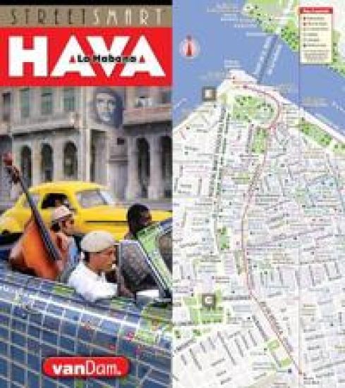
The new 2024 StreetSmart (R) Paris maps all top attractions including museums, monuments, hotels, major architecture, shopping and more all at a highly legible scale of 1:12,500, complete with 3-D building illustrations. Clear information design allows users to read the map from three feet away and has earned VanDam maps a place in the MoMA Collection. The map is film-laminated, waterproof and easily fits into pocket or purse.Contents: Paris Street Map 1:12,500; Paris Overview map: 1:200,000; Paris Metro Map; Dimensions: 4 x 36 (10 cm x 91 cm) open, 4 x 9 (10 cm x 22 cm) closed.StreetSmart (R) Paris is so legible you will understand how the Champs des Elysees connects with Champs de Mars, Bois de Boulogne with Belleville, Catacombs with Cimetiere Pere Lachaise, Les Halles with La Defense, Quartier Latin with Luxemburg, Montmartre with Montparnasse, Marais with St Germain des Pres and Canal St Martin. StreetSmart Paris Paris is unique in many ways. It was Emperor Napoleon III who in 1853 commissioned Baron Georges-Eugene Haussmann to reinvent the city with new infrastructure and Grand Boulevards cutting through blighted medieval neighborhoods to create the new City of Light. This map shows the plan with Metro stops by line right on the street map. So you can easily understand the local detail in context and see the entire system in an overview map for God's perspective.Paris is the city of the Flaneur the ambivalent drifter who wanders the citys Grand Boulevards looking for chance encounters of the literary and erotic kind. Park benches are said to be spaced in 500 m intervals to encourage Flaneurie.Walter Benjamin, the culture critic, elevated this gastronomy of the eye into the academy channeling the poetry of Baudelaire. The Situationist movement of the 1950s added the idea of psycho-geography an exploration of the city through drifting described as a toy box full of playful, inventive strategies for exploring cities to create new realities through maps.Paris is saturated with excellent museum exhibits this winter: Check out the new Bourse de Commerce which houses the Pinault Collection. StreetSmart Paris Every Sunday from 9 am until 1:30 pm, the air on Boulevard Raspail, between the Rue Cherche-Midi and Rue de Rennes, fills with the tantalizing smell of sauteing onions. It is the onion galettes - shredded onion, potato and cheese (2.50 euros)- frying at one of the dozens of stands at the Marche Biologique Raspail. This organic market has been a neighborhood jewel for 26 years. A new wave of affordable comfort food dining options with three-course meals for 20 Euros in 30 minutes is taking Paris by storm. It is a revival of the Bouillon working-class restaurants that thrived during the 19th C and an affirmation of Gallic identity.Here are six establishments worth trying: Bouillon Julien at 16 Faubourg St Denis, Bouillon Pigalle, 22 Blvd de Clichy, Aux Bons Crus, 54 Rue Godefroy Cavaignac, Buffet, 8 rue de la Main d Or, Le Cadoret, 1 rue Pradier, Cafe du Coin, 9 Rue Camille Desmoulins. StreetSmart Paris map is updated twice a year and most current. Its film lamination is extra durable and will last for your next trip. Simplicity reigns supreme to make complex cities clear and understandable.Get a StreetSmart Paris map and gain instant Paris StreetSmarts.