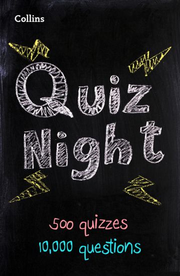
Kirjojen hintavertailu. Mukana 12 390 323 kirjaa ja 12 kauppaa.

Kirjahaku

Etsi kirjoja tekijän nimen, kirjan nimen tai ISBN:n perusteella.

1000 tulosta hakusanalla Collins KS2

Collins Quiz Night
Quizzing has never been so much fun. Quench your thirst for quiz trivia, with 500 new quizzes to test the brain cells in this bumper new edition of 10,000 questions. Perfect for playing with friends and family! These quizzes are suitable for all ages. good clean fun for all. The answers are quick and easy to find so that anyone can pick this up and become a quiz master or train for the next challenge. 10,000 general knowledge and themed questions and answers, will keep even the keenest quizzer occupied for ages.
Collins Social Studies Atlas for Jamaica
Prepared specifically to support social studies and geography courses at upper primary and lower secondary levels throughout the Caribbean. The atlas is fully illustrated and includes the most up to date reference and thematic mapping of the countries within the Caribbean Community as well as the broader Caribbean region. Maps are fully supported with illustrations, photographs and data. World maps cover international issues which have a bearing on Caribbean development.
Collins Children’s World Wall Map
Beautifully illustrated wall map for inquisitive kids Colourful Illustrated Map of the World This bestselling, highly illustrated pictorial map is designed to take children on a journey of discovery around the countries of the world. The mapping is up-to-date, colourful and highly informative and shows countries and capital cities. Stunning illustrations are used to depict themes such as national emblems, customs, food, birds, animals, buildings and sports to help younger readers gain an understanding of the world. Dimensions 610 X 915 mm / 24 x 36 inches Illustrated by Steve Evans. Now with barcode removed due to popular demand from our customers.
Collins Children’s Picture Atlas
Beautifully illustrated atlases for inquisitive kids A beautifully illustrated picture atlas designed to take children on an exciting journey around the world. This newly updated atlas opens with the continents, then presents a world view of countries showing fun facts and exciting places to visit within each. The maps are clear, colourful and perfect for children to explore the world and let their imaginations run riot.This book is ideal for home or school and finding out more about the world whilst also helping to develop essential reading skills.Clear, colourful, highly informative, illustrated mapping designed for young readers.Arranged by continent for easy reference.Facts about the world we live in are included on each spread.
Collins London Handy Street Map
An essential companion whether you are travelling around London by car, public transport or on foot. Clear and easy-to-read map of central London and surrounding area. Contains detailed mapping, presented in a handy compact format. This attractive map, ideal for both tourists and residents, and fully updated, has an extensive area of coverage and displays a wealth of detail. This map includes:• New for this edition: Electric car recharging sites• Fully classified roads• Congestion charging zone & T-charge (Ultra Low Emission Zone from April 2019)• Postal districts and boundaries clearly depicted• Full indexes to street names (on back of map), place names and places of interest• Fully updated London underground map conveniently located on the back cover Covers this area:Extends from Hampstead in the north to Clapham in the south and from Hammersmith in the west to Greenwich in the east. Scale: 1:17,500 (3.6 inches to 1 mile)
Collins Quiz Master
Run your own pub quiz with 500 brand new general knowledge quizzes. With 10,000 questions arranged in easy, medium and difficult categories, you can set the pace as quiz master for your friends and family, or pit yourself against the Collins Quiz Master in a battle of wits. Q: What’s inside this book?A: 500 quizzes covering everything from pop stars to death stars. Each round is a mixture of themes and potluck, with the questions heading from friendly teasers to ones that will scramble even an egghead’s brains. Q: Who is it for?A: You, your mum, your dad, your family and friends, the man down the road and two halves of the crowd at your local. Each quiz provides good clean fun for all. The answers are quick and easy to find so that anyone can pick this up and become the ultimate quiz master!
Collins Social Studies Skills for Jamaica Secondary Workbook
Prepared specifically to support social studies, map skills, early geography skills plus history and heritage topics in the National Standards Curriculum for grades 7 to 9. This workbook supports the use of the Social Studies Atlas for Jamaica as a practical tool in the primary social studies classroom. Written in line with the NSC. It contains a wide range of practical activities which help students learn and revise content, and develop critical thinking skills, essential for moving on to CSEC® level.• Covers a wide range of social studies topics listed in the National Standards Curriculum for grades 7 to 9• Separate sections for activities and worksheets for grades 7, 8 and 9, all linked to learning objectives in the National Standards Curriculum• Wide range of practice activities to help students learn and revise content and build skills through years 7, 8 and 9• Based on up-to-date reference and thematic mapping, and supported by information on Jamaica from the MONA Geoinformatics Institute, Kingston, Jamaica To access the answer key for this textbook, contact [email protected]
Collins School Atlas for Trinidad and Tobago
Prepared specifically to support social studies, map skills, early geography skills plus history and heritage topics in Trinidad and Tobago. The atlas is fully illustrated and includes the most up to date reference and thematic mapping of Trinidad and Tobago, countries within the Caribbean Community and the broader Caribbean region. Maps are fully supported with illustrations, photographs and data. World maps cover international issues which have a bearing on Caribbean development.
Collins Ireland Touring Map
Explore new places with handy pocket maps from Collins. Large full colour map of the whole of Ireland showing the road network in detail, and with a special emphasis on places of tourist interest. This map has a handy touring scale of 7.5 miles to 1 inch (1:475,200). It has more than 20 categories of tourist information depicted clearly on the map. There is a full index to place names and places of interest. This map includes:• All classified and most minor roads• Railway network and ferry routes• Viewpoints and sandy beaches• Speed enforcement zones and safety camera locations• Index to 20 categories of tourist information• Includes castles, historic houses, gardens, beaches and golf courses
Collins Jamaican Student’s Dictionary
Collins Jamaican Student’s Dictionary has been specially developed in association with teachers in Jamaica to ensure it meets the needs of students in Jamaican schools. This dictionary – which is fully up to date – provides coverage of vocabulary from all curriculum subjects to ensure students have the language they need at their fingertips. It includes a Unique Survival Guide that provides essential guidance on key aspects in the CXC syllabus including errors commonly made in exams. It features tips on essay-writing, exams, grammar, letter & CV-writing and guidance on punctuation and common spelling mistakes, helping students write effectively with confidence. Additional features include entry words in colour for ease of use, detailed word histories and ‘Word Tip’ usage notes. The social studies section provides essential information on the Caribbean and Jamaica with key facts and maps.
Collins Essential Road Atlas Europe

Collins Essential Road Atlas Europe

HARPERCOLLINS PUBLISHERS
2022
nidottu
Discover new places with handy road atlases from Collins.Up-to-date A4 paperback road atlas of Europe. Contains clear, large-scale, detailed road mapping, perfect for touring the Mediterranean, Iberian peninsula, Scandinavia and all European tourist destinations. Scale of main maps 1:1,000,000 (1 cm to 10 km / 1 inch to 16 miles). Main featuresClear, easy to follow road maps at a scale of 1:1,000,000. Euroroutes and motorways are easily distinguished on the mapping. The maps also show international road classifications, road distances in kilometres and relief is shown by attractive layer tints. Route planning mapsOver 100 scenic routes shownToll motorways shownGuide to international road signs, driving advice and useful internet linksRoute maps of 64 major citiesStreet plans of 16 major citiesLocator diagrams on each page to help you navigateMore detailed road maps extending from Amsterdam to Munich, making route following easier through this densely populated area Area of coverageThe mapping extends from the North Cape (Norway) to Gibraltar and from Ireland to east of Moscow. Also includes Iceland and Cyprus.