

Kirjahaku
Etsi kirjoja tekijän nimen, kirjan nimen tai ISBN:n perusteella.
1000 tulosta hakusanalla Gregory A. Freeman


Emory S. Land, Edward Macauley, John M. Carmody, Et Al., Petitioners, V. R. Stanley Dollar Et Al. U.S. Supreme Court Transcript of Record with Supporting Pleadings
Gregory A Harrison
Gale, U.S. Supreme Court Records
2011
pokkari

Gregory A. Demirdjian's first novel, "Warren", now available at Amazon.com, Lulu.com, and local bookstores near you.

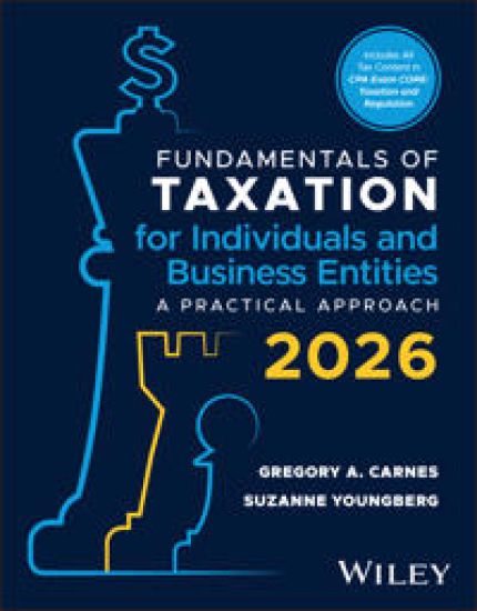
Fundamentals of Taxation - Individuals and Business Entities
Gregory A. Carnes; Suzanne Youngberg
JOHN WILEY SONS INC
2024
pokkari
Fundamentals of Taxation for Individuals and Business Entities, with eBook Access Code
Gregory A. Carnes; Suzanne Youngberg
JOHN WILEY SONS INC
2025
nidottu
Present the big picture with a practice-based approach to understanding tax laws so students can develop critical thinking and problem-solving skills that prepare them for the real world. Fundamentals of Taxation — Individuals and Business Entities, 2026 Edition introduces a logical foundation for the income tax system so students can understand why a law exists and how to apply the law to practical tax problems. Professional skill-building exercises develop critical thinking and communication skills and the ability to identify and address ethical dilemmas, preparing students to be effective tax professionals. AN INTERACTIVE, MULTIMEDIA LEARNING EXPERIENCE This textbook includes access to an interactive, multimedia e-text. Icons throughout the print book signal corresponding digital content in the e-text. Fundamentals of Taxation — Individuals and Business Entities integrates abundant video content developed to complement the text and engage readers more deeply. Content Review Videos provide a detailed review of each learning objective in each chapter and help students learn key concepts and an understanding of tax laws, the big picture, and the Why behind it. Solution Walkthrough Videos created by the authors provide step-by-step instruction on how to complete problems like those in the text. Downloadable Content appears throughout the E-Book, enabling students to see and work with tax forms, legal agreements, and spreadsheets. Concept Check Questions at the end of each section provide immediate feedback, helping readers monitor their understanding and mastery of the material.
Elements of STIL
Gregory A. Maston; Tony R. Taylor; Julie N. Villar
Springer-Verlag New York Inc.
2003
sidottu
Standard • Test In. terface ____________________ Language So I was wrong. I was absolutely sure that by having an IEEE Standard defined, reviewed, and accepted, that I wouldn't need to write a book about it as well. The Standard would be the complete reference. And be aware - this book does not serve as a replacement to the IEEE Std. 1450 document. You should have a copy of the Standard as you go through this book. I realized that the Standard would not be the complete reference, about the time that the Working Group started to put notes into the draft proposa- notes to elaborate decisions in the Working Group, but that would be removed in the final draft. Then, once the Standard was accepted I became the central point of contact for people who just picked up the Standard, who didn't have the benefit of the Working Group discussions, who only had available that one final sentence in the Standard and who didn't benefit from the perspective of where those words came from. Sometimes those questions have resulted in clarifications to the Standard. Sometimes I would respond to those questions with more background and perspective as well. It is this additional background and perspective I hope you find in this book.


Family Maps of Leake County, Mississippi, Deluxe Edition
Gregory a. Boyd J. D.
Arphax Publishing Co.
2010
nidottu

230 pages with 74 total maps Locating original landowners in maps has never been an easy task-until now. This volume in the Family Maps series contains newly created maps of original landowners (patent maps) in what is now Conway County, Arkansas, gleaned from the indexes of the U.S. Bureau of Land Management. But it offers much more than that. For each township in the county, there are two additional maps accompanying the patent map: a road map and a map showing waterways, railroads, and both modern and many historical city-centers and cemeteries. Included are indexes to help you locate what you are looking for, whether you know a person's name, a last name, a place-name, or a cemetery. The combination of maps and indexes are designed to aid researchers of American history or genealogy to explore frontier neighborhoods, examine family migrations, locate hard-to-find cemeteries and towns, as well as locate land based on legal descriptions found in old documents or deeds. The patent-maps are essentially plat maps but instead of depicting owners for a particular year, these maps show original landowners, no matter when the transfer from the federal government was completed. Dates of patents typically begin near the time of statehood and run into the early 1900s. What's Mapped in this book (that you'll not likely find elsewhere) . . . 2350 Parcels of Land (with original landowner names and patent-dates labeled in the relevant map) 60 Cemeteries plus . . . Roads, and existing Rivers, Creeks, Streams, Railroads, and Small-towns (including some historical), etc. What YEARS are these maps for? Here are the counts for parcels of land mapped, by the decade in which the corresponding land patents were issued: DecadeParcel-count 1820s205 1830s68 1840s224 1850s142 1860s212 1870s235 1880s595 1890s421 1900s100 1910s121 1920s27 What Cities and Towns are in Conway County, Arkansas (and in this book)? Ada, Arthur, Austin, Bethlehem, Birdtown, Blackwell, Blick, Catholic Point, Cedar Creek, Center Ridge, Clebb (historical), Cleveland, Country Estates (subdivision), Cypress Valley, Deerwood (subdivision), Divide (historical), Friendship, Gobblers Point, Grandview, Hattieville, Hickory Hill, Hill Creek, Holly Springs, Index (historical), Jerusalem, Kenwood, Lanty, Lewisburg, Lick Mountain, Lone Grove, Lost Corner, Macedonia, McClaren, Menifee, Middleton, Morrilton, North Hills Subdivision, Northview Subdivision, Old Hickory, Oppelo, Overcup, Pleasant Hill, Plumerville, Pontoon, Rehms Corner, Riverview, Robertsville, Saint Vincent, Sandtown (historical), Solgohachia, Spring Meadows, Springfield, Sunnyside, Wesley Chapel, West (historical), Winrock, Wonderview, Woolverton (historical)
Family Maps of Ste. Genevieve County, Missouri
Gregory a. Boyd J. D.
Arphax Publishing Co.
2010
nidottu
250 pages with 72 total maps Locating original landowners in maps has never been an easy task-until now. This volume in the Family Maps series contains newly created maps of original landowners (patent maps) in what is now Ste. Genevieve County, Missouri, gleaned from the indexes of the U.S. Bureau of Land Management. But it offers much more than that. For each township in the county, there are two additional maps accompanying the patent map: a road map and a map showing waterways, railroads, and both modern and many historical city-centers and cemeteries. Included are indexes to help you locate what you are looking for, whether you know a person's name, a last name, a place-name, or a cemetery. The combination of maps and indexes are designed to aid researchers of American history or genealogy to explore frontier neighborhoods, examine family migrations, locate hard-to-find cemeteries and towns, as well as locate land based on legal descriptions found in old documents or deeds. The patent-maps are essentially plat maps but instead of depicting owners for a particular year, these maps show original landowners, no matter when the transfer from the federal government was completed. Dates of patents typically begin near the time of statehood and run into the early 1900s. What's Mapped in this book (that you'll not likely find elsewhere) . . . 3789 Parcels of Land (with original landowner names and patent-dates labeled in the relevant map) 36 Cemeteries plus . . . Roads, and existing Rivers, Creeks, Streams, Railroads, and Small-towns (including some historical), etc. What YEARS are these maps for? Here are the counts for parcels of land mapped, by the decade in which the corresponding land patents were issued: DecadeParcel-count 1820s55 1830s240 1840s458 1850s2403 1860s335 1870s75 1880s58 1890s50 1900s62 1910s48 1920s3 What Cities and Towns are in Ste. Genevieve County, Missouri (and in this book)? Avon, Bloomsdale, Brickeys, Chestnut Ridge, Clearwater, Clement, Coffman, Copper Mine, Hicks, Jonca, Kinsey, Lawrenceton, Little Rock Landing, Marlo, Mill, Millers, Minnith, Mosher, Needmore, New Bourbon, New Offenburg, Ozora, Pickel, Quarry Town, River aux Vases, Rocky Ridge Ranch, Saint Jude Acres (subdivision), Saint Mary, Sainte Genevieve, Sprott, Thomure, Valley View, Weingarten, Womack, Zell
225 pages with 53 total maps Locating original landowners in maps has never been an easy task-until now. This volume in the Family Maps series contains newly created maps of original landowners (patent maps) in what is now Newton County, Mississippi, gleaned from the indexes of the U.S. Bureau of Land Management. But it offers much more than that. For each township in the county, there are two additional maps accompanying the patent map: a road map and a map showing waterways, railroads, and both modern and many historical city-centers and cemeteries. Included are indexes to help you locate what you are looking for, whether you know a person's name, a last name, a place-name, or a cemetery. The combination of maps and indexes are designed to aid researchers of American history or genealogy to explore frontier neighborhoods, examine family migrations, locate hard-to-find cemeteries and towns, as well as locate land based on legal descriptions found in old documents or deeds. The patent-maps are essentially plat maps but instead of depicting owners for a particular year, these maps show original landowners, no matter when the transfer from the federal government was completed. Dates of patents typically begin near the time of statehood and run into the early 1900s. What's Mapped in this book (that you'll not likely find elsewhere) . . . 3079 Parcels of Land (with original landowner names and patent-dates labeled in the relevant map) 26 Cemeteries plus . . . Roads, and existing Rivers, Creeks, Streams, Railroads, and Small-towns (including some historical), etc. What YEARS are these maps for? Here are the counts for parcels of land mapped, by the decade in which the corresponding land patents were issued: DecadeParcel-count 1820s1 1830s31 1840s1803 1850s488 1860s317 1870s34 1880s46 1890s200 1900s115 1910s41 1920s3 What Cities and Towns are in Newton County, Mississippi (and in this book)? Bartlett, Battlefield (historical), Bethel, Beulah, Bissaasha (historical), Blounts Store, Calhoun, Cedar Grove, Center Ridge, Chunky, Chunky (historical), Coatraw (historical), Conehatta, Decatur, Doolittle (historical), Duffee, Ebenezer, Evergreen (historical), Goodhope, Greenfield (historical), Greenland, Hazel, Hickory, Hubbard, Jeff, Lawrence, Lebanon, Liberty, Little Rock, Little Rock (historical), Lucern, Mount Vernon, New Ireland, New Providence, Newton, Oka Hullo (historical), Oka Kapassa (historical), Okahta Talaia (historical), Patrons Union (historical), Paula (historical), Perdue, Perota (historical), Pilgrim Grove, Pine Bluff, Poplar Springs, Prospect, Roberts, Rock Branch, Rock Creek, Roscoe (historical), Scanlon (historical), Six Towns (historical), Stamper (historical), Stratton, Tallow (historical), Tanglewood, Toomer (historical), Union, Urbo (historical), Volcan (historical), Wickward (historical), Willoughby
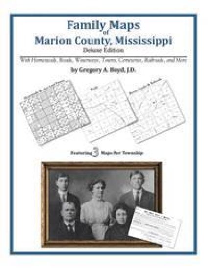
252 pages with 77 total maps Locating original landowners in maps has never been an easy task-until now. This volume in the Family Maps series contains newly created maps of original landowners (patent maps) in what is now Marion County, Mississippi, gleaned from the indexes of the U.S. Bureau of Land Management. But it offers much more than that. For each township in the county, there are two additional maps accompanying the patent map: a road map and a map showing waterways, railroads, and both modern and many historical city-centers and cemeteries. Included are indexes to help you locate what you are looking for, whether you know a person's name, a last name, a place-name, or a cemetery. The combination of maps and indexes are designed to aid researchers of American history or genealogy to explore frontier neighborhoods, examine family migrations, locate hard-to-find cemeteries and towns, as well as locate land based on legal descriptions found in old documents or deeds. The patent-maps are essentially plat maps but instead of depicting owners for a particular year, these maps show original landowners, no matter when the transfer from the federal government was completed. Dates of patents typically begin near the time of statehood and run into the early 1900s. What's Mapped in this book (that you'll not likely find elsewhere) . . . 3227 Parcels of Land (with original landowner names and patent-dates labeled in the relevant map) 66 Cemeteries plus . . . Roads, and existing Rivers, Creeks, Streams, Railroads, and Small-towns (including some historical), etc. What YEARS are these maps for? Here are the counts for parcels of land mapped, by the decade in which the corresponding land patents were issued: DecadeParcel-count 1820s19 1830s18 1840s178 1850s478 1860s84 1870s26 1880s815 1890s1063 1900s428 1910s107 1920s8 What Cities and Towns are in Marion County, Mississippi (and in this book)? Bethel, Bunker Hill, Carmich, Cheraw, Columbia, Columbia Springs (historical), Ebenezer, Edna, Emmanuel, Enon, Expose, Fordsville (historical), Fortenberry, Foxworth, Good Hope, Goss, Hamage, Harmony, Holly Springs, Hopewell, Hub, Hurricane Creek, Improve, Jamestown, Keno (historical), Kokomo, Lampton, Lightville (historical), Lovelace, Mildred, Morgantown, Natcole, New Hope, New Union, Newsom, Pickwick, Pinebur, Saint Paul, Sandy Hook, Sauer, Saxon, Spring Cottage, Sumbax, Twin, White Bluff
Family Maps of Lawrence County, Mississippi
Gregory a. Boyd J. D.
Arphax Publishing Co.
2010
nidottu
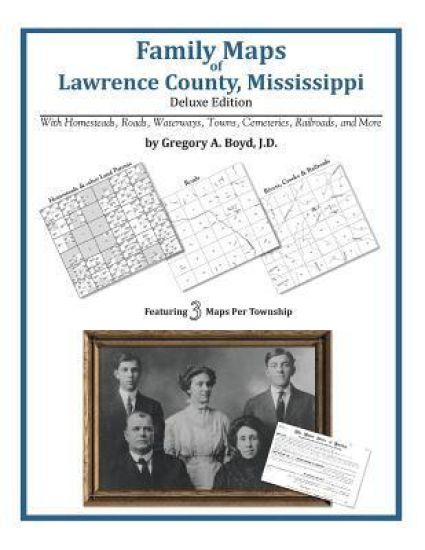
214 pages with 68 total maps Locating original landowners in maps has never been an easy task-until now. This volume in the Family Maps series contains newly created maps of original landowners (patent maps) in what is now Lawrence County, Mississippi, gleaned from the indexes of the U.S. Bureau of Land Management. But it offers much more than that. For each township in the county, there are two additional maps accompanying the patent map: a road map and a map showing waterways, railroads, and both modern and many historical city-centers and cemeteries. Included are indexes to help you locate what you are looking for, whether you know a person's name, a last name, a place-name, or a cemetery. The combination of maps and indexes are designed to aid researchers of American history or genealogy to explore frontier neighborhoods, examine family migrations, locate hard-to-find cemeteries and towns, as well as locate land based on legal descriptions found in old documents or deeds. The patent-maps are essentially plat maps but instead of depicting owners for a particular year, these maps show original landowners, no matter when the transfer from the federal government was completed. Dates of patents typically begin near the time of statehood and run into the early 1900s. What's Mapped in this book (that you'll not likely find elsewhere) . . . 3037 Parcels of Land (with original landowner names and patent-dates labeled in the relevant map) 18 Cemeteries plus . . . Roads, and existing Rivers, Creeks, Streams, Railroads, and Small-towns (including some historical), etc. What YEARS are these maps for? Here are the counts for parcels of land mapped, by the decade in which the corresponding land patents were issued: DecadeParcel-count 1820s13 1830s54 1840s355 1850s781 1860s102 1870s34 1880s496 1890s811 1900s305 1910s69 1920s9 What Cities and Towns are in Lawrence County, Mississippi (and in this book)? Arm, Bristers Store, Ferguson, Hardscrabble (historical), Hooker, Jayess, Lamberts Store, Monticello, New Hebron, Nola, Oak Vale, Oma, Robinwood, Rosella, Silver Creek, Sontag, Tilton, Topeka, Tryus, Verna, Wanilla
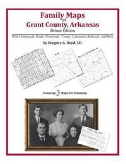
256 pages with 77 total maps Locating original landowners in maps has never been an easy task-until now. This volume in the Family Maps series contains newly created maps of original landowners (patent maps) in what is now Grant County, Arkansas, gleaned from the indexes of the U.S. Bureau of Land Management. But it offers much more than that. For each township in the county, there are two additional maps accompanying the patent map: a road map and a map showing waterways, railroads, and both modern and many historical city-centers and cemeteries. Included are indexes to help you locate what you are looking for, whether you know a person's name, a last name, a place-name, or a cemetery. The combination of maps and indexes are designed to aid researchers of American history or genealogy to explore frontier neighborhoods, examine family migrations, locate hard-to-find cemeteries and towns, as well as locate land based on legal descriptions found in old documents or deeds. The patent-maps are essentially plat maps but instead of depicting owners for a particular year, these maps show original landowners, no matter when the transfer from the federal government was completed. Dates of patents typically begin near the time of statehood and run into the early 1900s. What's Mapped in this book (that you'll not likely find elsewhere) . . . 3646 Parcels of Land (with original landowner names and patent-dates labeled in the relevant map) 33 Cemeteries plus . . . Roads, and existing Rivers, Creeks, Streams, Railroads, and Small-towns (including some historical), etc. What YEARS are these maps for? Here are the counts for parcels of land mapped, by the decade in which the corresponding land patents were issued: DecadeParcel-count 1830s110 1840s86 1850s725 1860s1819 1870s95 1880s263 1890s381 1900s120 1910s35 1920s4 1930s2 1950s6 What Cities and Towns are in Grant County, Arkansas (and in this book)? Ain, Amber (historical), Arthur (historical), Belfast, Brush Creek, Buie, Cane Creek, Carver, Center Grove, Cherry Grove (historical), Clear Lake, Cross Roads, Darysaw (historical), Deer Creek, Dogwood, Ebb, Fenter, Fikes (historical), Grapevine, Ico (historical), Junet, Lamont, Lamont (historical), Lenham, Leola, Lucian (historical), McLean (historical), Millerville, Obin (historical), Orion, Poyen, Prague, Prattsville, Saline River (historical), Sheridan, Slabtown, Studemeir (historical), Thiel, Tull, Turin (historical), Walnut Ridge
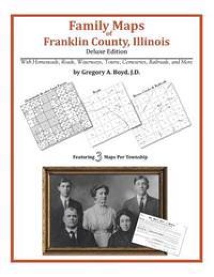
169 pages with 44 total maps Locating original landowners in maps has never been an easy task-until now. This volume in the Family Maps series contains newly created maps of original landowners (patent maps) in what is now Franklin County, Illinois, gleaned from the indexes of the Illinois State Archives. But it offers much more than that. For each township in the county, there are two additional maps accompanying the patent map: a road map and a map showing waterways, railroads, and both modern and many historical city-centers and cemeteries. Included are indexes to help you locate what you are looking for, whether you know a person's name, a last name, a place-name, or a cemetery. The combination of maps and indexes are designed to aid researchers of American history or genealogy to explore frontier neighborhoods, examine family migrations, locate hard-to-find cemeteries and towns, as well as locate land based on legal descriptions found in old documents or deeds. The patent-maps are essentially plat maps but instead of depicting owners for a particular year, these maps show original landowners, no matter when the transfer from the federal government was completed. Dates of patents typically begin near the time of statehood and run into the early 1900s. What's Mapped in this book (that you'll not likely find elsewhere) . . . 2319 Parcels of Land (with original landowner names and patent-dates labeled in the relevant map) 85 Cemeteries plus . . . Roads, and existing Rivers, Creeks, Streams, Railroads, and Small-towns (including some historical), etc. What YEARS are these maps for? Here are the counts for parcels of land mapped, by the decade in which the patent applications were made: DecadeParcel-count 1820s8 1830s309 1840s343 1850s1600 1860s20 1870s2 1880s6 1900s5 1910s26 What Cities and Towns are in Franklin County, Illinois (and in this book)? Akin, Akin Junction, Benton, Benton Park, Bessie, Boothby, Buckner, Cambon, Christopher, Cleburne, Coello, Deering City, Diana, Ewing, Ferber, Frankfort, Frisco, Greenville (historical), Groat, Hanaford, Hickory Corners, Kegley, Lake Creek, Locust Grove (historical), Macedonia, Meyer, Mitchell, Mulkeytown, Orient, Parrish, Pershing, Plumfield, Rend City, Royalton, Rust, Sesser, Smothersville, Steel City, Taylor Hill, Thompsonville, Urbain, Valier, Valier Patch, West City, West End, West Frankfort, Whittington, Zeigler
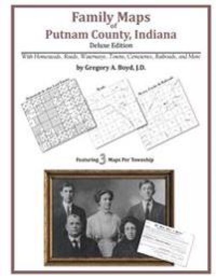
240 pages with 56 total maps Locating original landowners in maps has never been an easy task-until now. This volume in the Family Maps series contains newly created maps of original landowners (patent maps) in what is now Putnam County, Indiana, gleaned from the indexes of the U.S. Bureau of Land Management. But it offers much more than that. For each township in the county, there are two additional maps accompanying the patent map: a road map and a map showing waterways, railroads, and both modern and many historical city-centers and cemeteries. Included are indexes to help you locate what you are looking for, whether you know a person's name, a last name, a place-name, or a cemetery. The combination of maps and indexes are designed to aid researchers of American history or genealogy to explore frontier neighborhoods, examine family migrations, locate hard-to-find cemeteries and towns, as well as locate land based on legal descriptions found in old documents or deeds. The patent-maps are essentially plat maps but instead of depicting owners for a particular year, these maps show original landowners, no matter when the transfer from the federal government was completed. Dates of patents typically begin near the time of statehood and run into the early 1900s. What's Mapped in this book (that you'll not likely find elsewhere) . . . 4447 Parcels of Land (with original landowner names and patent-dates labeled in the relevant map) 39 Cemeteries plus . . . Roads, and existing Rivers, Creeks, Streams, Railroads, and Small-towns (including some historical), etc. What YEARS are these maps for? Here are the counts for parcels of land mapped, by the decade in which the corresponding land patents were issued: Decade Parcel-count 1820s 1174 1830s 2836 1840s 366 1850s 66 1870s 1 1920s 4 What Cities and Towns are in Putnam County, Indiana (and in this book)? Bainbridge, Barnard, Belle Union, Blakesburg, Board Park, Brick Chapel, Broad Park, Brunerstown, Cagle Mill, Carpentersville, Cary, Clinton Falls, Cloverdale, Cradick Corner, Edgewood Lake, Fillmore, Fincastle, Fox Ridge, Greencastle, Groveland, Hirt Corner, Jenkinsville, Keytsville, Limedale, Manhattan, Morton, Mount Meridian, New Maysville, Pleasant Gardens, Portland Mills, Putnamville, Raab Crossroads, Raccoon, Reelsville, Roachdale, Russellville, Vivalia, Westland
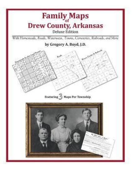
298 pages with 86 total maps Locating original landowners in maps has never been an easy task-until now. This volume in the Family Maps series contains newly created maps of original landowners (patent maps) in what is now Drew County, Arkansas, gleaned from the indexes of the U.S. Bureau of Land Management. But it offers much more than that. For each township in the county, there are two additional maps accompanying the patent map: a road map and a map showing waterways, railroads, and both modern and many historical city-centers and cemeteries. Included are indexes to help you locate what you are looking for, whether you know a person's name, a last name, a place-name, or a cemetery. The combination of maps and indexes are designed to aid researchers of American history or genealogy to explore frontier neighborhoods, examine family migrations, locate hard-to-find cemeteries and towns, as well as locate land based on legal descriptions found in old documents or deeds. The patent-maps are essentially plat maps but instead of depicting owners for a particular year, these maps show original landowners, no matter when the transfer from the federal government was completed. Dates of patents typically begin near the time of statehood and run into the early 1900s. What's Mapped in this book (that you'll not likely find elsewhere) . . . 4525 Parcels of Land (with original landowner names and patent-dates labeled in the relevant map) 70 Cemeteries plus . . . Roads, and existing Rivers, Creeks, Streams, Railroads, and Small-towns (including some historical), etc. What YEARS are these maps for? Here are the counts for parcels of land mapped, by the decade in which the corresponding land patents were issued: DecadeParcel-count 1830s532 1840s316 1850s2039 1860s1106 1870s37 1880s88 1890s196 1900s123 1910s81 1920s7 What Cities and Towns are in Drew County, Arkansas (and in this book)? Allis, Barkada, Baxter, Bethel, Beulah, Bowser (historical), Brandon, Carpenter, Coleman, College Heights, Collins, Cominto, Deane, Enon, Florence, Goose Hollow, Green Hill, Jade (historical), Jerome, Jeter (historical), Jordan (historical), Killin, Lacey, Ladelle, Leavits (historical), Lewis, Lone Sasafras (historical), Monticello, Montongo, Moody (historical), Negro Bend (historical), New Hope, Oakwoods (historical), Old Piney (historical), Old Union (historical), Ozmont Bluff (historical), Paradise (historical), Plantersville, Prairie Grove, Red Neck (historical), Reed Settlement (historical), Rock Springs, Rose Hill, Rough and Ready (historical), Scipio, Scrouge Out (historical), Selma, Shiloh, Sixteenth Section, Tennessee, Tillar, Troy (historical), Valley Junction, Wilmar, Winchester, Youngstown
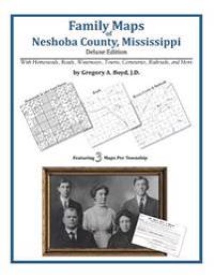
225 pages with 53 total maps Locating original landowners in maps has never been an easy task-until now. This volume in the Family Maps series contains newly created maps of original landowners (patent maps) in what is now Neshoba County, Mississippi, gleaned from the indexes of the U.S. Bureau of Land Management. But it offers much more than that. For each township in the county, there are two additional maps accompanying the patent map: a road map and a map showing waterways, railroads, and both modern and many historical city-centers and cemeteries. Included are indexes to help you locate what you are looking for, whether you know a person's name, a last name, a place-name, or a cemetery. The combination of maps and indexes are designed to aid researchers of American history or genealogy to explore frontier neighborhoods, examine family migrations, locate hard-to-find cemeteries and towns, as well as locate land based on legal descriptions found in old documents or deeds. The patent-maps are essentially plat maps but instead of depicting owners for a particular year, these maps show original landowners, no matter when the transfer from the federal government was completed. Dates of patents typically begin near the time of statehood and run into the early 1900s. What's Mapped in this book (that you'll not likely find elsewhere) . . . 3006 Parcels of Land (with original landowner names and patent-dates labeled in the relevant map) 61 Cemeteries plus . . . Roads, and existing Rivers, Creeks, Streams, Railroads, and Small-towns (including some historical), etc. What YEARS are these maps for? Here are the counts for parcels of land mapped, by the decade in which the corresponding land patents were issued: DecadeParcel-count 1830s61 1840s1575 1850s528 1860s196 1870s21 1880s58 1890s174 1900s219 1910s172 1920s2 What Cities and Towns are in Neshoba County, Mississippi (and in this book)? Alice, Arlington, Barfoot, Beatline, Bethsaida, Bloomfield, Bogue Chitto, Bond, Burnside, Coldwater, Coy, Crossroads, Deemer, DeWeese, Dixon, Dover, Dowdville, Fairview, Forestdale, Golden Grove, Good Hope, Herbert Springs, High Hill, Hope, House, Kitchener, Laurel Hill, Linwood, Longino, McDonald, Neshoba, Neville, North Bend, Ocobla, Pearl River, Philadelphia, Sandtown, Spring Creek, Spring Hill, Stallo, Trapp, Tucker, Waldo, Williamsville, Zaphyr Hill
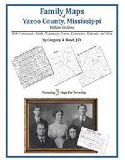
408 pages with 119 total maps Locating original landowners in maps has never been an easy task-until now. This volume in the Family Maps series contains newly created maps of original landowners (patent maps) in what is now Yazoo County, Mississippi, gleaned from the indexes of the U.S. Bureau of Land Management. But it offers much more than that. For each township in the county, there are two additional maps accompanying the patent map: a road map and a map showing waterways, railroads, and both modern and many historical city-centers and cemeteries. Included are indexes to help you locate what you are looking for, whether you know a person's name, a last name, a place-name, or a cemetery. The combination of maps and indexes are designed to aid researchers of American history or genealogy to explore frontier neighborhoods, examine family migrations, locate hard-to-find cemeteries and towns, as well as locate land based on legal descriptions found in old documents or deeds. The patent-maps are essentially plat maps but instead of depicting owners for a particular year, these maps show original landowners, no matter when the transfer from the federal government was completed. Dates of patents typically begin near the time of statehood and run into the early 1900s. What's Mapped in this book (that you'll not likely find elsewhere) . . . 5453 Parcels of Land (with original landowner names and patent-dates labeled in the relevant map) 55 Cemeteries plus . . . Roads, and existing Rivers, Creeks, Streams, Railroads, and Small-towns (including some historical), etc. What YEARS are these maps for? Here are the counts for parcels of land mapped, by the decade in which the corresponding land patents were issued: DecadeParcel-count 1820s271 1830s2557 1840s2408 1850s180 1860s3 1880s1 1890s10 1900s3 1910s14 1920s6 What Cities and Towns are in Yazoo County, Mississippi (and in this book)? Anding, Bayland, Belle Prairie, Belle Prairie, Benton, Bentonia, Berryville, Bethesda (historical), Campbellville, Carter, Cedar Hill (historical), Chethams (historical), Claibornesville (historical), Colby, Crump, Crupp, Deasonville, Dover, Dover (historical), Eden, Ellwood Landing, Enola, Evans, Fairview Landing, Fordyke, Free Run, Fugate, George, Germania, Hilton (historical), Holly Bluff, Horn Place Landing, Jonestown, Kansas Landing, Kearney, Lake City, Limerick, Linwood, Little Yazoo, Liverpool (historical), Loch Lomond, Mechanicsburg, Midway, Myrleville, Nod, Norway, Oil City, Patosi, Pearce (historical), Phoenix, Pierce Crossroad, Plumville (historical), Renshaw, Roadside, Satartia, Scotland, Scotland Fork, Tinsley, Valley, Vaughan, Woodlawn, Yazoo City, Yazoo Junction, Zeiglerville, Zelleria