Kirjojen hintavertailu. Mukana 11 342 296 kirjaa ja 12 kauppaa.

Kirjahaku

Etsi kirjoja tekijän nimen, kirjan nimen tai ISBN:n perusteella.

1000 tulosta hakusanalla Gregory a. Boyd J. D.

Family Maps of Conway County, Arkansas

Family Maps of Conway County, Arkansas

Gregory a. Boyd J. D.

Arphax Publishing Co.
2010
nidottu
230 pages with 74 total maps Locating original landowners in maps has never been an easy task-until now. This volume in the Family Maps series contains newly created maps of original landowners (patent maps) in what is now Conway County, Arkansas, gleaned from the indexes of the U.S. Bureau of Land Management. But it offers much more than that. For each township in the county, there are two additional maps accompanying the patent map: a road map and a map showing waterways, railroads, and both modern and many historical city-centers and cemeteries. Included are indexes to help you locate what you are looking for, whether you know a person's name, a last name, a place-name, or a cemetery. The combination of maps and indexes are designed to aid researchers of American history or genealogy to explore frontier neighborhoods, examine family migrations, locate hard-to-find cemeteries and towns, as well as locate land based on legal descriptions found in old documents or deeds. The patent-maps are essentially plat maps but instead of depicting owners for a particular year, these maps show original landowners, no matter when the transfer from the federal government was completed. Dates of patents typically begin near the time of statehood and run into the early 1900s. What's Mapped in this book (that you'll not likely find elsewhere) . . . 2350 Parcels of Land (with original landowner names and patent-dates labeled in the relevant map) 60 Cemeteries plus . . . Roads, and existing Rivers, Creeks, Streams, Railroads, and Small-towns (including some historical), etc. What YEARS are these maps for? Here are the counts for parcels of land mapped, by the decade in which the corresponding land patents were issued: DecadeParcel-count 1820s205 1830s68 1840s224 1850s142 1860s212 1870s235 1880s595 1890s421 1900s100 1910s121 1920s27 What Cities and Towns are in Conway County, Arkansas (and in this book)? Ada, Arthur, Austin, Bethlehem, Birdtown, Blackwell, Blick, Catholic Point, Cedar Creek, Center Ridge, Clebb (historical), Cleveland, Country Estates (subdivision), Cypress Valley, Deerwood (subdivision), Divide (historical), Friendship, Gobblers Point, Grandview, Hattieville, Hickory Hill, Hill Creek, Holly Springs, Index (historical), Jerusalem, Kenwood, Lanty, Lewisburg, Lick Mountain, Lone Grove, Lost Corner, Macedonia, McClaren, Menifee, Middleton, Morrilton, North Hills Subdivision, Northview Subdivision, Old Hickory, Oppelo, Overcup, Pleasant Hill, Plumerville, Pontoon, Rehms Corner, Riverview, Robertsville, Saint Vincent, Sandtown (historical), Solgohachia, Spring Meadows, Springfield, Sunnyside, Wesley Chapel, West (historical), Winrock, Wonderview, Woolverton (historical)
Family Maps of Ste. Genevieve County, Missouri

Family Maps of Ste. Genevieve County, Missouri

Gregory a. Boyd J. D.

Arphax Publishing Co.
2010
nidottu
250 pages with 72 total maps Locating original landowners in maps has never been an easy task-until now. This volume in the Family Maps series contains newly created maps of original landowners (patent maps) in what is now Ste. Genevieve County, Missouri, gleaned from the indexes of the U.S. Bureau of Land Management. But it offers much more than that. For each township in the county, there are two additional maps accompanying the patent map: a road map and a map showing waterways, railroads, and both modern and many historical city-centers and cemeteries. Included are indexes to help you locate what you are looking for, whether you know a person's name, a last name, a place-name, or a cemetery. The combination of maps and indexes are designed to aid researchers of American history or genealogy to explore frontier neighborhoods, examine family migrations, locate hard-to-find cemeteries and towns, as well as locate land based on legal descriptions found in old documents or deeds. The patent-maps are essentially plat maps but instead of depicting owners for a particular year, these maps show original landowners, no matter when the transfer from the federal government was completed. Dates of patents typically begin near the time of statehood and run into the early 1900s. What's Mapped in this book (that you'll not likely find elsewhere) . . . 3789 Parcels of Land (with original landowner names and patent-dates labeled in the relevant map) 36 Cemeteries plus . . . Roads, and existing Rivers, Creeks, Streams, Railroads, and Small-towns (including some historical), etc. What YEARS are these maps for? Here are the counts for parcels of land mapped, by the decade in which the corresponding land patents were issued: DecadeParcel-count 1820s55 1830s240 1840s458 1850s2403 1860s335 1870s75 1880s58 1890s50 1900s62 1910s48 1920s3 What Cities and Towns are in Ste. Genevieve County, Missouri (and in this book)? Avon, Bloomsdale, Brickeys, Chestnut Ridge, Clearwater, Clement, Coffman, Copper Mine, Hicks, Jonca, Kinsey, Lawrenceton, Little Rock Landing, Marlo, Mill, Millers, Minnith, Mosher, Needmore, New Bourbon, New Offenburg, Ozora, Pickel, Quarry Town, River aux Vases, Rocky Ridge Ranch, Saint Jude Acres (subdivision), Saint Mary, Sainte Genevieve, Sprott, Thomure, Valley View, Weingarten, Womack, Zell
Family Maps of Newton County, Mississippi

Family Maps of Newton County, Mississippi

Gregory a. Boyd J. D.

Arphax Publishing Co.
2010
nidottu
225 pages with 53 total maps Locating original landowners in maps has never been an easy task-until now. This volume in the Family Maps series contains newly created maps of original landowners (patent maps) in what is now Newton County, Mississippi, gleaned from the indexes of the U.S. Bureau of Land Management. But it offers much more than that. For each township in the county, there are two additional maps accompanying the patent map: a road map and a map showing waterways, railroads, and both modern and many historical city-centers and cemeteries. Included are indexes to help you locate what you are looking for, whether you know a person's name, a last name, a place-name, or a cemetery. The combination of maps and indexes are designed to aid researchers of American history or genealogy to explore frontier neighborhoods, examine family migrations, locate hard-to-find cemeteries and towns, as well as locate land based on legal descriptions found in old documents or deeds. The patent-maps are essentially plat maps but instead of depicting owners for a particular year, these maps show original landowners, no matter when the transfer from the federal government was completed. Dates of patents typically begin near the time of statehood and run into the early 1900s. What's Mapped in this book (that you'll not likely find elsewhere) . . . 3079 Parcels of Land (with original landowner names and patent-dates labeled in the relevant map) 26 Cemeteries plus . . . Roads, and existing Rivers, Creeks, Streams, Railroads, and Small-towns (including some historical), etc. What YEARS are these maps for? Here are the counts for parcels of land mapped, by the decade in which the corresponding land patents were issued: DecadeParcel-count 1820s1 1830s31 1840s1803 1850s488 1860s317 1870s34 1880s46 1890s200 1900s115 1910s41 1920s3 What Cities and Towns are in Newton County, Mississippi (and in this book)? Bartlett, Battlefield (historical), Bethel, Beulah, Bissaasha (historical), Blounts Store, Calhoun, Cedar Grove, Center Ridge, Chunky, Chunky (historical), Coatraw (historical), Conehatta, Decatur, Doolittle (historical), Duffee, Ebenezer, Evergreen (historical), Goodhope, Greenfield (historical), Greenland, Hazel, Hickory, Hubbard, Jeff, Lawrence, Lebanon, Liberty, Little Rock, Little Rock (historical), Lucern, Mount Vernon, New Ireland, New Providence, Newton, Oka Hullo (historical), Oka Kapassa (historical), Okahta Talaia (historical), Patrons Union (historical), Paula (historical), Perdue, Perota (historical), Pilgrim Grove, Pine Bluff, Poplar Springs, Prospect, Roberts, Rock Branch, Rock Creek, Roscoe (historical), Scanlon (historical), Six Towns (historical), Stamper (historical), Stratton, Tallow (historical), Tanglewood, Toomer (historical), Union, Urbo (historical), Volcan (historical), Wickward (historical), Willoughby
Family Maps of Marion County, Mississippi

Family Maps of Marion County, Mississippi

Gregory a. Boyd J. D.

Arphax Publishing Co.
2010
nidottu
252 pages with 77 total maps Locating original landowners in maps has never been an easy task-until now. This volume in the Family Maps series contains newly created maps of original landowners (patent maps) in what is now Marion County, Mississippi, gleaned from the indexes of the U.S. Bureau of Land Management. But it offers much more than that. For each township in the county, there are two additional maps accompanying the patent map: a road map and a map showing waterways, railroads, and both modern and many historical city-centers and cemeteries. Included are indexes to help you locate what you are looking for, whether you know a person's name, a last name, a place-name, or a cemetery. The combination of maps and indexes are designed to aid researchers of American history or genealogy to explore frontier neighborhoods, examine family migrations, locate hard-to-find cemeteries and towns, as well as locate land based on legal descriptions found in old documents or deeds. The patent-maps are essentially plat maps but instead of depicting owners for a particular year, these maps show original landowners, no matter when the transfer from the federal government was completed. Dates of patents typically begin near the time of statehood and run into the early 1900s. What's Mapped in this book (that you'll not likely find elsewhere) . . . 3227 Parcels of Land (with original landowner names and patent-dates labeled in the relevant map) 66 Cemeteries plus . . . Roads, and existing Rivers, Creeks, Streams, Railroads, and Small-towns (including some historical), etc. What YEARS are these maps for? Here are the counts for parcels of land mapped, by the decade in which the corresponding land patents were issued: DecadeParcel-count 1820s19 1830s18 1840s178 1850s478 1860s84 1870s26 1880s815 1890s1063 1900s428 1910s107 1920s8 What Cities and Towns are in Marion County, Mississippi (and in this book)? Bethel, Bunker Hill, Carmich, Cheraw, Columbia, Columbia Springs (historical), Ebenezer, Edna, Emmanuel, Enon, Expose, Fordsville (historical), Fortenberry, Foxworth, Good Hope, Goss, Hamage, Harmony, Holly Springs, Hopewell, Hub, Hurricane Creek, Improve, Jamestown, Keno (historical), Kokomo, Lampton, Lightville (historical), Lovelace, Mildred, Morgantown, Natcole, New Hope, New Union, Newsom, Pickwick, Pinebur, Saint Paul, Sandy Hook, Sauer, Saxon, Spring Cottage, Sumbax, Twin, White Bluff
Family Maps of Lawrence County, Mississippi

Family Maps of Lawrence County, Mississippi

Gregory a. Boyd J. D.

Arphax Publishing Co.
2010
nidottu
214 pages with 68 total maps Locating original landowners in maps has never been an easy task-until now. This volume in the Family Maps series contains newly created maps of original landowners (patent maps) in what is now Lawrence County, Mississippi, gleaned from the indexes of the U.S. Bureau of Land Management. But it offers much more than that. For each township in the county, there are two additional maps accompanying the patent map: a road map and a map showing waterways, railroads, and both modern and many historical city-centers and cemeteries. Included are indexes to help you locate what you are looking for, whether you know a person's name, a last name, a place-name, or a cemetery. The combination of maps and indexes are designed to aid researchers of American history or genealogy to explore frontier neighborhoods, examine family migrations, locate hard-to-find cemeteries and towns, as well as locate land based on legal descriptions found in old documents or deeds. The patent-maps are essentially plat maps but instead of depicting owners for a particular year, these maps show original landowners, no matter when the transfer from the federal government was completed. Dates of patents typically begin near the time of statehood and run into the early 1900s. What's Mapped in this book (that you'll not likely find elsewhere) . . . 3037 Parcels of Land (with original landowner names and patent-dates labeled in the relevant map) 18 Cemeteries plus . . . Roads, and existing Rivers, Creeks, Streams, Railroads, and Small-towns (including some historical), etc. What YEARS are these maps for? Here are the counts for parcels of land mapped, by the decade in which the corresponding land patents were issued: DecadeParcel-count 1820s13 1830s54 1840s355 1850s781 1860s102 1870s34 1880s496 1890s811 1900s305 1910s69 1920s9 What Cities and Towns are in Lawrence County, Mississippi (and in this book)? Arm, Bristers Store, Ferguson, Hardscrabble (historical), Hooker, Jayess, Lamberts Store, Monticello, New Hebron, Nola, Oak Vale, Oma, Robinwood, Rosella, Silver Creek, Sontag, Tilton, Topeka, Tryus, Verna, Wanilla
Family Maps of Grant County, Arkansas

Family Maps of Grant County, Arkansas

Gregory a. Boyd J. D.

Arphax Publishing Co.
2010
nidottu
256 pages with 77 total maps Locating original landowners in maps has never been an easy task-until now. This volume in the Family Maps series contains newly created maps of original landowners (patent maps) in what is now Grant County, Arkansas, gleaned from the indexes of the U.S. Bureau of Land Management. But it offers much more than that. For each township in the county, there are two additional maps accompanying the patent map: a road map and a map showing waterways, railroads, and both modern and many historical city-centers and cemeteries. Included are indexes to help you locate what you are looking for, whether you know a person's name, a last name, a place-name, or a cemetery. The combination of maps and indexes are designed to aid researchers of American history or genealogy to explore frontier neighborhoods, examine family migrations, locate hard-to-find cemeteries and towns, as well as locate land based on legal descriptions found in old documents or deeds. The patent-maps are essentially plat maps but instead of depicting owners for a particular year, these maps show original landowners, no matter when the transfer from the federal government was completed. Dates of patents typically begin near the time of statehood and run into the early 1900s. What's Mapped in this book (that you'll not likely find elsewhere) . . . 3646 Parcels of Land (with original landowner names and patent-dates labeled in the relevant map) 33 Cemeteries plus . . . Roads, and existing Rivers, Creeks, Streams, Railroads, and Small-towns (including some historical), etc. What YEARS are these maps for? Here are the counts for parcels of land mapped, by the decade in which the corresponding land patents were issued: DecadeParcel-count 1830s110 1840s86 1850s725 1860s1819 1870s95 1880s263 1890s381 1900s120 1910s35 1920s4 1930s2 1950s6 What Cities and Towns are in Grant County, Arkansas (and in this book)? Ain, Amber (historical), Arthur (historical), Belfast, Brush Creek, Buie, Cane Creek, Carver, Center Grove, Cherry Grove (historical), Clear Lake, Cross Roads, Darysaw (historical), Deer Creek, Dogwood, Ebb, Fenter, Fikes (historical), Grapevine, Ico (historical), Junet, Lamont, Lamont (historical), Lenham, Leola, Lucian (historical), McLean (historical), Millerville, Obin (historical), Orion, Poyen, Prague, Prattsville, Saline River (historical), Sheridan, Slabtown, Studemeir (historical), Thiel, Tull, Turin (historical), Walnut Ridge
Family Maps of Franklin County, Illinois

Family Maps of Franklin County, Illinois

Gregory a. Boyd J. D.

Arphax Publishing Co.
2010
nidottu
169 pages with 44 total maps Locating original landowners in maps has never been an easy task-until now. This volume in the Family Maps series contains newly created maps of original landowners (patent maps) in what is now Franklin County, Illinois, gleaned from the indexes of the Illinois State Archives. But it offers much more than that. For each township in the county, there are two additional maps accompanying the patent map: a road map and a map showing waterways, railroads, and both modern and many historical city-centers and cemeteries. Included are indexes to help you locate what you are looking for, whether you know a person's name, a last name, a place-name, or a cemetery. The combination of maps and indexes are designed to aid researchers of American history or genealogy to explore frontier neighborhoods, examine family migrations, locate hard-to-find cemeteries and towns, as well as locate land based on legal descriptions found in old documents or deeds. The patent-maps are essentially plat maps but instead of depicting owners for a particular year, these maps show original landowners, no matter when the transfer from the federal government was completed. Dates of patents typically begin near the time of statehood and run into the early 1900s. What's Mapped in this book (that you'll not likely find elsewhere) . . . 2319 Parcels of Land (with original landowner names and patent-dates labeled in the relevant map) 85 Cemeteries plus . . . Roads, and existing Rivers, Creeks, Streams, Railroads, and Small-towns (including some historical), etc. What YEARS are these maps for? Here are the counts for parcels of land mapped, by the decade in which the patent applications were made: DecadeParcel-count 1820s8 1830s309 1840s343 1850s1600 1860s20 1870s2 1880s6 1900s5 1910s26 What Cities and Towns are in Franklin County, Illinois (and in this book)? Akin, Akin Junction, Benton, Benton Park, Bessie, Boothby, Buckner, Cambon, Christopher, Cleburne, Coello, Deering City, Diana, Ewing, Ferber, Frankfort, Frisco, Greenville (historical), Groat, Hanaford, Hickory Corners, Kegley, Lake Creek, Locust Grove (historical), Macedonia, Meyer, Mitchell, Mulkeytown, Orient, Parrish, Pershing, Plumfield, Rend City, Royalton, Rust, Sesser, Smothersville, Steel City, Taylor Hill, Thompsonville, Urbain, Valier, Valier Patch, West City, West End, West Frankfort, Whittington, Zeigler
Family Maps of Putnam County, Indiana

Family Maps of Putnam County, Indiana

Gregory a. Boyd J. D.

Arphax Publishing Co.
2010
nidottu
240 pages with 56 total maps Locating original landowners in maps has never been an easy task-until now. This volume in the Family Maps series contains newly created maps of original landowners (patent maps) in what is now Putnam County, Indiana, gleaned from the indexes of the U.S. Bureau of Land Management. But it offers much more than that. For each township in the county, there are two additional maps accompanying the patent map: a road map and a map showing waterways, railroads, and both modern and many historical city-centers and cemeteries. Included are indexes to help you locate what you are looking for, whether you know a person's name, a last name, a place-name, or a cemetery. The combination of maps and indexes are designed to aid researchers of American history or genealogy to explore frontier neighborhoods, examine family migrations, locate hard-to-find cemeteries and towns, as well as locate land based on legal descriptions found in old documents or deeds. The patent-maps are essentially plat maps but instead of depicting owners for a particular year, these maps show original landowners, no matter when the transfer from the federal government was completed. Dates of patents typically begin near the time of statehood and run into the early 1900s. What's Mapped in this book (that you'll not likely find elsewhere) . . . 4447 Parcels of Land (with original landowner names and patent-dates labeled in the relevant map) 39 Cemeteries plus . . . Roads, and existing Rivers, Creeks, Streams, Railroads, and Small-towns (including some historical), etc. What YEARS are these maps for? Here are the counts for parcels of land mapped, by the decade in which the corresponding land patents were issued: Decade Parcel-count 1820s 1174 1830s 2836 1840s 366 1850s 66 1870s 1 1920s 4 What Cities and Towns are in Putnam County, Indiana (and in this book)? Bainbridge, Barnard, Belle Union, Blakesburg, Board Park, Brick Chapel, Broad Park, Brunerstown, Cagle Mill, Carpentersville, Cary, Clinton Falls, Cloverdale, Cradick Corner, Edgewood Lake, Fillmore, Fincastle, Fox Ridge, Greencastle, Groveland, Hirt Corner, Jenkinsville, Keytsville, Limedale, Manhattan, Morton, Mount Meridian, New Maysville, Pleasant Gardens, Portland Mills, Putnamville, Raab Crossroads, Raccoon, Reelsville, Roachdale, Russellville, Vivalia, Westland
Family Maps of Drew County, Arkansas

Family Maps of Drew County, Arkansas

Gregory a. Boyd J. D.

Arphax Publishing Co.
2010
nidottu
298 pages with 86 total maps Locating original landowners in maps has never been an easy task-until now. This volume in the Family Maps series contains newly created maps of original landowners (patent maps) in what is now Drew County, Arkansas, gleaned from the indexes of the U.S. Bureau of Land Management. But it offers much more than that. For each township in the county, there are two additional maps accompanying the patent map: a road map and a map showing waterways, railroads, and both modern and many historical city-centers and cemeteries. Included are indexes to help you locate what you are looking for, whether you know a person's name, a last name, a place-name, or a cemetery. The combination of maps and indexes are designed to aid researchers of American history or genealogy to explore frontier neighborhoods, examine family migrations, locate hard-to-find cemeteries and towns, as well as locate land based on legal descriptions found in old documents or deeds. The patent-maps are essentially plat maps but instead of depicting owners for a particular year, these maps show original landowners, no matter when the transfer from the federal government was completed. Dates of patents typically begin near the time of statehood and run into the early 1900s. What's Mapped in this book (that you'll not likely find elsewhere) . . . 4525 Parcels of Land (with original landowner names and patent-dates labeled in the relevant map) 70 Cemeteries plus . . . Roads, and existing Rivers, Creeks, Streams, Railroads, and Small-towns (including some historical), etc. What YEARS are these maps for? Here are the counts for parcels of land mapped, by the decade in which the corresponding land patents were issued: DecadeParcel-count 1830s532 1840s316 1850s2039 1860s1106 1870s37 1880s88 1890s196 1900s123 1910s81 1920s7 What Cities and Towns are in Drew County, Arkansas (and in this book)? Allis, Barkada, Baxter, Bethel, Beulah, Bowser (historical), Brandon, Carpenter, Coleman, College Heights, Collins, Cominto, Deane, Enon, Florence, Goose Hollow, Green Hill, Jade (historical), Jerome, Jeter (historical), Jordan (historical), Killin, Lacey, Ladelle, Leavits (historical), Lewis, Lone Sasafras (historical), Monticello, Montongo, Moody (historical), Negro Bend (historical), New Hope, Oakwoods (historical), Old Piney (historical), Old Union (historical), Ozmont Bluff (historical), Paradise (historical), Plantersville, Prairie Grove, Red Neck (historical), Reed Settlement (historical), Rock Springs, Rose Hill, Rough and Ready (historical), Scipio, Scrouge Out (historical), Selma, Shiloh, Sixteenth Section, Tennessee, Tillar, Troy (historical), Valley Junction, Wilmar, Winchester, Youngstown
Family Maps of Neshoba County, Mississippi

Family Maps of Neshoba County, Mississippi

Gregory a. Boyd J. D.

Arphax Publishing Co.
2010
nidottu
225 pages with 53 total maps Locating original landowners in maps has never been an easy task-until now. This volume in the Family Maps series contains newly created maps of original landowners (patent maps) in what is now Neshoba County, Mississippi, gleaned from the indexes of the U.S. Bureau of Land Management. But it offers much more than that. For each township in the county, there are two additional maps accompanying the patent map: a road map and a map showing waterways, railroads, and both modern and many historical city-centers and cemeteries. Included are indexes to help you locate what you are looking for, whether you know a person's name, a last name, a place-name, or a cemetery. The combination of maps and indexes are designed to aid researchers of American history or genealogy to explore frontier neighborhoods, examine family migrations, locate hard-to-find cemeteries and towns, as well as locate land based on legal descriptions found in old documents or deeds. The patent-maps are essentially plat maps but instead of depicting owners for a particular year, these maps show original landowners, no matter when the transfer from the federal government was completed. Dates of patents typically begin near the time of statehood and run into the early 1900s. What's Mapped in this book (that you'll not likely find elsewhere) . . . 3006 Parcels of Land (with original landowner names and patent-dates labeled in the relevant map) 61 Cemeteries plus . . . Roads, and existing Rivers, Creeks, Streams, Railroads, and Small-towns (including some historical), etc. What YEARS are these maps for? Here are the counts for parcels of land mapped, by the decade in which the corresponding land patents were issued: DecadeParcel-count 1830s61 1840s1575 1850s528 1860s196 1870s21 1880s58 1890s174 1900s219 1910s172 1920s2 What Cities and Towns are in Neshoba County, Mississippi (and in this book)? Alice, Arlington, Barfoot, Beatline, Bethsaida, Bloomfield, Bogue Chitto, Bond, Burnside, Coldwater, Coy, Crossroads, Deemer, DeWeese, Dixon, Dover, Dowdville, Fairview, Forestdale, Golden Grove, Good Hope, Herbert Springs, High Hill, Hope, House, Kitchener, Laurel Hill, Linwood, Longino, McDonald, Neshoba, Neville, North Bend, Ocobla, Pearl River, Philadelphia, Sandtown, Spring Creek, Spring Hill, Stallo, Trapp, Tucker, Waldo, Williamsville, Zaphyr Hill
Family Maps of Yazoo County, Mississippi

Family Maps of Yazoo County, Mississippi

Gregory a. Boyd J. D.

Arphax Publishing Co.
2010
nidottu
408 pages with 119 total maps Locating original landowners in maps has never been an easy task-until now. This volume in the Family Maps series contains newly created maps of original landowners (patent maps) in what is now Yazoo County, Mississippi, gleaned from the indexes of the U.S. Bureau of Land Management. But it offers much more than that. For each township in the county, there are two additional maps accompanying the patent map: a road map and a map showing waterways, railroads, and both modern and many historical city-centers and cemeteries. Included are indexes to help you locate what you are looking for, whether you know a person's name, a last name, a place-name, or a cemetery. The combination of maps and indexes are designed to aid researchers of American history or genealogy to explore frontier neighborhoods, examine family migrations, locate hard-to-find cemeteries and towns, as well as locate land based on legal descriptions found in old documents or deeds. The patent-maps are essentially plat maps but instead of depicting owners for a particular year, these maps show original landowners, no matter when the transfer from the federal government was completed. Dates of patents typically begin near the time of statehood and run into the early 1900s. What's Mapped in this book (that you'll not likely find elsewhere) . . . 5453 Parcels of Land (with original landowner names and patent-dates labeled in the relevant map) 55 Cemeteries plus . . . Roads, and existing Rivers, Creeks, Streams, Railroads, and Small-towns (including some historical), etc. What YEARS are these maps for? Here are the counts for parcels of land mapped, by the decade in which the corresponding land patents were issued: DecadeParcel-count 1820s271 1830s2557 1840s2408 1850s180 1860s3 1880s1 1890s10 1900s3 1910s14 1920s6 What Cities and Towns are in Yazoo County, Mississippi (and in this book)? Anding, Bayland, Belle Prairie, Belle Prairie, Benton, Bentonia, Berryville, Bethesda (historical), Campbellville, Carter, Cedar Hill (historical), Chethams (historical), Claibornesville (historical), Colby, Crump, Crupp, Deasonville, Dover, Dover (historical), Eden, Ellwood Landing, Enola, Evans, Fairview Landing, Fordyke, Free Run, Fugate, George, Germania, Hilton (historical), Holly Bluff, Horn Place Landing, Jonestown, Kansas Landing, Kearney, Lake City, Limerick, Linwood, Little Yazoo, Liverpool (historical), Loch Lomond, Mechanicsburg, Midway, Myrleville, Nod, Norway, Oil City, Patosi, Pearce (historical), Phoenix, Pierce Crossroad, Plumville (historical), Renshaw, Roadside, Satartia, Scotland, Scotland Fork, Tinsley, Valley, Vaughan, Woodlawn, Yazoo City, Yazoo Junction, Zeiglerville, Zelleria
Family Maps of Holmes County, Mississippi

Family Maps of Holmes County, Mississippi

Gregory a. Boyd J. D.

Arphax Publishing Co.
2010
nidottu
368 pages with 101 total maps Locating original landowners in maps has never been an easy task-until now. This volume in the Family Maps series contains newly created maps of original landowners (patent maps) in what is now Holmes County, Mississippi, gleaned from the indexes of the U.S. Bureau of Land Management. But it offers much more than that. For each township in the county, there are two additional maps accompanying the patent map: a road map and a map showing waterways, railroads, and both modern and many historical city-centers and cemeteries. Included are indexes to help you locate what you are looking for, whether you know a person's name, a last name, a place-name, or a cemetery. The combination of maps and indexes are designed to aid researchers of American history or genealogy to explore frontier neighborhoods, examine family migrations, locate hard-to-find cemeteries and towns, as well as locate land based on legal descriptions found in old documents or deeds. The patent-maps are essentially plat maps but instead of depicting owners for a particular year, these maps show original landowners, no matter when the transfer from the federal government was completed. Dates of patents typically begin near the time of statehood and run into the early 1900s. What's Mapped in this book (that you'll not likely find elsewhere) . . . 5284 Parcels of Land (with original landowner names and patent-dates labeled in the relevant map) 131 Cemeteries plus . . . Roads, and existing Rivers, Creeks, Streams, Railroads, and Small-towns (including some historical), etc. What YEARS are these maps for? Here are the counts for parcels of land mapped, by the decade in which the corresponding land patents were issued: DecadeParcel-count 1820s143 1830s837 1840s3581 1850s507 1860s54 1870s8 1880s42 1890s60 1900s31 1910s7 1920s13 What Cities and Towns are in Holmes County, Mississippi (and in this book)? Aberdeen Junction, Acona, Bee Lake, Blissdale, Bowling Green, Brozville, Butler, Castalian Springs, Choctaw, Coxburg, Cruger, Dulweber, Durant, Ebenezer, Edsville, Egypt, Emory, Eulogy, Franklin, Good Hope, Goodman, Gum Grove, Gwin, Hoffman, Horseshoe, Howard, Ituma, Jones Crossing, Keirn, Lebanon, Lexington, Marcella, Marksville, McMillan, Meeks, Mileston, Montgomery, Oak Grove, Omega, Oregon, Oswego, Owens Wells, Pickens, Pinchback, Pine Grove, Pluto, Poplar Springs, Quofaloma, Richland, Roseneath, Shackleford, Stonewall, Tchula, Thornton, Tolarville, West, West Hill, Westfield, Wyatt, Zeiglerville
Family Maps of Winston County, Mississippi

Family Maps of Winston County, Mississippi

Gregory a. Boyd J. D.

Arphax Publishing Co.
2010
nidottu
262 pages with 59 total maps Locating original landowners in maps has never been an easy task-until now. This volume in the Family Maps series contains newly created maps of original landowners (patent maps) in what is now Winston County, Mississippi, gleaned from the indexes of the U.S. Bureau of Land Management. But it offers much more than that. For each township in the county, there are two additional maps accompanying the patent map: a road map and a map showing waterways, railroads, and both modern and many historical city-centers and cemeteries. Included are indexes to help you locate what you are looking for, whether you know a person's name, a last name, a place-name, or a cemetery. The combination of maps and indexes are designed to aid researchers of American history or genealogy to explore frontier neighborhoods, examine family migrations, locate hard-to-find cemeteries and towns, as well as locate land based on legal descriptions found in old documents or deeds. The patent-maps are essentially plat maps but instead of depicting owners for a particular year, these maps show original landowners, no matter when the transfer from the federal government was completed. Dates of patents typically begin near the time of statehood and run into the early 1900s. What Cities and Towns are in Winston County, Mississippi (and in this book)? What's Mapped in this book (that you'll not likely find elsewhere) . . . 3883 Parcels of Land (with original landowner names and patent-dates labeled in the relevant map) 73 Cemeteries plus . . . Roads, and existing Rivers, Creeks, Streams, Railroads, and Small-towns (including some historical), etc. What YEARS are these maps for? Here are the counts for parcels of land mapped, by the decade in which the corresponding land patents were issued: DecadeParcel-count 1830s33 1840s2658 1850s468 1860s132 1870s15 1880s82 1890s258 1900s97 1910s134 1920s5 What Cities and Towns are in Winston County, Mississippi (and in this book)? Betheden, Boon, Calvary, Center Ridge, Claytown, Coonwood (historical), Deposit (historical), Ellison Ridge, Estes, Evergreen, Fearns Springs, Finis Hook (historical), Ford, Gum Springs, Handle, Highpoint, Hight, Hinze, Liberty, Loakfoma, Lobutcha (historical), Louisville, McMillan, Millcreek, Nanih Waiya, Noxapater, Perkinsville (historical), Plattsburg, Randalls Bluff (historical), Rome, Rural Hill, Singleton (historical), Triplets Corners, Vernon, Vowell, Webster, Winston
Family Maps of Clark County, Arkansas

Family Maps of Clark County, Arkansas

Gregory a. Boyd J. D.

Arphax Publishing Co.
2010
nidottu
348 pages with 110 total maps Locating original landowners in maps has never been an easy task-until now. This volume in the Family Maps series contains newly created maps of original landowners (patent maps) in what is now Clark County, Arkansas, gleaned from the indexes of the U.S. Bureau of Land Management. But it offers much more than that. For each township in the county, there are two additional maps accompanying the patent map: a road map and a map showing waterways, railroads, and both modern and many historical city-centers and cemeteries. Included are indexes to help you locate what you are looking for, whether you know a person's name, a last name, a place-name, or a cemetery. The combination of maps and indexes are designed to aid researchers of American history or genealogy to explore frontier neighborhoods, examine family migrations, locate hard-to-find cemeteries and towns, as well as locate land based on legal descriptions found in old documents or deeds. The patent-maps are essentially plat maps but instead of depicting owners for a particular year, these maps show original landowners, no matter when the transfer from the federal government was completed. Dates of patents typically begin near the time of statehood and run into the early 1900s. What's Mapped in this book (that you'll not likely find elsewhere) . . . 3569 Parcels of Land (with original landowner names and patent-dates labeled in the relevant map) 70 Cemeteries plus . . . Roads, and existing Rivers, Creeks, Streams, Railroads, and Small-towns (including some historical), etc. What YEARS are these maps for? Here are the counts for parcels of land mapped, by the decade in which the corresponding land patents were issued: DecadeParcel-count 1820s42 1830s744 1840s166 1850s635 1860s622 1870s119 1880s600 1890s303 1900s203 1910s124 1920s10 What Cities and Towns are in Clark County, Arkansas (and in this book)? Alpine, Amity, Arkadelphia, Barringer, Beirne, Bethel, Boswell, Britt (historical), Burtsell, Caddo Valley, Central, Clear Spring, Curtis, Daleville, De Gray, Dobyville, Elm (historical), Fendley, Gravel Junction, Graysonia, Griffithtown, Gum Springs, Gurdon, Halfway, Haretown, Hearn (historical), Hebron (historical), Hollywood, Joan, Kansas, Keyton (historical), Knoxville, Lenox, Love Creek, Majors, Meeks Settlement, Midway, Native (historical), Okolona, Pike Junction, Red Springs, Richwoods, Shakertown, Smithton, Smithton (historical), Smyrna, Sycamore, Trace, Vaden, Whelen Springs, Witherspoon
Family Maps of Noxubee County, Mississippi

Family Maps of Noxubee County, Mississippi

Gregory a. Boyd J. D.

Arphax Publishing Co.
2010
nidottu
343 pages with 65 total maps Locating original landowners in maps has never been an easy task-until now. This volume in the Family Maps series contains newly created maps of original landowners (patent maps) in what is now Noxubee County, Mississippi, gleaned from the indexes of the U.S. Bureau of Land Management. But it offers much more than that. For each township in the county, there are two additional maps accompanying the patent map: a road map and a map showing waterways, railroads, and both modern and many historical city-centers and cemeteries. Included are indexes to help you locate what you are looking for, whether you know a person's name, a last name, a place-name, or a cemetery. The combination of maps and indexes are designed to aid researchers of American history or genealogy to explore frontier neighborhoods, examine family migrations, locate hard-to-find cemeteries and towns, as well as locate land based on legal descriptions found in old documents or deeds. The patent-maps are essentially plat maps but instead of depicting owners for a particular year, these maps show original landowners, no matter when the transfer from the federal government was completed. Dates of patents typically begin near the time of statehood and run into the early 1900s. What's Mapped in this book (that you'll not likely find elsewhere) . . . 4949 Parcels of Land (with original landowner names and patent-dates labeled in the relevant map) 54 Cemeteries plus . . . Roads, and existing Rivers, Creeks, Streams, Railroads, and Small-towns (including some historical), etc. What YEARS are these maps for? Here are the counts for parcels of land mapped, by the decade in which the corresponding land patents were issued: DecadeParcel-count 1830s93 1840s4473 1850s139 1860s64 1870s6 1880s26 1890s58 1900s37 1910s45 1920s4 What Cities and Towns are in Noxubee County, Mississippi (and in this book)? Allgoods Mill (historical), Armitage (historical), Aubrey, Bells (historical), Big Lake (historical), Bigbee Valley, Brazelia (historical), Brooklyn (historical), Brooksville, Calyx, Center Point (historical), Clearman, Cliftonville, Cooksville, Cross Roads (historical), Crow (historical), Deerbrook, Dinsmore, Dixie (historical), Eli (historical), Elon (historical), Fairhill, Fairport (historical), Fairview (historical), Farewells (historical), Foxtrap (historical), Gholson, Grantsville (historical), Harlan (historical), Hashuqua (historical), Jeff Davis (historical), Lynn Creek, Macedonia, Macon, Mashulaville, May Spring, McLeod, Mohegan (historical), Parkeville (historical), Paulette, Plantersville (historical), Prairie Point, Ravine, Shavers (historical), Shuqualak, Summerville (historical), Taylors (historical), Togo, X-Prairie
Family Maps of Hinds County, Mississippi

Family Maps of Hinds County, Mississippi

Gregory a. Boyd J. D.

Arphax Publishing Co.
2010
nidottu
412 pages with 98 total maps Locating original landowners in maps has never been an easy task-until now. This volume in the Family Maps series contains newly created maps of original landowners (patent maps) in what is now Hinds County, Mississippi, gleaned from the indexes of the U.S. Bureau of Land Management. But it offers much more than that. For each township in the county, there are two additional maps accompanying the patent map: a road map and a map showing waterways, railroads, and both modern and many historical city-centers and cemeteries. Included are indexes to help you locate what you are looking for, whether you know a person's name, a last name, a place-name, or a cemetery. The combination of maps and indexes are designed to aid researchers of American history or genealogy to explore frontier neighborhoods, examine family migrations, locate hard-to-find cemeteries and towns, as well as locate land based on legal descriptions found in old documents or deeds. The patent-maps are essentially plat maps but instead of depicting owners for a particular year, these maps show original landowners, no matter when the transfer from the federal government was completed. Dates of patents typically begin near the time of statehood and run into the early 1900s. What's Mapped in this book (that you'll not likely find elsewhere) . . . 7523 Parcels of Land (with original landowner names and patent-dates labeled in the relevant map) 58 Cemeteries plus . . . Roads, and existing Rivers, Creeks, Streams, Railroads, and Small-towns (including some historical), etc. What YEARS are these maps for? Here are the counts for parcels of land mapped, by the decade in which the corresponding land patents were issued: DecadeParcel-count 1820s940 1830s3110 1840s3221 1850s178 1860s22 1870s2 1880s1 1890s15 1900s10 1910s19 1920s5 What Cities and Towns are in Hinds County, Mississippi (and in this book)? Adams, Bear Creek, Bernard, Bethesda, Bolton, Bradie, Brookleigh, Brownsville, Byram, Carmichael, Cayuga, Champion Hill, Chapel Hill, Clinton, Cynthia, Dabney Crossroads, Dixon, Dry Grove, Duke, Edwards, Elton, Fairchilds Crossroads, Forest Hill, Green Crossing, Hubbard, Institute, Jackson, Lakeover, Learned, Lebanon, Lynchburg, Mayfair, McRaven, Midway, Moncure, Morgans Store, Morning Star, Nevada, New Byram, Newman, Nogan, North Colony, Norwood, Oakley, Orangeville, Palestine, Pine Grove, Pinehaven Estates, Pocahontas, Queens Hill, Raymond, Reedtown, Rosemary, Salem, Seven Springs, Siwel, Smiths, Spring Ridge, Taylorsville, Terry, Thompson, Thompsonville, Tinnin, Tougaloo, Utica, Van Winkle, West View
Family Maps of Attala County, Mississippi

Family Maps of Attala County, Mississippi

Gregory a. Boyd J. D.

Arphax Publishing Co.
2010
nidottu
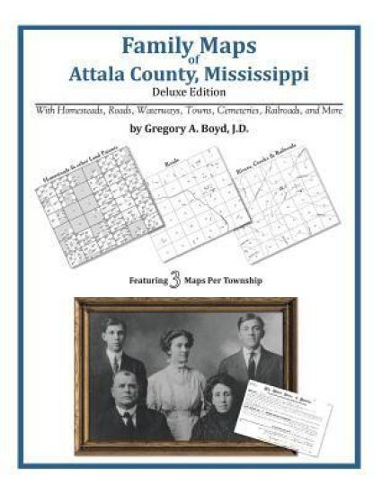
322 pages with 80 total maps Locating original landowners in maps has never been an easy task-until now. This volume in the Family Maps series contains newly created maps of original landowners (patent maps) in what is now Attala County, Mississippi, gleaned from the indexes of the U.S. Bureau of Land Management. But it offers much more than that. For each township in the county, there are two additional maps accompanying the patent map: a road map and a map showing waterways, railroads, and both modern and many historical city-centers and cemeteries. Included are indexes to help you locate what you are looking for, whether you know a person's name, a last name, a place-name, or a cemetery. The combination of maps and indexes are designed to aid researchers of American history or genealogy to explore frontier neighborhoods, examine family migrations, locate hard-to-find cemeteries and towns, as well as locate land based on legal descriptions found in old documents or deeds. The patent-maps are essentially plat maps but instead of depicting owners for a particular year, these maps show original landowners, no matter when the transfer from the federal government was completed. Dates of patents typically begin near the time of statehood and run into the early 1900s. What's Mapped in this book (that you'll not likely find elsewhere) . . . 5202 Parcels of Land (with original landowner names and patent-dates labeled in the relevant map) 135 Cemeteries plus . . . Roads, and existing Rivers, Creeks, Streams, Railroads, and Small-towns (including some historical), etc. What YEARS are these maps for? Here are the counts for parcels of land mapped, by the decade in which the corresponding land patents were issued: DecadeParcel-count 1820s3 1830s112 1840s2609 1850s1176 1860s590 1870s41 1880s136 1890s219 1900s128 1910s166 1920s22 What Cities and Towns are in Attala County, Mississippi (and in this book)? Antioch (historical), Aponaug (historical), Attalaville (historical), Auris (historical), Bear Creek (historical), Berea (historical), Beulah (historical), Bluff Springs (historical), Bowies Chapel, Bowlin (historical), Boyette, Branchville (historical), Burkettsville (historical), Carmack, Carson Ridge (historical), Center, Center Point (historical), Chapel Hill (historical), Chita (historical), Cowpen (historical), Dodds, Dossville, Doty Springs (historical), Earlyville, East Macedonia, Edgefield (historical), Ethel, Forrest (historical), Friendship (historical), Glendale (historical), Gregory (historical), Hesterville, Hurricane, Joplin (historical), Joseph, Knox, Kosciusko, Langley (historical), Liberty Chapel, Liberty Hill (historical), Macedonia (historical), Marvins Chapel, McAdams, McCool, McVille, Mercer (historical), Mount Herman, Multona Springs, Munson (historical), New Hope (historical), New Hope (historical), Newport, Newtonville (historical), Nile, North Center (historical), North Union (historical), Oak Ridge (historical), Patterson, Pierces Chapel, Pilgrims Rest (historical), Plantation, Pleasant Ridge (historical), Possumneck, Providence, Rockport (historical), Rocky Point, Rutherford (historical), Sallis, Sand Hill (historical), Shady Grove, Shrock (historical), Smyrna, Springdale, Steele (historical), Tabernacle (historical), Thompson (historical), Thweatt (historical), Unity (historical), Valena (historical), Williamsville, Zama, Zemuly
Family Maps of Copiah County, Mississippi

Family Maps of Copiah County, Mississippi

Gregory a. Boyd J. D.

Arphax Publishing Co.
2010
nidottu
356 pages with 89 total maps Locating original landowners in maps has never been an easy task-until now. This volume in the Family Maps series contains newly created maps of original landowners (patent maps) in what is now Copiah County, Mississippi, gleaned from the indexes of the U.S. Bureau of Land Management. But it offers much more than that. For each township in the county, there are two additional maps accompanying the patent map: a road map and a map showing waterways, railroads, and both modern and many historical city-centers and cemeteries. Included are indexes to help you locate what you are looking for, whether you know a person's name, a last name, a place-name, or a cemetery. The combination of maps and indexes are designed to aid researchers of American history or genealogy to explore frontier neighborhoods, examine family migrations, locate hard-to-find cemeteries and towns, as well as locate land based on legal descriptions found in old documents or deeds. The patent-maps are essentially plat maps but instead of depicting owners for a particular year, these maps show original landowners, no matter when the transfer from the federal government was completed. Dates of patents typically begin near the time of statehood and run into the early 1900s. What's Mapped in this book (that you'll not likely find elsewhere) . . . 6452 Parcels of Land (with original landowner names and patent-dates labeled in the relevant map) 83 Cemeteries plus . . . Roads, and existing Rivers, Creeks, Streams, Railroads, and Small-towns (including some historical), etc. What YEARS are these maps for? Here are the counts for parcels of land mapped, by the decade in which the corresponding land patents were issued: DecadeParcel-count 1820s809 1830s257 1840s2582 1850s2391 1860s269 1870s12 1880s26 1890s27 1900s38 1910s24 1920s17 What Cities and Towns are in Copiah County, Mississippi (and in this book)? Allen, Ashley, Barlow, Beauregard, Beech Grove, Bowerton, Browns Wells, Burtonton (historical), Carpenter, Coaler (historical), Coars Springs (historical), Conn, Cowanville, Crystal Springs, Dentville, Egypt Hill, Gallatin, Gallman, Gatesville, Georgetown, Glancy, Harperville (historical), Hazlehurst, Hoodtown, Hopewell, Jack, Kinnaird (historical), Linden (historical), Martinsville, Midway, Myles, Old Georgetown (historical), Pleasant Hill, Rockport, Ruby, Sand Hill, Sardis, Shady Grove, Smyrna, Stronghope, Tillman, Wesson, Willing
Family Maps of Yalobusha County, Mississippi

Family Maps of Yalobusha County, Mississippi

Gregory a. Boyd J. D.

Arphax Publishing Co.
2010
nidottu
248 pages with 77 total maps Locating original landowners in maps has never been an easy task-until now. This volume in the Family Maps series contains newly created maps of original landowners (patent maps) in what is now Yalobusha County, Mississippi, gleaned from the indexes of the U.S. Bureau of Land Management. But it offers much more than that. For each township in the county, there are two additional maps accompanying the patent map: a road map and a map showing waterways, railroads, and both modern and many historical city-centers and cemeteries. Included are indexes to help you locate what you are looking for, whether you know a person's name, a last name, a place-name, or a cemetery. The combination of maps and indexes are designed to aid researchers of American history or genealogy to explore frontier neighborhoods, examine family migrations, locate hard-to-find cemeteries and towns, as well as locate land based on legal descriptions found in old documents or deeds. The patent-maps are essentially plat maps but instead of depicting owners for a particular year, these maps show original landowners, no matter when the transfer from the federal government was completed. Dates of patents typically begin near the time of statehood and run into the early 1900s. What's Mapped in this book (that you'll not likely find elsewhere) . . . 2681 Parcels of Land (with original landowner names and patent-dates labeled in the relevant map) 81 Cemeteries plus . . . Roads, and existing Rivers, Creeks, Streams, Railroads, and Small-towns (including some historical), etc. What YEARS are these maps for? Here are the counts for parcels of land mapped, by the decade in which the corresponding land patents were issued: Decade Parcel-count 1830s 198 1840s 1633 1850s 402 1860s 123 1870s 14 1880s 85 1890s 143 1900s 43 1910s 19 1920s 13 Back to Top of Description What Cities and Towns are in Yalobusha County, Mississippi (and in this book)? Benwood, Bruce Junction, Bryant, Camp Ground, Coffeeville, Gatewood, Gums, Gums Crossing, Hubbard Creek, Hyde, Lakeside, Long Branch, New Hope, Oakland, Palestine, Pine Valley, Scobey, Spearman, Tillatoba, Turkey Creek, Tyson, Velma, Wallace Creek, Water Valley, Water Valley Landing