Kirjojen hintavertailu. Mukana 12 555 343 kirjaa ja 12 kauppaa.

Kirjailija

Barbara Raue

Kirjat ja teokset yhdessä paikassa: 295 kirjaa, julkaisuja vuosilta 2010-2020, suosituimpien joukossa Aylmer Ontario Book 2 in Colour Photos: Saving Our History One Photo at a Time. Vertaile teosten hintoja ja tarkista saatavuus suomalaisista kirjakaupoista.

Mukana myös kirjoitusasut: Barbara Raue'

295 kirjaa

Kirjojen julkaisuhaarukka 2010-2020.

Stouffville Ontario Book 2 in Colour Photos: Saving Our History One Photo at a Time
On January 1, 1971, the Village of Stouffville amalgamated with Whitchurch Township and was designated a community within the larger town of Whitchurch-Stouffville, a municipality in the Greater Toronto Area, about fifty kilometers north of downtown Toronto. It is more than two hundred and six square kilometres in size, and located in the mid-eastern area of the Regional Municipality of York on the ecologically-sensitive Oak Ridges Moraine and the Rouge River watershed. Its motto since 1993 is "country close to the city".Stouffville is the primary urban area within the town of Whitchurch-Stouffville. It is centred at the intersection of Main Street, Mill Street and Market Street. Stouffville was founded in 1804 by Abraham Stouffer who built a sawmill and grist-mill on the banks of Duffin's Creek in the 1820s.Urban Stouffville stretches from the York-Durham Line to Highway 48 and is about 2.7 kilometers wide with development north and south of Main Street. Stouffville is bounded by farmland and a golf course. Uxbridge lies to the east.Stouffville Station was built in 1871 by Toronto and Nipissing Railway connecting Stouffville and Uxbridge with Toronto. The line's north-eastern terminus at Coboconk, Ontario on Balsam Lake in the Kawarthas was completed in 1872. In 1877, a second track was built from Stouffville north to Jackson's Point on Lake Simcoe. These connections were to provide a reliable and efficient means of transporting timber harvested and milled in these regions. Stouffville Junction serviced thirty trains per day. The railway became the Grand Trunk Railway in 1884, and Canadian National Railways took over the line in 1914. Stouffville Station was demolished in 1980s and replaced by current GO station.
Uxbridge Ontario Book 2 in Colour Photos

Uxbridge Ontario Book 2 in Colour Photos

Barbara Raue

Independently Published
2018
pokkari
Uxbridge is a township in the Regional Municipality of Durham in south-central Ontario and is located about forty kilometers northeast of Metropolitan Toronto. The main center in the township is the community of Uxbridge. Other communities within the township include Coppins Corners, Goodwood, Leaskdale, Sandford, Siloam, Victoria's Corner, and Zephyr.It was named for Uxbridge, England, a name which was derived from "Wixan's Bridge".The first settlers in the area were Quakers who started arriving in 1806 from Pennsylvania. The community's oldest building, the Uxbridge Friends Meeting House, was built in 1820 and overlooks the town from Quaker Hill, a kilometer to the west.The first passenger-carrying narrow-gauge railway in North America, the Toronto and Nipissing Railway arrived in Uxbridge in June 1871, and for over a decade Uxbridge was the headquarters of the railway. In 1872, the Village of Uxbridge was separated from the Township and incorporated as a separate entity.With the creation of the Regional Municipality of Durham in 1974, Uxbridge Township was amalgamated with the Town of Uxbridge and Scott Township to create an expanded Township of Uxbridge.Today, Uxbridge is as a mostly suburban community in northern Durham Region. Major manufacturing employers include Pine Valley Packaging (packaging, containers and portable shelters), Koch-Glitsch Canada (mass transfer systems) and Hela Canada (spice and ingredient manufacture). Many residents commute to other centers in Durham and York Regions and beyond.The Thomas Foster Memorial Temple, erected in 1935-36 by the former mayor of Toronto, is situated a short distance north of town. Inspired by Foster's visit to India, the Temple was designed by architects J.H. Craig (1889-1954) and H.H. Madrill (1889-1998). The former home of famed author Lucy Maud Montgomery of Anne of Green Gables fame is situated in Leaskdale. Montgomery lived in the area from 1911 to 1926, and wrote half of her books at what is now the site of the Leaskdale Manse Museum.
Uxbridge Ontario Book 1 in Colour Photos

Uxbridge Ontario Book 1 in Colour Photos

Barbara Raue

Independently Published
2018
pokkari
Uxbridge is a township in the Regional Municipality of Durham in south-central Ontario and is located about forty kilometers northeast of Metropolitan Toronto. The main center in the township is the community of Uxbridge. Other communities within the township include Coppins Corners, Goodwood, Leaskdale, Sandford, Siloam, Victoria's Corner, and Zephyr.It was named for Uxbridge, England, a name which was derived from "Wixan's Bridge".The first settlers in the area were Quakers who started arriving in 1806 from Pennsylvania. The community's oldest building, the Uxbridge Friends Meeting House, was built in 1820 and overlooks the town from Quaker Hill, a kilometer to the west.The first passenger-carrying narrow-gauge railway in North America, the Toronto and Nipissing Railway arrived in Uxbridge in June 1871, and for over a decade Uxbridge was the headquarters of the railway. In 1872, the Village of Uxbridge was separated from the Township and incorporated as a separate entity.With the creation of the Regional Municipality of Durham in 1974, Uxbridge Township was amalgamated with the Town of Uxbridge and Scott Township to create an expanded Township of Uxbridge.Today, Uxbridge is as a mostly suburban community in northern Durham Region. Major manufacturing employers include Pine Valley Packaging (packaging, containers and portable shelters), Koch-Glitsch Canada (mass transfer systems) and Hela Canada (spice and ingredient manufacture). Many residents commute to other centers in Durham and York Regions and beyond.
Sudbury Ontario in Colour Photos: Saving Our History One Photo at a Time
Greater Sudbury is the largest city in Northern Ontario. Sudbury was founded in 1883 following the discovery of nickel ore during the construction of the transcontinental railway. The people live in an urban core and many smaller communities scattered around three hundred lakes and among hills of rock blackened by smelting activity. Mining and related industries dominated the economy for much of the twentieth century. The two major mining companies which shaped the history of Sudbury were Inco, now Vale Limited, which employed more than 25% of the population by the 1970s, and Falconbridge, now Glencore. Sudbury has since expanded from its resource-based economy to emerge as the major retail, economic, health and educational centre for North-eastern Ontario.The city recovered from the Great Depression much more quickly than almost any other city in North America due to increased demand for nickel in the 1930s. Sudbury was the fastest-growing city and one of the wealthiest cities in Canada for most of the decade. Many of the city's social problems in the Great Depression era were caused by the difficulty in keeping up with all of the new infrastructure demands created by rapid growth. Employed mineworkers sometimes ended up living in boarding houses or makeshift shanty towns because demand for new housing was rising faster than supply.The open coke beds used in the early to mid-twentieth century and logging for fuel resulted in almost a total loss of native vegetation in the area. Consequently, the terrain was made up of exposed rocky outcrops permanently stained charcoal black, first by the air pollution from the roasting yards. Acid rain added more staining, in a layer that penetrates up to three inches into the once pink-grey granite.The construction of the Inco Super stack in 1972 dispersed sulphuric acid through the air over a much wider area, reducing the acidity of local precipitation. This enabled the city to begin an environmental recovery program. In the late 1970s, private and public interests combined to establish a "regreening" effort. Lime was spread over the charred soil by hand and by aircraft. Seeds of wild grasses and other vegetation were also spread. More than nine million new trees have been planted in the city.Sudbury's pentlandite, pyrite and pyrrhotite ores contain profitable amounts of many elements-primarily nickel and copper, but also platinum, palladium and other valuable metals.
Cayuga and York Ontario in Colour Photos

Cayuga and York Ontario in Colour Photos

Barbara Raue

Independently Published
2018
pokkari
Early patterns of settlement in Haldimand County are still visible in the landscape and architecture, spanning from the pre-Contact era to the proclamation of the Haldimand Land Grant for the Six Nations and the subsequent migration of Loyalist settlers - Americans, largely of German descent and Mennonite tradition. Throughout the 1800s, immigration from the British Isles contributed significantly to the area's development, as did the small but industrious Black community of the late nineteenth century - many descended from ex-slaves of the American South. Since the post-war years of the twentieth century, a significant stream of immigration from the Netherlands has also added to our ever-expanding mosaic of cultural identity, as have the age-old traditions of our Indigenous neighbours - the Six Nations and New Credit communities.Following the American Revolution, Sir Frederick Haldimand, Governor-in-Chief of Canada, granted in 1784 to the Six Nations of the Iroquois a tract of land extending for six miles on both sides of the Grand River from its source to Lake Erie. This grant was made in recognition of their services as allies of the British Crown during the war, and to recompense them for the loss of their former lands in northern New York State. In later years, large areas of this tract, including portions of the present counties of Haldimand, Brant, Waterloo and Wellington, were sold to white settlers.By 1853, Cayuga had lumber yards, a foundry, and a glass factory.At its height, York had twenty businesses that included mills, inns, shoemakers, general stores, blacksmiths, and a lumber yard. It had a two-room school house and two churches.
Dunnville Ontario Book 2 and Other Haldimand County towns in Colour Photos: Saving Our History One Photo at a Time
Haldimand County is a municipality on the Niagara Peninsula in Southern Ontario, on the north shore of Lake Erie, and on the Grand River. Haldimand was first created as a county in 1800, from a portion of Norfolk. It was named after the governor of the Province of Quebec Sir Frederick Haldimand. From 1974 to 2000, Haldimand County and Norfolk County were merged to form the Regional Municipality of Haldimand-Norfolk.The population centers in Haldimand are Caledonia, Dunnville, Hagersville, Jarvis and Cayuga. Most of Haldimand is agricultural land, although some heavy industry, including the Nanticoke Generating Station, is located here. Some of the smaller communities within the municipality are Byng, Canborough, Canfield, Cheapside, Fisherville, Kohler, Lowbanks, Nanticoke, Rainham Centre, Selkirk, South Cayuga, Sweets Corners, and York.Dunnville is a community near the mouth of Grand River in Haldimand County, and is only a few kilometers from Lake Erie. Dunnville was one of the early thriving centers of Upper Canada and Ontario. Following the American Revolution, a six mile strip of land on both sides of the Grand River from its mouth to its sources was opened up to settlement by displaced members of the Six Nations Confederacy. The land was granted to the Iroquois tribes by the British to compensate the Confederacy for land lost in the United States during the revolution. The British originally intended the land to remain in the hands of the Indians, but Mohawk Chief Joseph Brant wanted to open it up to settlement in order to create a source of revenue. Brant persuaded the Six Nations to surrender large blocks of land. Many of the early European arrivals were United Empire Loyalists.South Cayuga lies on the north shore of Lake Erie, ten kilometers east of Dunnville. Initially part of the Six Nations of the Grand River Indian Reserve, the heavy clay soil of South Cayuga Township was well suited to the cultivation of grain, hay, and livestock.Sweet's Corners is located on Rainham Road west of South Cayuga.Kohler was named for the Kohler family, one of many German immigrants who came to the area in the mid-1800s. It is located on County Road 8 south of Cayuga, and north of Rainham Centre.Jarvis is located near the towns of Simcoe, Cayuga, Port Dover and Hagersville. Jarvis is strategically located at the junction of Highways 3 and 6. Jarvis has some excellent examples of brick architecture. Many of the historic homes were built after 1873. Many of the town's restaurants and shops are clustered around the intersection of the highways. The majority of the buildings are red brick.
Fort Erie Ontario in Colour Photos

Fort Erie Ontario in Colour Photos

Barbara Raue

Independently Published
2018
pokkari
Fort Erie is a town on the Niagara River in the Niagara Region of Ontario. It is across the river from Buffalo, New York and is the site of Old Fort Erie which played a prominent role in the War of 1812. Fort Erie is also home to other commercial core areas of Bridgeburg, Ridgeway, Stevensville and Crystal Beach as a result of the 1970 amalgamation of Bertie Township and the village of Crystal Beach with Fort Erie.The Fort Erie area contains deposits of flint, and became important in the production of spearheads, arrowheads, and other tools.During the American Revolution Fort Erie was used as a supply depot for British troops. After the war the territory of what is now the Town of Fort Erie was settled by soldiers demobilised from Butler's Rangers, and the area was named Bertie Township in 1784.During the war, the Americans attacked Fort Erie twice in 1812, captured and abandoned it in 1813, and then recaptured it in 1814. The Americans held it for a time, breaking a prolonged British siege. Later they destroyed Fort Erie and returned to Buffalo in the winter of 1814.The Fort Erie area became a major terminus for slaves using the Underground Railroad between 1840 and 1860; many had crossed into Canada from Buffalo, New York.In 1866, during the Fenian raids, between 1,000 and 1,500 Irish-American Fenians crossed the Niagara River, invading Canada as part of an attempt to oust the British and create an independent Irish republic; they occupied the town and demanded food and horses. The only payment they were able to offer was Fenian bonds which were not acceptable to the citizens. The Fenians then cut the telegraph wires and tore up some railway tracks. Afterwards, they marched to Chippewa and the next day to Ridgeway where they fought the Battle of Ridgeway, a series of skirmishes with the Canadian militia. The Fenians then returned to Fort Erie and fought the Battle of Fort Erie in 1866, defeating the Canadian militia. Fearing British reinforcements, they then decided to retreat to the U.S.The Battle of Ridgeway shocked the country, spurring improvements to Canada's defences, and helping to bolster the movement for confederation, which took place the next year.Ridgeway was settled by the United Empire loyalists in the late 18th-century, and was originally a farming community. In the 1850s the Buffalo, Brantford and Goderich Railway line was put through, and service industries began to develop around the train stop on Ridge Road. The business district spread north from there towards Dominion Road. In 1873 the post office was opened, having been moved from Point Abino.In 1869 Fort Erie was served by the Grand Trunk and the Erie & Niagara railways. The Grand Trunk Railway built the International Railway Bridge in 1873, bringing about a new town, originally named Victoria and subsequently renamed to Bridgeburg, north of the original settlement of Fort Erie.Situated a few kilometres north of Lake Erie, and a short drive from Niagara Falls, Stevensville is surrounded primarily by agricultural land. The centre of the community is the intersection of Stevensville Road and Main Street. Black Creek runs through the area which is often used for kayaking and canoeing, with a boat launch at the end of Main Street.In 1888, the amusement park at Crystal Beach opened. The park continued to operate until it closed in 1989.On August 7, 1927 the Peace Bridge was opened between Fort Erie and Buffalo.
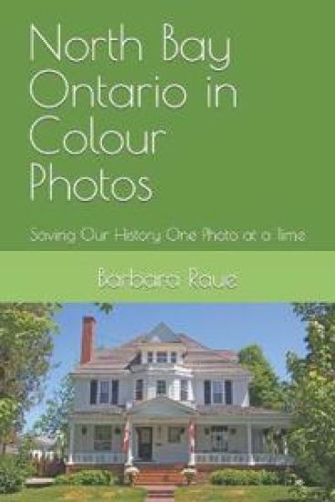
North Bay Ontario in Colour Photos

North Bay Ontario in Colour Photos

Barbara Raue

Independently Published
2018
pokkari
North Bay is a city in Northeastern Ontario about 330 kilometers (210 miles) north of Toronto. It differs in geography from Southern Ontario because North Bay is situated on the Canadian Shield which results in a more rugged landscape. North Bay straddles both the Ottawa River watershed to the east and the Great Lakes Basin to the west. The city's urban core is located between Lake Nipissing and the smaller Trout Lake. In 1882, John Ferguson decided that the north bay of Lake Nipissing was a promising spot for settlement. Apart from Indigenous people, voyageurs and surveyors, there was little activity in the Lake Nipissing area until the arrival of the Canadian Pacific Railway (CPR) in 1882. North Bay was selected as the southern terminus of the Temiskaming and Northern Ontario Railway (T&NO) in 1902 when the Ross government took the bold move to establish a development road to serve the Haileybury settlement. During construction of the T&NO, silver was discovered at Cobalt and started a mining frenzy in the northern part of the province that continued for many years. The Canadian Northern Railway was built to North Bay in 1913.North Bay grew through a strong lumbering sector, mining and the three railways in the early days.Born in France about 1598, Jean Nicolet, explorer, fur trader, and interpreter came to Canada in 1618. Under orders from Samuel de Champlain, he spent the following two years with the Algonquins of Allumette Island. He was then sent to the Nipissing Indians of this area and dwelt among them for at least eight years, learning their language, adopting their customs, and strengthening their alliance with the French. Nicolet is credited with the discovery of Lake Michigan which he explored as far south as the head of Green Bay in 1634. He later settled in Trois Rivieres. He drowned in the St. Lawrence in 1642.The rivers and lakes of northern Ontario have been highways for travel and commerce for hundreds of years. First nations and European explorers used Lake Nipissing for transporting their furs. When the railroad reached the area in the 1880s, settlers and timber were transported across the lake.The Gateway Arch was constructed in 1928 and serves as an entrance to Lee Park. It is an important symbol of North Bay, the
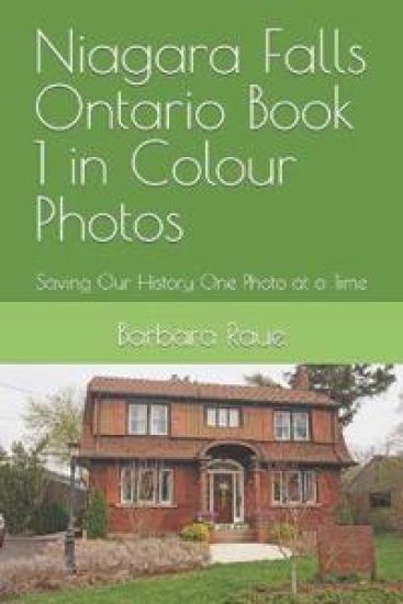
Niagara Falls Ontario Book 1 in Colour Photos

Niagara Falls Ontario Book 1 in Colour Photos

Barbara Raue

Independently Published
2018
pokkari
Niagara Falls Ontario is located along the Niagara Falls waterfalls and the Niagara Gorge on the western bank of the Niagara River, which flows from Lake Erie to Lake Ontario. The Niagara River flows over Niagara Falls at this location and creates a natural spectacle that attracts millions of tourists each year.Louis Hennepin, a French priest and missionary, is believed to be the first European to visit the area in the 1670s. Increased settlement in this area took place during and after the American Revolutionary War, when the British Crown made land grants to Loyalists to help them resettle in Upper Canada and provide some compensation for their losses after the United States became independent. Loyalist Robert Land received 200 acres and was one of the first people of European descent to settle in the Niagara Region.Tourism started in the early nineteenth century. The falls became known as a natural wonder, due in part to paintings by prominent American artists such as Albert Bierstadt. Niagara Falls is the self-proclaimed "honeymoon capital of the world."Niagara Falls is about 130 kilometers (81 miles) by road from Toronto, which is across Lake Ontario to the north.With a plentiful and inexpensive source of hydroelectric power from the waterfalls, many electro-chemical and electro-metallurgical industries located there in the early to mid-20th century.
Niagara Falls Ontario Book 2 in Colour Photos: Saving Our History One Photo at a Time
Niagara Falls Ontario is located along the Niagara Gorge on the western bank of the Niagara River which flows from Lake Erie to Lake Ontario. The Niagara River flows over Niagara Falls at this location and creates a natural spectacle that attracts millions of tourists each year.In 1853 construction began to build an international suspension bridge over the Niagara Gorge. This brought work and prosperity to the north end of Stamford Township. A shanty-town development was erected to house workers at the base of the bridge. Over the years this became the Village of Elgin. Amalgamation of the Village of Elgin with the Town of Clifton was caused by the economic impact of the Great Western, Erie and Ontario Railways. The prosperous town boasted fifteen grocery stores and twenty saloons and hotels. Samuel Zimmerman, one of the founding fathers of the city, came from Pennsylvania in 1842 with lots of ambition, and some knowledge of construction. He rebuilt parts of the Welland Canal. Recognizing the importance of railroads, Zimmerman began building railway lines including the Great Western (now Canadian National) from Hamilton. Zimmerman's company played a role in building the Railway Suspension Bridge across the Niagara River Gorge.During Zimmerman's lifetime, there were four small communities within what is now Niagara Falls: Chippawa to the south, Clifton, Drummondville, and Stamford Village in the north.The majority of the early downtown businesses were located on the lower part of Bridge Street, Erie Avenue and River Road, with a few businesses on Clifton Avenue (now Zimmerman) and Park Street. At the turn of the century, retail activity slowly started to shift to Queen Street where to date some of these firms are still operating. The residences of Queen Street have given way to stores and offices that form the Downtown core we see today.
Sampler Book 8, Ontario in Colour Photos: Saving Our History One Photo at a Time
Each photo I take that precedes a demolition, or a natural disaster such as a tornado or a fire, is meeting this aim of mine of Saving Our History One Photo at a Time. There are more than 100 towns already photographed which you can visit without moving from your comfortable chair in your living room. Think about what it was like in those by-gone days. Imagine what it was like to live in a mansion like one of these.Sampler Book 8 includes pictures from the following places: Belleville, Port Colborne, Erin, Goderich and Owen Sound.All the photos in this book have been taken with my cameras. I own the rights to them. I only submit content for which I do have the exclusive publishing rights.
Niagara Falls Ontario Book 3 in Colour Photos: Saving Our History One Photo at a Time
Niagara Falls Ontario is located along the Niagara Gorge on the western bank of the Niagara River, which flows from Lake Erie to Lake Ontario. The Niagara River flows over Niagara Falls at this location and creates a natural spectacle that attracts millions of tourists each year. Niagara Falls is about 130 kilometers (81 miles) by road from Toronto, which is across Lake Ontario to the north.Tourism started in the early nineteenth century. The falls became known as a natural wonder, due in part to paintings by prominent American artists such as Albert Bierstadt. Niagara Falls is the self-proclaimed "honeymoon capital of the world."With a plentiful and inexpensive source of hydroelectric power from the waterfalls, many electro-chemical and electro-metallurgical industries located there in the early to mid-20th century.By 1792-94, a village grew up near Fort Chippawa on Chippawa Creek near the end of the new portage road from Queenston. In 1793, the creek was renamed the Welland River. The village was largely destroyed 1812-14 when the British and American forces fought for control of the Welland River. Portage traffic revived after the war and continued until Chippawa became an outlet for the original Welland Canal from 1829 to 1833. The first horse-powered railway in Upper Canada was built to Niagara Falls in 1837-39. Precipitated by the opening of the Welland Canal in 1829, by the 1840s, Chippawa was a thriving town. A wide variety of business establishments were located around Cummington Square. Chippawa amalgamated with the City of Niagara Falls in 1970.
Oshawa Ontario Book 3 in Colour Photos

Oshawa Ontario Book 3 in Colour Photos

Barbara Raue

Createspace Independent Publishing Platform
2018
pokkari
Oshawa is a city in Southern Ontario on the Lake Ontario shoreline. It is about sixty kilometers east of Downtown Toronto. The name Oshawa comes from the Ojibwa word meaning "the crossing place" or "where we must leave our canoes". More than 5,000 people work and more than 2,400 university students study in the downtown core.Oshawa's roots are tied to the automobile industry with the Canadian division of General Motors located here. It was founded in 1876 as the McLaughlin Carriage Company. The lavish home of the carriage company's founder, Parkwood Estate, is a National Historic Site of Canada.Historians believe that Oshawa began as a transfer point for the fur trade. Beaver and other animals trapped for their pelts by local natives were traded with the Coureurs des bois (voyagers). Furs were loaded onto canoes by the Mississauga Indians at the Oshawa harbor and transported to the trading posts located to the west at the mouth of the Credit River. Around 1760, the French constructed a trading post near the harbor location; this was abandoned after a few years, but its ruins provided shelter for the first residents of what later became Oshawa.In the late eighteenth century a local resident, Roger Conant, started an export business shipping salmon to the United States. His success attracted further migration into the region. A large number of the founding immigrants were United Empire Loyalists, who left the United States to live under British rule. Later Irish and then French Canadian immigration increased as did industrialization. Oshawa and the surrounding Ontario County were the settling grounds of a large number of nineteenth century Cornish immigrants. The surveys ordered by Governor John Graves Simcoe, and subsequent land grants, helped populate the area. When Col. Asa Danforth laid out his York-to-Kingston road, it passed through the Oshawa area.In 1822, a "colonization road" (a north-south road to facilitate settlement) known as Simcoe Street was constructed. It ran from the harbor to the area of Lake Scugog. It intersected the "Kingston Road: at what became Oshawa's "Four Corners."In 1846 there were about 1,000 people in a community surrounded by farms. There were three churches, a post office, tradesmen of various types, a foundry, a grist mill and a fulling mill, a brewery, two distilleries, a machine shop and four cabinet makers.The newly established village became an industrial center, and implement works, tanneries, asheries and wagon factories opened. In 1876, Robert Samuel McLaughlin, Sr. moved his carriage works to Oshawa from Enniskillen to take advantage of its harbor and of the availability of a rail link not too far away. He constructed a two-storey building, which was soon added to. This building was heavily remodeled in 1929, receiving a new facade and being extended to the north. Around 1890, the carriage works relocated from its Simcoe Street address to an unused furniture factory a couple of blocks to the northeast, and this remained its site until the building burnt in 1899. Offered assistance by the town, McLaughlin chose to stay in Oshawa, building a new factory across Mary Street from the old site. Rail service had been provided in 1890 by the Oshawa Railway; this was originally set up as a streetcar line, but by about 1910 a second freight line was built slightly to the east of Simcoe Street which provided streetcar and freight service, connected central Oshawa with the Grand Trunk (now Canadian National) Railway, and with the Canadian Northern (which ran through the very north of Oshawa) and the Canadian Pacific, built in 1912-13.
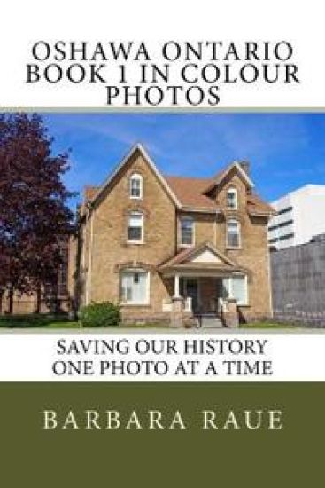
Oshawa Ontario Book 1 in Colour Photos

Oshawa Ontario Book 1 in Colour Photos

Barbara Raue

Createspace Independent Publishing Platform
2018
pokkari
Oshawa is a city in Southern Ontario on the Lake Ontario shoreline. It is about sixty kilometres east of Downtown Toronto. The name Oshawa comes from the Ojibwa word meaning "the crossing place" or "where we must leave our canoes". More than 5,000 people work and more than 2,400 university students study in the downtown core.Oshawa's roots are tied to the automobile industry with the Canadian division of General Motors located here. It was founded in 1876 as the McLaughlin Carriage Company. The lavish home of the carriage company's founder, Parkwood Estate, is a National Historic Site of Canada.Historians believe that Oshawa began as a transfer point for the fur trade. Beaver and other animals trapped for their pelts by local natives were traded with the Coureurs des bois (voyagers). Furs were loaded onto canoes by the Mississauga Indians at the Oshawa harbor and transported to the trading posts located to the west at the mouth of the Credit River. Around 1760, the French constructed a trading post near the harbor location; this was abandoned after a few years, but its ruins provided shelter for the first residents of what later became Oshawa.In the late eighteenth century a local resident, Roger Conant, started an export business shipping salmon to the United States. His success attracted further migration into the region. A large number of the founding immigrants were United Empire Loyalists, who left the United States to live under British rule. Later Irish and then French Canadian immigration increased as did industrialization. Oshawa and the surrounding Ontario County were the settling grounds of a large number of nineteenth century Cornish immigrants. The surveys ordered by Governor John Graves Simcoe, and subsequent land grants, helped populate the area. When Col. Asa Danforth laid out his York-to-Kingston road, it passed through the Oshawa area.In 1822, a "colonization road" (a north-south road to facilitate settlement) known as Simcoe Street was constructed. It ran from the harbor to the area of Lake Scugog. It intersected the "Kingston Road: at what became Oshawa's "Four Corners."In 1846 there were about 1,000 people in a community surrounded by farms. There were three churches, a post office, tradesmen of various types, a foundry, a grist mill and a fulling mill, a brewery, two distilleries, a machine shop and four cabinet makers.The newly established village became an industrial center, and implement works, tanneries, asheries and wagon factories opened. In 1876, Robert Samuel McLaughlin, Sr. moved his carriage works to Oshawa from Enniskillen to take advantage of its harbor and of the availability of a rail link not too far away. He constructed a two-storey building, which was soon added to. This building was heavily remodeled in 1929, receiving a new facade and being extended to the north. Around 1890, the carriage works relocated from its Simcoe Street address to an unused furniture factory a couple of blocks to the northeast, and this remained its site until the building burnt in 1899. Offered assistance by the town, McLaughlin chose to stay in Oshawa, building a new factory across Mary Street from the old site. Rail service had been provided in 1890 by the Oshawa Railway; this was originally set up as a streetcar line, but by about 1910 a second freight line was built slightly to the east of Simcoe Street which provided streetcar and freight service, connected central Oshawa with the Grand Trunk (now Canadian National) Railway, and with the Canadian Northern (which ran through the very north of Oshawa) and the Canadian Pacific, built in 1912-13.
Sampler Book 6, Ontario in Colour Photos: Saving Our History One Photo at a Time

Sampler Book 6, Ontario in Colour Photos: Saving Our History One Photo at a Time

Barbara Raue

Createspace Independent Publishing Platform
2018
nidottu
Each photo I take that precedes a demolition, or a natural disaster such as a tornado or a fire, is meeting this aim of mine of Saving Our History One Photo at a Time. There are more than 100 towns already photographed which you can visit without moving from your comfortable chair in your living room. Think about what it was like in those by-gone days. Imagine what it was like to live in a mansion like one of these.Sampler Book 6 includes pictures from the following places: Welland, Kingston, Ottawa, Midland, Penetanguishene, Kemptville and Cornwall.All the photos in this book have been taken with my cameras. I own the rights to them. I confirm that I will never submit any content for which I do not have the exclusive publishing rights.
Sampler Book 7, Ontario in Colour Photos: Saving Our History One Photo at a Time

Sampler Book 7, Ontario in Colour Photos: Saving Our History One Photo at a Time

Barbara Raue

Createspace Independent Publishing Platform
2018
nidottu
Each photo I take that precedes a demolition, or a natural disaster such as a tornado or a fire, is meeting this aim of mine of Saving Our History One Photo at a Time. There are more than 100 towns already photographed which you can visit without moving from your comfortable chair in your living room. Think about what it was like in those by-gone days. Imagine what it was like to live in a mansion like one of these.Sampler Book 7 includes pictures from the following places: Mariatown, Maitland, Morrisburg, Brockville, Merrickville, Smiths Falls, Portland, Newboro, Westport, Port Elmsley, and Perth.All the photos in this book have been taken with my cameras. I own the rights to them. I confirm that I will never submit any content for which I do not have the exclusive publishing rights.