Kirjojen hintavertailu. Mukana 12 390 323 kirjaa ja 12 kauppaa.

Kirjailija

David Burch

Kirjat ja teokset yhdessä paikassa: 33 kirjaa, julkaisuja vuosilta 1998-2024, suosituimpien joukossa Inland and Coastal Navigation. Vertaile teosten hintoja ja tarkista saatavuus suomalaisista kirjakaupoista.

33 kirjaa

Kirjojen julkaisuhaarukka 1998-2024.

Electronic Chart Symbols

Electronic Chart Symbols

David Burch

Starpath Publications
2024
pokkari
A compilation of nautical chart symbols used on electronic navigational charts (ENC), edited to meet international standards and annotated to clarify nuances in the symbol usage as needed. An appendix includes a complete list of all ENC chart objects and attributes.At the end of 2024, all traditional NOAA paper charts will have been permanently discontinued and the ENC that replaces them will be the only official nautical charts of US waters. These chart symbols will become increasing more important as mariners transition to the use of ENC.
ENC Essentials

ENC Essentials

David Burch

Starpath Publications
2023
pokkari
By the end of 2024, electronic navigational charts (ENC) are projected to be the only official NOAA charts, and all traditional paper charts will have been discontinued and NOAA is on schedule to remove the rest as announced. These charts are being replaced by new (reschemed) versions of electronic navigational charts (ENC) that have been in use for over 15 years in ocean shipping, but have not been used much by recreational and other commercial mariners.As of October, 2023, over 60% of paper charts have been permanently removed, and hundreds of new ENC have replaced them.ENC contain much more information than paper charts do, they are easier to keep up to date, and they add notable safety features to navigation-each chart is a dynamic prescription for drawing the chart that knows where all hazards lie, and therefore our electronic chart system (ECS) in use can warn us of their approach.But ENC look different and are structured differently than paper charts. The safe use of ENC requires new knowledge on charts and chart reading.This booklet is a quick guide to how to use these powerful electronic charts, which will very shortly be what we mean when we say "nautical chart."
Introduction to Electronic Chart Navigation

Introduction to Electronic Chart Navigation

David Burch

Starpath Publications
2022
pokkari
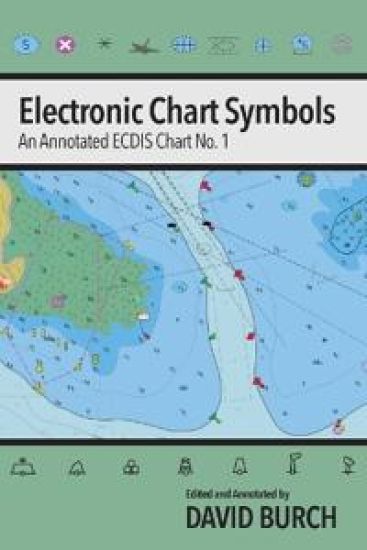
There are two types of electronic charts: raster navigational charts (RNC) and electronic navigational charts (ENC). RNC are exact copies of paper charts and their use underway comes naturally to navigators accustomed to paper charts. All traditional paper charts, however, and their RNC are being discontinued by NOAA. Many are gone already and all will be gone in a year or so.ENC (also called vector charts), on the other hand, include much more information than RNC; they allow user-selected display options that enhance safety and efficiency; and they are easier to keep up to date. But they do not look like traditional charts, and they do not behave like traditional charts. Navigation with ENC is fundamentally different from navigation with paper charts or RNC.Electronic charting benefits all mariners, professional and recreational, large vessels and small, power and sail, racing and cruising. The unique information in this book should help mariners in any of these categories master the use of ENC to enhance their safety and performance underway. There are many virtues of ENC, but to take advantage of these, a new approach to "reading charts" is called for. This book explains and illustrates the process.From the Forward to the Second EditionTwo primary factors have taken place since the first edition that affect the content of this book. Foremost is the ongoing NOAA program to redesign the layout of all ENC to make them more consistent amongst themselves and with the ENC from other nations. This is a major improvement. The process is called rescheming. The most apparent changes are the shapes and coverages of the individual charts, which, when reschemed, become regular and consistent. Chart scales and depth contour conventions are also improved, plus we get a larger (more detailed) compilation scale for many areas.On top of these changes, the USCG has just completed a call for comments on the proposed new ruling that vessels must have some electronic chart viewer on board to effectively read the official ENC. In other words, we are at the moment when ENC have gone from an optional substitute for paper charts to being a required method of navigation. With all of this going on, we can see why NOAA decided it was time to take on the daunting task of rescheming all of the US ENC.We have added an appendix on rescheming to cover the details of the changes and how we recognize them in conjunction with what we now call the legacy ENC that exist before rescheming. The full conversion will take some years to complete, so we will be using the legacy ENC layouts for quite a while to come. The interpretation and basic use of ENC does not change with the reschemed charts. When a topic comes up in the book that is affected by rescheming, we make note of the changes with a reference to the appendix.There is also a short appendix on the new NOAA custom chart program (NCC); another on Inland ENC, the US Army Corps of Engineers charts for the Western Rivers; and one emphasizing a recommended vessel icon set up for navigation in strong wind or current. An overview of the next generation ENC called S-100 has also been added as an appendix.The second primary factor that has led to updates in this edition was the preparation for and first experiences we have had with our new training course on Electronic Chart Navigation. Many sections throughout the book have been enhanced to reflect the practical experience we gained. Interactions with students first learning a new subject is an invaluable resource we are lucky to have.Topics with more extensive updates include: coverage of the Quality of data object and Zone of Confidence attributes; treatment of magnetic variation; use of safety contour and safety depth; plus a new section on the use of encrypted S-63 charts with a specific example using the newly free ENC from New Zealand.
The Star Finder Book

The Star Finder Book

David Burch

Starpath Publications
2019
pokkari
This book turns the 2102-D Star Finder into a hand-held planetarium, which will become your most important tool for star ID and for planning star and planet sights. It also includes many unique practical tables not found elsewhere, such as how to tell the best use of the moon from its age, how to compare brightness of stars and planets in an easy way, which stars are reddish, and more.Includes a general discussion of choosing and optimizing star-planet sights and how to optimize sun-moon fixes during the day, along with general tips on practical celestial navigation. Plus how to use the Star Finder as a solar compass if your magnetic compass should fail.Extensive realistic examples worked out in full numerical detail. This is definitely a specialized book. But it will certainly tell you all you ever wanted to know about the Star Finder -- and probably more -- but it is organized in a way that is easy to use to find what you need.We prepared this book in about 1984 when we learned that nearly every yacht gone ocean voyaging carried a Star Finder with it, but that barely anyone ever used it to any practical value. This book will change that situation for those who take the time to read through it.Computer programs and smart phone apps can do a lot these days to help with star ID, but few are set up to do this job as well as you can do it yourself with the 2102-D Star Finder.
GPS Backup with a Mark 3 Sextant

GPS Backup with a Mark 3 Sextant

David Burch

Starpath Publications
2018
pokkari
No power, and batteries used up? This book and an inexpensive Mark 3 sextant lets you carry on. Alternatively, if you want to learn a basic celestial navigation position fix for any reason with minimum investment, this book shows how to do that. It's a short book, mostly tables. You can read it in an hour or two, master the sights in less than that, and find your position the next time you see the noonday sun.Our guiding principle for this booklet was to provide a means of learning and executing a position fix at sea when a vessel has lost its GPS navigation. We wanted a solution that is compact and inexpensive, using tables and procedures that are easy to learn and use. This goal led to our proposing a minimum kit that mariners would not hesitate to add to their gear to cover the unlikely situation it would actually be needed. Mariners who cross oceans in small boats realize they must be self-reliant and cover all contingencies.For those who did not have the chance to learn the full range of celestial navigation, this booklet and a Mark 3 sextant provide a minimum backup that can be used to navigate across any ocean if needed.The almanac pages included have been custom designed to facilitate fast, easy solutions for Lat and Lon from the sun, plus we include a unique new Regiment of the North Star for easy Latitude by Polaris sights on any date.
Modern Marine Weather

Modern Marine Weather

David Burch

Starpath Publications
2018
sidottu
A comprehensive text on how to take weather into account for the planning and navigation of voyages, local or global, using the latest technologies as well as the time-honored skills of maritime tradition, so that your time on the water remains as safe and efficient as possible. Covers practical applications of GRIB files, ASCAT wind measurements, and other modern resources.
Modern Marine Weather

Modern Marine Weather

David Burch

Starpath Publications
2018
pokkari
A comprehensive text on how to take weather into account for the planning and navigation of voyages, local or global, using the latest technologies as well as the time-honored skills of maritime tradition, so that your time on the water remains as safe and efficient as possible. Covers practical applications of GRIB files, ASCAT wind measurements, and other modern resources.
Hawaii by Sextant

Hawaii by Sextant

David Burch; Stephen Miller

Starpath Publications
2014
sidottu
In the spirit of early Bowditch editions, we offer navigation details of a full ocean passage as an excellent way to learn the ropes of practical celestial navigation. With your own tables and plotting sheets, you can analyze 224 timed sextant sights of sun, moon, stars, and planets to obtain 26 position fi xes to fi nd your way along a 2,800-nmi voyage lasting 17 days. Solutions are provided by computation, workforms, and detailed plots using universal plotting sheets. After completing this passage you will be prepared to navigate by celestial navigation on your own, whether you need to or choose to. Also includes notes on optimizing sight analysis, hurricane tracking, DR error analysis, ocean currents, and use of visible light ranges for nighttime arrivals.