
Kirjailija
David J. Wishart
Kirjat ja teokset yhdessä paikassa: 7 kirjaa, julkaisuja vuosilta 1992-2025, suosituimpien joukossa Atlas of the Great Plains. Vertaile teosten hintoja ja tarkista saatavuus suomalaisista kirjakaupoista.
7 kirjaa
Kirjojen julkaisuhaarukka 1992-2025.
Atlas of Nebraska
J. Clark Archer; Richard Edwards; Leslie M. Howard; Fred M. Shelley; Donald A. Wilhite; David J. Wishart
University of Nebraska Press
2021
pokkari
2018 Nebraska Book Award The state of Nebraska has a rich and varied culture, from the eastern metropolitan cities of Omaha and Lincoln to the ranches of the western Sand Hills. The first atlas of Nebraska published in over thirty years, this collection chronicles the history of the state with more than three hundred original, full-color maps accompanied by extended explanatory text. Far more than simply the geography of Nebraska, this atlas explores a myriad of subjects from Native Americans to settlement patterns, agricultural ventures to employment, and voting records to crime rates. These detailed and beautifully designed maps convey the significance of the state, capturing the essence of its people and land. This volume promises to be an essential reference tool to enjoy for many years to come.
2017 Nebraska Book Awards Nonfiction: Reference David J. Wishart’s Great Plains Indians covers thirteen thousand years of fascinating, dynamic, and often tragic history. From a hunting and gathering lifestyle to first contact with Europeans to land dispossession to claims cases, and much more, Wishart takes a wide-angle look at one of the most significant groups of people in the country. Myriad internal and external forces have profoundly shaped Indian lives on the Great Plains. Those forces-the environment, religion, tradition, guns, disease, government policy-have written their way into this history. Wishart spans the vastness of Indian time on the Great Plains, bringing the reader up to date on reservation conditions and rebounding populations in a sea of rural population decline. Great Plains Indians is a compelling introduction to Indian life on the Great Plains from thirteen thousand years ago to the present.
Looking over the vast open plains of eastern Colorado, western Kansas, and southwestern Nebraska, where one can travel miles without seeing a town or even a house, it is hard to imagine the crowded landscape of the last decades of the nineteenth century. In those days farmers, speculators, and town builders flooded the region, believing that rain would follow the plow and that the "Rainbelt" would become their agricultural Eden. It took a mere decade for drought and economic turmoil to drive these dreaming thousands from the land, turning farmland back to rangeland and reducing settlements to ghost towns.David J. Wishart's The Last Days of the Rainbelt is the sobering tale of the rapid rise and decline of the settlement of the western Great Plains. History finds its voice in interviews with elderly residents of the region by Civil Works Administration employees in 1933 and 1934. Evidence similarly emerges from land records, climate reports, census records, and diaries, as Wishart deftly tracks the expansion of westward settlement across the central plains and into the Rainbelt. Through an examination of migration patterns, land laws, town-building, and agricultural practices, Wishart re-creates the often-difficult life of settlers in a semiarid region who undertook the daunting task of adapting to a new environment. His book brings this era of American settlement and failure on the western Great Plains fully into the scope of historical memory.
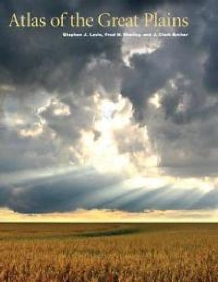
Atlas of the Great Plains
Center for Great Plains Studies; David J. Wishart; Stephen J. Lavin; J. Clark Archer; Fred M. Shelley
University of Nebraska Press
2011
sidottu
2011 Booklist Editor's Choice, reference categoryThe Great Plains, stretching northward from Texas into Canada, is a region that has been understudied and overlooked. The Atlas of the Great Plains, however, brings a new focus to North America's midcontinent. With more than three hundred original full-color maps, accompanied by extended explanatory text, this collection chronicles the history of the Great Plains, including political and social developments. Far more than simply the geography of the region, this atlas explores a myriad of subjects from Native Americans to settlement patterns, agricultural ventures to voting records, and medical services to crime rates. These detailed and beautifully designed maps convey the significance of the region, capturing the essence of its land and life. The only current and comprehensive atlas of the Great Plains region, it is also the first atlas to include both the United States and Canada, showing the region's full length and breadth.

Of all the interactions between American Indians and Euro-Americans, none was as fundamental as the acquisition of the indigenous peoples' lands. To Euro-Americans this takeover of lands was seen as a natural right, an evolution to a higher use; to American Indians the loss of homelands was a tragedy involving also a loss of subsistence, a loss of history, and a loss of identity. Historical geographer David J. Wishart tells the story of the dispossession process as it affected the Nebraska Indians—Otoe-Missouria, Ponca, Omaha, and Pawnee—over the course of the nineteenth century. Working from primary documents, and including American Indian voices, Wishart analyzes the spatial and ecological repercussions of dispossession. Maps give the spatial context of dispossession, showing how Indian societies were restricted to ever smaller territories where American policies of social control were applied with increasing intensity. Graphs of population loss serve as reference lines for the narrative, charting the declining standards of living over the century of dispossession. Care is taken to support conclusions with empirical evidence, including, for example, specific details of how much the Indians were paid for their lands. The story is told in a language that is free from jargon and is accessible to a general audience.
"In stressing the exploitation and destruction of the physical and human environment rather than the usual frontier romanticism, David Wishart has provided for students of the trans-Mississippi fur trade a valuable service."--Journal of the Early Republic. A standard reference work [that] should be required reading for all students of the American west."--Pacific Historical Review. "The whole [fur trade] system is traced out from the Green River rendezvous or the Fort Union post to the trading houses of St. Louis and the auctions in New York and Europe. Such factors as capital formation, shifting commercial institutions, the role of advanced market information, and the nature, kinds, costs, and speed of transportation are all worked into the story, as is the relationship of the whole fur trade to national and international business cycles. This is an impressive achievement for a book so brief...[It] opens out onto new methodological vistas and paradigms in western history."--William H. Goetzmann, New Mexico Historical Review David J. Wishart is a professor of geography at the University of Nebraska-Lincoln. He is the winner of the John Brinckerhoff Jackson Prize for distin-guished books in American geography, sponsored by the Association of American Geographers for An Unspeakable Sadness: The Dispossession of the Nebraska Indians, also available from the University of Nebraska Press.