Kirjojen hintavertailu. Mukana 12 390 323 kirjaa ja 12 kauppaa.

Kirjailija

Henry Stedman

Kirjat ja teokset yhdessä paikassa: 11 kirjaa, julkaisuja vuosilta 2021-2026, suosituimpien joukossa Hadrian's Wall Path Trailblazer Walking Guide. Vertaile teosten hintoja ja tarkista saatavuus suomalaisista kirjakaupoista.

11 kirjaa

Kirjojen julkaisuhaarukka 2021-2026.

Hadrian's Wall Path Trailblazer Walking Guide

Hadrian's Wall Path Trailblazer Walking Guide

Henry Stedman

TRAILBLAZER PUBLICATIONS
2026
pokkari
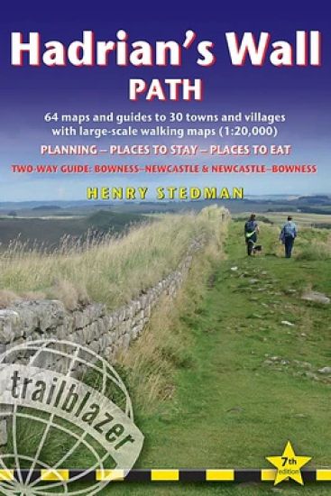
All-in-one guide to walking Hadrian's Wall Path National Trail now in its 8th edition, re-walked and fully updated. Two-way edition with routes re-walked from Bowness-on-Solway to Wallsend (Newcastle) and Wallsend (Newcastle) to Bowness-on-Solway. Hadrian's Wall Path, 84 miles from end to end, follows the course of northern Europe's largest surviving Roman monument, a 2nd-century fortification built - in the border country between England and Scotland - on the orders of the Emperor Hadrian in AD122. Opened in 2003, the path crosses the beautiful border country between England and Scotland. It is the first National Trail to follow the course of a UNESCO World Heritage Site. This week-long walk is regarded as one of the least challenging National Trails. This 8th edition has been re-walked and fully updated. Printed in two-colours - follow east to west or west to east directions 8 town plans and 59 large-scale walking maps - at just under 1:20,000 - showing route times, places to stay, points of interest and much more Includes 8 stage maps and 2 overview maps Itineraries for all walkers - whether walking the route in its entirety over seven to eight days or sampling the highlights on day walks and short breaks Practical information for all budgets Where to stay with reviews - camping, bunkhouses, hostels, B&Bs, pubs and hotels Where to eat with reviews - cafes, pubs, tea-shops, restaurants, takeaways and shops/supermarkets What to see - historical, cultural, geographical information Detailed street plans Comprehensive public transport information - for all access points on the Hadrian's Wall Path Flora and fauna - four page full colour flower guide, plus an illustrated section on local wildlife Green hiking - understanding the local environment and minimising our impact on it Newcastle city guide GPS waypoints and what3words references - also downloadable from the Trailblazer website 16 pages of colour mapping for stage sections (one stage per page) with trail profiles
Kilimanjaro Trailblazer Trekking Guide 6e

Kilimanjaro Trailblazer Trekking Guide 6e

Henry Stedman

TRAILBLAZER PUBLICATIONS
2024
pokkari
Practical, best-selling guide to climbing Mount Kilimanjaro, Africa's highest mountain and most popular trek. At 5895m (19,341ft) Kilimanjaro is Africa's highest mountain. Yet with no mountaineering skills necessary to reach the summit, even non-climbers can experience the thrill of climbing one of the world's greatest peaks. Taking you from the dusty plains of East Africa through jungle and moorland to the glacier-clad summit, this is one of the most beautiful and challenging treks there is. Trailblazer's Kilimanjaro guide includes: Comprehensive trail guide and maps (with GPS waypoints also downloadable from the Trailblazer website) to the six major routes: Machame, Marangu, Rongai (Loitokitok), Lemosho, Shira and Umbwe by an author who's climbed them all numerous timesCity guides - Where to stay, eat and what to see en route to Kili in: Dar es Salaam, Nairobi and gateway towns of Arusha, Moshi and MaranguPlanning your trip and booking a trek with full reviews of trekking agencies - when to go, how to bookMount Meru - a popular pre-Kilimanjaro trekBackground information - comprehensive history, geology, climate, flora and fauna - including a detailed bird spotter's guide and a flora identification section - plus cultural information on the Chagga peoplePorters' rights - how to helpHealth and safetyFully updated 6th edition of this best-selling guidebook to Africa's most popular trek. Kilimanjaro is the world's tallest freestanding peak. It's the most popular trek in Africa, both for independent trekkers and for charity organisationsRoutes covered on 35 detailed walking maps in the proven Trailblazer style; all walking times are indicated along with points of interest and gradientsExtra colour sections plus a 16pp colour introduction to Kilimanjaro and the climb
Cleveland Trailblazer Walking Guide

Cleveland Trailblazer Walking Guide

Henry Stedman; Bradley Mayhew

TRAILBLAZER PUBLICATIONS
2024
nidottu
All the information you need to enjoy your hiking adventure along the Cleveland Way in this fully revised and updated 2nd edition. In the beautiful, wild countryside of the North York Moors National Park in northern England lies this fabulous trail, the Cleveland Way. The 110-mile route runs from Helmsley near Thirsk around the western edge of the park to reach the coast at Saltburn-by-the-Sea. It then continues along the eastern edge of the park south down the coast through Whitby, Robin Hood's Bay and Scarborough to finish in Filey. Combining moorland and coast there's wonderful scenic variety to this walk, with crumbling castles and idyllic fishing villages to explore. The guide includes: 48 large-scale walking maps - at just under 1:20,000 - showing route times, places to stay, places to eat, points of interest, and 8 town plans10 colour stage maps to help plan your walk, including hills and descents, and two colour overview mapsPlaces to stay with reviews - campsites, bunkhouses, hostels, B&Bs, pubs and hotelsPlaces to eat with reviews - cafes, teashops, pubs, takeaways, restaurantsWhat to see from the path - history, culture, natural historyComprehensive public transport information - for all access points on the WayFlora and fauna - four page full colour flower guide, plus an illustrated section on local wildlifeItineraries for all walkers - whether walking the route in its entirety over two weeks or sampling the highlights on day walks and short breaksGreen hiking - understanding the local environment and minimizing our impact on itGPS waypoints - also downloadable from the Trailblazer website page.
South Downs Way Trailblazer Walking Guide 8e

South Downs Way Trailblazer Walking Guide 8e

Jim Manthorpe; Henry Stedman

TRAILBLAZER PUBLICATIONS
2024
pokkari
All the information you need to walk the South Downs Way. Trailblazer's guide to South Downs Way shows the route in both directions from Winchester to Eastbourne and from Eastbourne to Winchester. This handy, pocket size South Downs Way guide includes: 82 Maps in two-colour style - 60 large-scale walking maps - 1:20,000 (3-1/8 inches to 1 mile), 11 town plans, 10 stage maps with trail profiles showing hills and descents, and 2 overview mapsDetailed accommodation with reviews - B&Bs, campsites, pubs, hotels, bunkhousesWhere to eat with reviews - cafes, teashops, pubs, takeaways and restaurantsComprehensive public transport information - with frequency of services for all access points on the PathDownloadable GPS waypointsItineraries for all walkers - whether hiking the entire route or sampling highlights on day walks, weekends or short breaksUnique mapping features - walking times, directions, tricky junctions, places to stay, places to eat, points of interest written onto the mapsFlora and fauna - four page full colour flower guide, plus an illustrated section on local wildlifeGreen hiking - understanding the local environment and minimizing our impact on it
Coast to Coast Path Trailblazer Walking Guide 10e

Coast to Coast Path Trailblazer Walking Guide 10e

Henry Stedman

TRAILBLAZER PUBLICATIONS
2023
pokkari
All the information you need to enjoy your hiking adventure from Coast to Coast in this updated 10th edition. Fully re-walked and revised 10th edition of this classic 191-mile walk from the Irish Sea to the North Sea. Crossing three national parks - the Lake District, the Yorkshire Dales, and the North York Moors - it samples the very best of the English countryside - rugged mountains and lakes, gentle dales and stone-built villages; wild moorland; sea cliffs and fishing villages. The guide includes: 109 large-scale walking maps - at just under 1:20,000 - showing route times, places to stay, places to eat, points of interest, and 9 town plans14 colour stage maps to help plan your walk, including hills and descentsPlaces to stay with reviews - campsites, bunkhouses, hostels, B&Bs, pubs and hotelsPlaces to eat with reviews - cafes, teashops, pubs, takeaways, restaurantsWhat to see from the path - history, culture, natural historyComprehensive public transport information - for all access points on the pathFlora and fauna - four page full colour flower guide, plus an illustrated section on local wildlifeItineraries for all walkers - whether walking the route in its entirety over two weeks or sampling the highlights on day walks and short breaksGreen hiking - understanding the local environment and minimizing our impact on itGPS waypoints - also downloadable from the Trailblazer website page
Dorset and South Devon Coast Path - guide and maps to 48 towns and villages with large-scale walking maps (1:20 000)
Trailblazer British Walking Guide: Dorset & South Devon Coast Path, South-West Coast Path Part 3, Plymouth to Poole Harbour Comprehensive, all-in-one guide to walking the Dorset & South Devon Coast Path, the third and last section of the South West Coast Path National Trail. The walking guide includes: 88 large-scale walking maps at just under 1:20,000 - showing route times, places to stay, places to eat, points of interest and much more.29 town plans, 14 colour stage maps showing hills and descents, and 2 colour overview maps.Places to stay with reviews - pubs, hotels, B&Bs, hostels, bunkhouses, campsites.Places to eat with reviews - teashops, cafes, takeaways, pubs, restaurants.What to see along the way - historical, cultural and geographical background information.Itineraries for all walkers - whether walking the route in its entirety over a week to 10 days or sampling the highlights on day walks and short breaks.Comprehensive public transport information - for all access points on the path.Flora and fauna - four page full colour flower guide, plus an illustrated section on local wildlife.Green hiking - understanding the local environment and minimizing our impact on it.Downloadable GPS waypoints.The information is written onto the maps, so walking directions, tricky junctions, places to stay and eat, points of interest and walking times are all written onto the maps themselves in the places to which they apply. The maps are not general-purpose ones but fully-edited maps drawn by walkers for walkers.
Hadrian's Wall Path Trailblazer walking guide

Hadrian's Wall Path Trailblazer walking guide

Henry Stedman

TRAILBLAZER PUBLICATIONS
2023
pokkari
All the information you need to enjoy your hiking adventure along Hadrian's Wall Path in this fully revised 7th edition. Hadrian's Wall Path, 84 miles from end to end, follows the course of northern Europe's largest surviving Roman monument, a 2nd-century fortification built - in the border country between England and Scotland - on the orders of the Emperor Hadrian in AD122. Opened in 2003, the path crosses the beautiful border country between England and Scotland. It is the first National Trail to follow the course of a UNESCO World Heritage Site. This week-long walk is regarded as one of the least challenging National Trails. This 7th edition has been re-walked and fully updated. 8 town plans and 59 large-scale walking maps - at just under 1:20,000 - showing route times, places to stay, points of interest and much morePlus 8 stage maps and 2 overview mapsItineraries for all walkers - whether walking the route in its entirety over seven to eight days or sampling the highlights on day walks and short breaksPractical information for all budgetsWhere to stay with reviews - camping, bunkhouses, hostels, B&Bs, pubs and hotelsWhere to eat with reviews - cafes, pubs, tea-shops, restaurants, takeaways and shops/supermarketsWhat to see - historical, cultural, geographical informationDetailed street plansComprehensive public transport information - for all access points on the Hadrian's Wall PathFlora and fauna - four page full colour flower guide, plus an illustrated section on local wildlifeGreen hiking - understanding the local environment and minimizing our impact on itNewcastle city guideGPS waypoints. These are also downloadable from the Trailblazer websiteIncludes extra colour sections: 16pp colour introduction and 16pp of colour mapping for stage sections (one stage per page) with trail profiles.
West Highland Way Trailblazer Walking Guide

West Highland Way Trailblazer Walking Guide

Charlie Loram; Henry Stedman

TRAILBLAZER PUBLICATIONS
2022
nidottu
** Reprinted with amendments 2024 ** All the information you need to enjoy your hiking adventure along the West Highland Way in this fully revised 8th edition. The West Highland Way passes through some of the most spectacular scenery in all of Britain. From the outskirts of Glasgow it winds for 96 miles (154.5km) along the wooded banks of Loch Lomond, across the wilderness of Rannoch Moor, over the mountains above Glencoe to a dramatic finish passing Ben Nevis - Britain's highest mountain - into the centre of Fort William. 4 large-scale town plans, 8 overview maps and 53 large-scale walking maps - at just under 1:20,000 - showing route times, places to stay, places to eat, points of interest and much more. These are not general-purpose maps but fully-edited maps drawn by walkers for walkers.Itineraries for all walkers - whether walking the route in its entirety over a week to 10 days or sampling the highlights on day walks and short break.Practical information for all budgets - camping, bunkhouses, hostels, B&Bs, pubs and hotels; Glasgow through to Fort William - where to stay, where to eat, what to see, plus detailed street plans.Comprehensive public transport information - for all access points on the West Highland Way.Climb Ben Nevis - route descriptions to the top of Britain's highest mountain and other peaks.Flora and fauna - four page full colour flower guide, plus an illustrated section on local wildlife.Green hiking - understanding the local environment and minimizing our impact on it.Includes GPS waypoints. - also downloadable from the Trailblazer website.Plus extra colour sections: 16pp colour introduction and 10pp of colour mapping for stage sections (one stage per page) with trail profiles.
Dales Way Trailblazer Walking Guide

Dales Way Trailblazer Walking Guide

Henry Stedman

TRAILBLAZER PUBLICATIONS
2022
nidottu
All the information you need to enjoy your hiking adventure along the Dales Way in this fully revised and updated 2nd edition. Enjoy the Dales Way with this all-in-one guide to walking the long distance footpath from Ilkley, West Yorkshire, through the Yorkshire Dales National Park, for 84 miles (135km) to end in the Lake District, in Bowness-on-Windermere. New edition re-researched and rewritten, with maps redrawn in new two-colour styleIncludes 38 detailed walking maps, the largest-scale maps available - At just under 1:20,000 (8cm or 3 1/8 inches to 1 mile) these are bigger than even the most detailed walking maps currently available in the shopsUnique mapping features - walking times, directions, tricky junctions, places to stay, places to eat, points of interest. These are not general-purpose maps but fully edited maps drawn by walkers for walkersItineraries for all walkers - whether hiking the entire route or sampling highlights on day walks or short breaksDetailed public transport information - for all access pointsPractical information for all budgets. What to see, where to eat (cafes, pubs and restaurants); where to stay (B&Bs, hotels, bunkhouses, hostels & campsites)
Cornwall Coast Path Trailblazer walking guide

Cornwall Coast Path Trailblazer walking guide

Henry Stedman; Joel Newton

TRAILBLAZER PUBLICATIONS
2022
pokkari
All the information you need to enjoy your hiking adventure along the South West Coast Path in this fully revised and updated 7th edition. Trailblazer's Cornwall Coast Path Walking Guide is a practical, complete hiking route guide, with maps and accommodation for the 288-mile footpath that runs around the entire coastline of Cornwall from Bude to Plymouth. The Cornwall Coast Path is part 2 of the South-West-Coast Path, a 630-mile National Trail from Minehead to Poole.The Trailblazer guide to the Cornwall Coast Path includes: 142 large-scale walking maps in two-colour style (3 1/8inches to 1 mile), 15 town plans, guides to 81 towns and villages, 24 stage maps and overview mapItineraries for all walkers - whether walking the route in its entirety over a week to 10 days or sampling the highlights on day walks and short breaksGPS waypointsPractical information for all budgets - camping, bunkhouses, hostels, B&Bs, pubs and hotels; where to stay, where to eat, what to seeComprehensive public transport information - for all access points on the coast pathFlora and fauna - 6 page full colour, flower, butterfly, bird guideGreen hiking - understanding the local environment and minimizing our impact on itPlus extra colour sections: 16pp colour introduction and 21pp of colour mapping for stage sections (one stage per page) with trail profiles, and colour overview mapAlso includes the route across the North Devon border, Hartland Quay to Bude
London LOOP Trailblazer Walking Guide

London LOOP Trailblazer Walking Guide

Henry Stedman

Trailblazer Publications
2021
pokkari
All-in-one guide to walking the complete London LOOP - London Outer Orbital Path, including trail maps, places to stay, where to eat and what to see, public transport information. The London LOOP - London Outer Orbital Path is a 150 mile circuit of the country s capital, starting at Erith and finishing at Purfleet-on-Thames. It stays within the M25 and sticks by-and-large to the Metropolitan Green Belt - that buffer zone of green largely undeveloped land that encircles the city. The guide includes: 48 Trail maps (at just under 1:20,000) in two-colour style, 16pp colour stage maps and 2 overview maps40 colour photos, including colour flower and butterfly guidePlaces to stay and eat with reviewsAttractions along the wayDetailed public transport information showing all access points on the path, for day walkersCovers the complete circuit but also ideal for London-based day walks