Kirjojen hintavertailu. Mukana 12 595 353 kirjaa ja 12 kauppaa.

Kirjailija

Lalit Kumar

Kirjat ja teokset yhdessä paikassa: 28 kirjaa, julkaisuja vuosilta 2011-2025, suosituimpien joukossa A Study on Construction Worker Safety in Metro Construction. Vertaile teosten hintoja ja tarkista saatavuus suomalaisista kirjakaupoista.

28 kirjaa

Kirjojen julkaisuhaarukka 2011-2025.

Learn ASP.NET Web API: Become Asp. Net Web API Developer in Just Few Days
ASP.Net Web API 2.1 is the latest Microsoft technology which comes with ASP.Net MVC 4.0 onwards and it enables you to build restful, http-based services, which can be consumed by a variety of clients. In this guide you will learn step-by-step the techniques of using web api framework to create api services, it has lots of coding examples to explain the concepts and features of web api. It covers api controllers, api routing, data formats like json, xml, Bson and csv, api versioning, api controller action versioning, api hosting, controller unit testing, OData query support, authentication, authorization, and security.Web api 2.1, the latest version of web api, which has very sophisticated features for examples attribute routing which helps in api versioning, earlier versions had conventional routing only.The author is expert in Microsoft technologies and have been working in IT for last 17 years. He is hard core developer in Microsoft technologies.The guide is designed in such a manner so that you can learn the concepts and gain practical knowledge in the fastest possible manner.
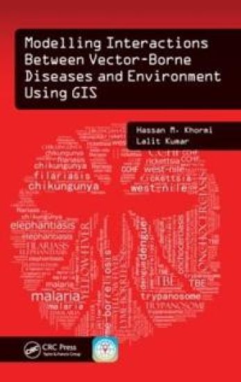
Modelling Interactions Between Vector-Borne Diseases and Environment Using GIS

Modelling Interactions Between Vector-Borne Diseases and Environment Using GIS

Hassan M. Khormi; Lalit Kumar

Apple Academic Press Inc.
2015
sidottu
Master GIS Applications on Modelling and Mapping the Risks of DiseasesInfections transmitted by mosquitoes, ticks, triatomine bugs, sandflies, and black flies cause significant rates of death and disease, especially in developing countries. Why are certain places more susceptible to vector-borne diseases? Modelling Interactions Between Vector-Borne Diseases and Environment Using GIS reveals how using geographic information systems (GISs) can provide a greater understanding of how vector-borne diseases are spread and explores the use of geographical techniques in vector-borne disease monitoring, management, and control. This text provides readers with a better understanding of the vector-borne disease problem and its impact on public health. Introduces New Spatial Approaches Based on Location and EnvironmentThe book exposes readers to information on how to identify vector hotspots, determine when and where they can occur, and eliminate vector breeding sites. Utilizing simple illustrations based on real data, as well as the authors’ more than 20 years of experience in the field, this text combines key spatial analysis techniques available in modern GIS with real-world applications. It offers step-by-step instruction on developing vector-borne disease risk models at different spatial and temporal scales and helps practitioners formulate disease causation hypotheses and identify areas at risk. In addition, it addresses medical geography, GIS, spatial analysis, and modelling, and covers other factors related to the spread of vector-borne diseases.This book: Gives an overview of common vector-borne diseases, GIS-based mapping and modelling, impacts of climate change on vector distributions, and availability and importance of accurate epidemiologically relevant spatial dataDescribes modelling and simulating the prevalence of vector-borne diseases around the worldSummarizes some key spatial techniques and how they can be used to aid in the analysis of geographical and attributed dataDefines the concept of establishing and characterizing spatial data systems, including their quality, errors, references, and issues of scale, and building such a system from often quite separate, disparate sourcesShows how to develop weather-based predictive modelling, which can be used to predict the weekly trend of vector abundanceProvides a GIS case study for modelling the future potential distribution of vector-borne disease based on different climatic change scenariosModelling Interactions Between Vector-Borne Diseases and Environment Using GIS combines spatial analysis techniques available in modern GIS, together with real-world applications to provide you with a better understanding of ways to map, model, prevent, and control vector-borne diseases.
Impression Procedures in Prosthodontics
A variety of techniques has evolved overtime. Selection of the specific techniques depends on experience and an evaluation of an individual patient. Time, expense and accuracy must all the considered in making the selection. A thorough understanding of the characteristics of each of the impression materials leads to the obvious conclusion that no single material can record both the anatomic form of teeth and tissues in the dental arch and at the same time the functional form of the residual ridge.